Regional geological disaster trend prediction method

A technology for predicting geological hazards and trends. It is used in forecasting, geographic information databases, and image data processing. It can solve problems such as poor accuracy and low accuracy of forecast results, and achieve the effect of improving accuracy and rational layout.

Pending Publication Date: 2020-12-29
河北省地质环境监测院
View PDF6 Cites 5 Cited by
  • Summary
  • Abstract
  • Description
  • Claims
  • Application Information

AI Technical Summary

Problems solved by technology

[0003] At present, the trend prediction of geological hazards in a certain area in a long period is mostly based o

Method used


Image

  • Regional geological disaster trend prediction method
  • Regional geological disaster trend prediction method
  • Regional geological disaster trend prediction method

Examples


Example Embodiment

[0025]Example 1

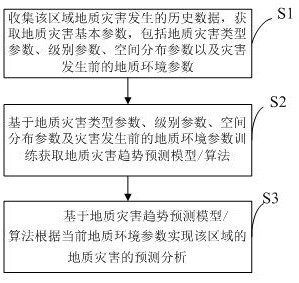
[0026]Such asfigure 1 As shown, a regional geological disaster trend prediction method includes the following steps:

[0027]S1. Collect historical data on the occurrence of geological disasters in the region, and obtain basic parameters of geological disasters, including geological disaster type parameters, level parameters, spatial distribution parameters, and geological environment parameters before the disaster occurs;

[0028]S2. Obtain geological disaster trend prediction models / algorithms based on geological disaster type parameters, level parameters, spatial distribution parameters and geological environment parameter training before the disaster occurs;

[0029]S3. Based on the geological hazard trend prediction model / algorithm, the prediction and analysis of the geological hazard in the region are realized according to the current geological environment parameters.

[0030]In this embodiment, in the step S1, the synchronous mining of the basic parameters of geological d...

Example Embodiment

[0033]Example 2

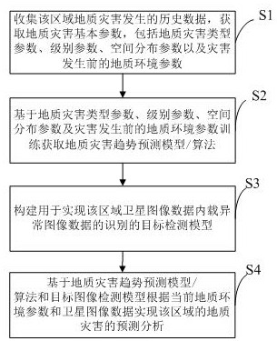
[0034]Such asfigure 2 As shown, a regional geological disaster trend prediction method includes the following steps:

[0035]S1. Collect historical data on the occurrence of geological disasters in the region, and obtain basic parameters of geological disasters, including geological disaster type parameters, level parameters, spatial distribution parameters, and geological environment parameters before the disaster occurs;

[0036]S2. Obtain geological disaster trend prediction models / algorithms based on geological disaster type parameters, level parameters, spatial distribution parameters and geological environment parameter training before the disaster occurs;

[0037]S3. Construct a target detection model for realizing the recognition of abnormal image data contained in satellite image data in the region; specifically: the target image detection model adopts the Dssd_Inception_V3_coco model. First, pretrain the Inception_V3 deep neural network with the coco data set, and th...

Example Embodiment

[0042]Example 3

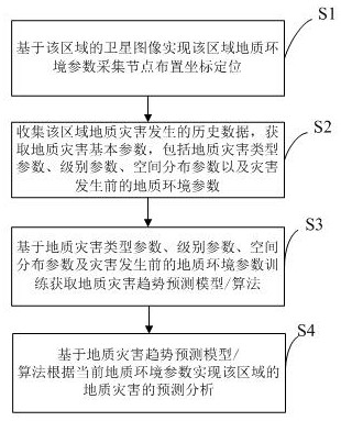
[0043]Such asimage 3 As shown, a regional geological disaster trend prediction method includes the following steps:

[0044]S1. Based on the satellite image of the region, realize the coordinate positioning of the geological environment parameter collection node of the region; specifically, first, obtain the satellite image data of the region, and then collect the geological environment parameter according to the detection coverage threshold of the geological environment parameter collection node Node location location, generate geological environment parameter collection node location map, when geological environment collection node layout, based on geological environment parameter collection node location map navigation to realize the location of each geological environment collection node;

[0045]S2. Collect historical data on the occurrence of geological disasters in the region, and obtain basic parameters of geological disasters, including geological disaster type par...


PUM


Abstract

The invention relates to the field of geological disaster prediction, in particular to a regional geological disaster trend prediction method, and the method comprises the following steps: S1, collecting historical data of a regional geological disaster, and obtaining basic geological disaster parameters including a geological disaster type parameter, a grade parameter, a spatial distribution parameter and a geological environment parameter before the disaster occurs; S2, training and obtaining a geological disaster trend prediction model/algorithm based on the geological disaster type parameters, the grade parameters, the spatial distribution parameters and the geological environment parameters before disasters occur; and S3, realizing prediction analysis of geological disasters in the region according to the current geological environment parameters based on a geological disaster trend prediction model/algorithm. The method can predict the geological disaster occurrence trend of theregion in a certain period of time in the future in advance, and is high in accuracy.

Description

Technical field[0001]The invention relates to the field of geological disaster prediction, in particular to a method for predicting the trend of regional geological disasters.Background technique[0002]Geological disasters refer to phenomena or events that cause sudden or gradual damage to the geological environment due to geological processes (natural, man-made or comprehensive), and cause loss of human life and property. In recent years, geological disasters such as mudslides, landslides, and landslides have occurred frequently, causing huge losses to people's lives and property. How to deal with various geological disasters, improve the disaster prevention of the whole society and reduce disaster losses is an urgent task facing us.[0003]At present, most of the geological disaster trend prediction for a long period and a certain area is based on qualitative prediction, which generally has the defects of low precision and poor accuracy of prediction results.Summary of the invention[...

Claims


Application Information

Patent Timeline
IPC IPC(8): G06Q10/04G06Q50/26G06F16/2458G06F16/29G06T17/05G06K9/00G08B21/10
CPCG06Q10/04G06Q50/265G06F16/2465G06F16/29G06T17/05G08B21/10G06F2216/03G06V20/13
Inventor 高明辉孙超赵永真刘硕赵建青王玉清顾福计王立峰吴广超邢晓琳
Owner 河北省地质环境监测院
Why Eureka
Try Eureka