A network deployment method of air base station for the area coverage of swarm drones

An area coverage and unmanned aerial vehicle technology, applied in the field of aerial base station network deployment covered by cluster unmanned aerial vehicles, can solve the problems of fixed base station providing communication, unable to guarantee the quality of communication link, limited communication, etc., so as to improve the communication chain road quality, achieve dynamic full coverage, and the effect of fast dredging

Active Publication Date: 2022-02-15
BEIJING INSTITUTE OF TECHNOLOGYGY
View PDF16 Cites 0 Cited by
  • Summary
  • Abstract
  • Description
  • Claims
  • Application Information

AI Technical Summary

Problems solved by technology

For densely populated areas, 5G base stations can provide good coverage, but for sparsely populated areas, emergency communication needs are prone to occur. At this time, fixed base stations cannot provide communication for areas in need. Therefore, mobile base stations are required in emergencies. necessary communication facilities
[0004] Although traditional communication vehicles are sufficient for emergency communication support under normal circumstances, when an emergency event occurs in a mountainous area or a lake, the communication vehicle limited by the road cannot provide timely support and cannot guarantee the quality of the communication link. limited communication

Method used


Image

  • A network deployment method of air base station for the area coverage of swarm drones
  • A network deployment method of air base station for the area coverage of swarm drones
  • A network deployment method of air base station for the area coverage of swarm drones

Examples


Embodiment

[0134] Step 1. Determine the target area coordinates (0, 0), (0, 1), (1, 0), (1, 1), the unit is meter (m); determine the number of drones 25, the deployment height is 50m, The detection radius of the airborne sensor is 0.35m, the initial distribution of information volume is set to 4 information sources, and the information volume is q(t)=e -20t , t is time, the unit is s;

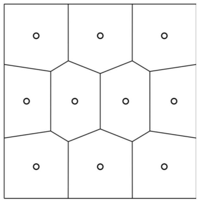
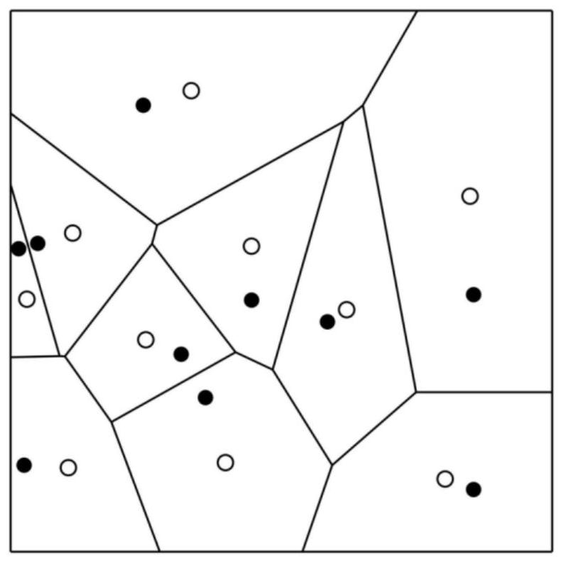
[0135] Use the CVT partition method to evenly divide the target area into 25 sub-areas, and record the centroid position of each sub-area. The set of centroid coordinates is Deploy the UAV at the centroid position of each sub-area in turn;

[0136] Step 2. Each UAV detects the amount of information in each sub-area, broadcasts the detection results to the base station network in the air, and constructs the distribution of information in the entire domain. The simulation results are as follows Figure 4a with Figure 4b shown;

[0137] Step 3. Evaluate the information volume of the target area, and th...


PUM


Abstract

The invention discloses an air base station network deployment method for regional coverage of a cluster of drones. The method includes: step 1, deploying the initial position of the drone in the target area; step 2, obtaining the distribution of information in the target area; Step 3. Evaluate the amount of information in the target area; Step 4. Update the deployment location of the drone. Optionally, loop through steps 2-4. The invention adopts unmanned aerial vehicles to build an aerial base station network, receives and sends information, ensures the quality of communication links, and conducts regional information dredging. The present invention detects the distribution of information through the base station network in the air, constructs a continuous model by using the discrete network model and the diffusion process, and determines the expected information distribution of the region through the continuous model and the distribution of the current regional information, and combines the CVT division method for the UAV Location deployment realizes real-time, detection and update of regional information volume, obtains the optimal deployment mode under the current information volume distribution, and realizes dynamic coverage of regional information.

Description

technical field [0001] The invention belongs to the technical field of wireless communication networks, and in particular relates to an air base station network deployment method for regional coverage of cluster drones. Background technique [0002] In the past, the application of the UAV network was mainly to establish a multi-actuator-sensor network (MAS-net), and through the information perception of the area by multiple UAVs, the UAVs were assigned to perform actions in the demand area. This type of application mainly includes detecting the growth of crops in the field and spraying pesticides, observing the disaster situation in the disaster area and delivering relief supplies, evaluating the battlefield environment and conducting tactical strikes, etc. However, the use of drones to guide network information Applied research is scarce. [0003] The 5G network uses millimeter waves for signal propagation, which reduces the penetration ability of the signal. Therefore, in...

Claims


Application Information

Patent Timeline
Patent Type & Authority Patents(China)
IPC IPC(8): H04W16/18H04W16/22H04B7/185H04W84/06
CPCH04W16/18H04W16/22H04B7/18504H04W84/06
Inventor 张福彪陈祺林德福宋韬郑多王江莫雳
Owner BEIJING INSTITUTE OF TECHNOLOGYGY
Why Eureka
Try Eureka