
A green mine construction planning method based on real 3D modeling
A technology of 3D modeling and 3D modeling, applied in 3D modeling, details involving 3D image data, instruments, etc., to achieve intuitive scientific evaluation support and improve efficiency
- Summary
- Abstract
- Description
- Claims
- Application Information
AI Technical Summary
Problems solved by technology
Method used
Image

Examples
Embodiment Construction
[0022] The present invention will be further described below in conjunction with the accompanying drawings, but the present invention is not limited to the scope of the described embodiments.
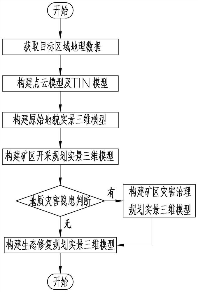
[0023] see figure 1 , a green mine construction planning method based on real 3D modeling, comprising the following steps;
[0024] The first step is to obtain the geographical data of the target area: define the area where the green mine project is located as the target area, and collect the geographical information of the target area according to the requirements to obtain the geographical information of the target area;
[0025] The second step is to construct a point cloud model and a TIN model: import the obtained geographic information into the 3D software, and after generating the 3D model, mark the position coordinates of the target area on the 3D model to obtain the point cloud model of the target area, and use the Convert point cloud model to TIN model;
[0026] The third st...
PUM
 Abstract
Description
Claims
Application Information