
Method for estimating sea surface green tide coverage area under MODIS image cloud

A technology covering area and green tide, applied in the field of estimation of green tide coverage area under cloud sea surface in MODIS images, can solve the problem that the interpretation of Enteromorpha has obvious influence, does not consider the coverage of floating macroalgae, increases the biomass of green tide and the actual biological Quantitative differences and other issues to achieve the effect of reducing the impact

Active Publication Date: 2021-02-02
OCEANOGRAPHIC INSTR RES INST SHANDONG ACAD OF SCI
View PDF7 Cites 3 Cited by
  • Summary
  • Abstract
  • Description
  • Claims
  • Application Information

AI Technical Summary

Problems solved by technology

However, the noise signal in microwave remote sensing data has a significant impact on the interpretation of Enteromorpha, and the method of using microwave remote sensing to monitor green tide is still in its infancy
[0004] Therefore, most of the current studies on the area and biomass of green tides first pick up the clouds and then analyze them, without considering whether there is floating macroalgae under the clouds, which will increase the gap between the estimated green tide biomass and the actual biomass. difference

Method used


Image

  • Method for estimating sea surface green tide coverage area under MODIS image cloud
  • Method for estimating sea surface green tide coverage area under MODIS image cloud
  • Method for estimating sea surface green tide coverage area under MODIS image cloud

Examples


Embodiment Construction

[0033] The following will clearly and completely describe the technical solutions in the embodiments of the present invention with reference to the drawings in the embodiments of the present invention.

[0034] The present invention provides a method for estimating the green tide coverage area of ​​the sea surface under the clouds of MODIS images, and the specific examples are as follows:

[0035] (1) Carry out radiometric calibration and atmospheric correction on the remote sensing image data, and obtain the remote sensing albedo image of the water body in the research sea area;

[0036] (2) The DVI algorithm is used to process the remote sensing albedo image of the water body to obtain the DVI image map of the research sea area; the formula of the DVI algorithm is as follows:

[0037] DVI=R NIR -R RED (1)

[0038] Among them, DVI represents the difference vegetation index value of each pixel on the image, and R NIR and R RED Represents the reflectance of each pixel on ...


PUM


Abstract

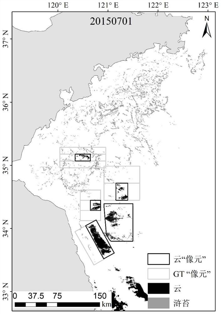
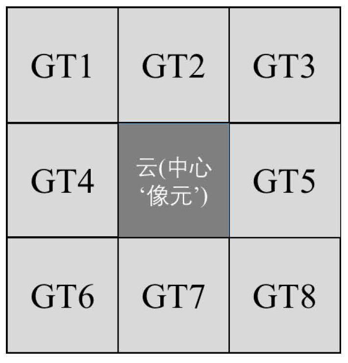
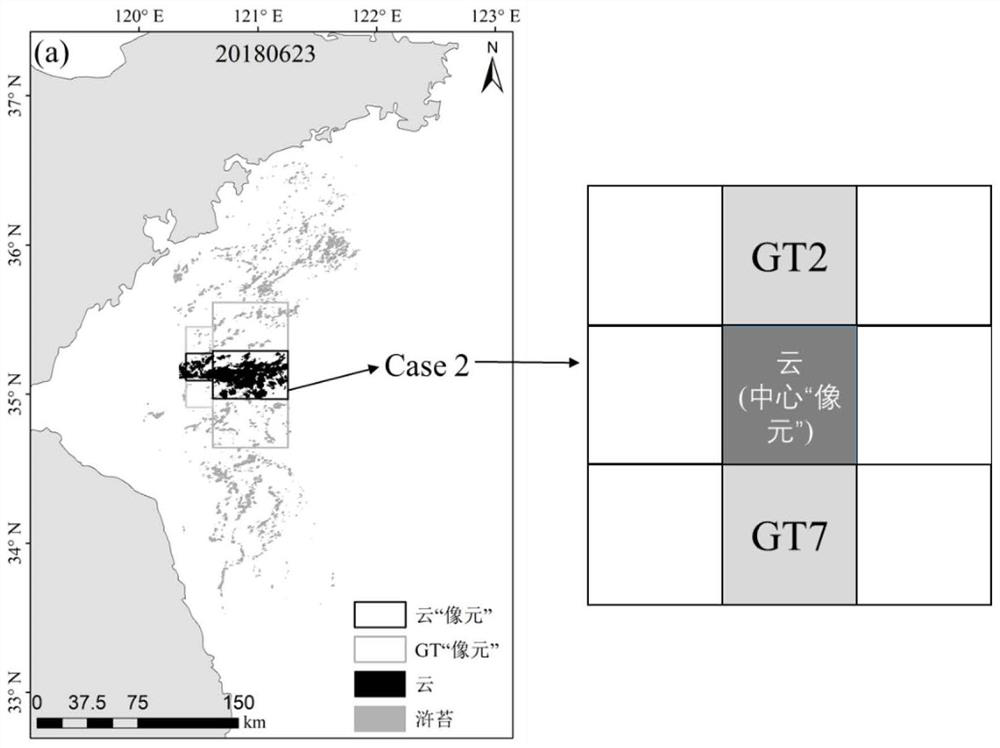
The invention discloses a method for estimating the sea surface green tide coverage area under MODIS image cloud, and the method comprises the following steps: carrying out the preprocessing of remotesensing image data, obtaining a water body remote sensing reflectivity image and a DVI image map of a research sea area, extracting green tide information and surrounding cloud information covered bygreen tide, determining a cloud pixel with green tide distribution around by utilizing the rectangular frame, assuming that the cloud pixel is a central pixel and the same rectangular frame with green tide at the periphery is an adjacent pixel, calculating a cloud coverage area in the central pixel and a green tide coverage area in each adjacent pixel, calculating the mean value of the green tidecoverage ratios in the adjacent pixels, taking the mean value as a central pixel value, and taking the product of the cloud coverage area in the central pixel and the central pixel value as the coverage area of the green tide on the sea surface under the cloud. According to the method disclosed by the invention, the green tide coverage area of the sea surface under the MODIS image cloud can be better estimated, the influence of the cloud on the optical image on green tide area estimation is reduced, and technical support can be provided for quantitative analysis and research of green tide.

Description

technical field [0001] The invention relates to the technical field of marine monitoring, in particular to a method for estimating the coverage area of ​​green tides on the sea surface under clouds of MODIS images. Background technique [0002] In recent years, the green tide and gold tide disasters caused by the rapid reproduction and accumulation of floating macroalgae have increased significantly in the global ocean and become a global marine ecological problem. Since 2007, the Yellow Sea has experienced the world's largest cross-regional green tide disaster every summer, which has caused serious ecological environment and socio-economic impacts, and has attracted widespread attention from scholars and the public. In many studies, satellite data has played an important role due to its multi-view, multi-scale, and large-scale advantages. Through remote sensing data, the origin and early development process of the green tide are gradually clear: The green tide in the South...

Claims


Application Information

Patent Timeline
IPC IPC(8): G06T7/62
CPCG06T7/62G06T2207/10032G06T2207/30181G06T2207/20024
Inventor 安德玉邢前国禹定峰
Owner OCEANOGRAPHIC INSTR RES INST SHANDONG ACAD OF SCI
Learn More