Land diversity metering method based on territorial survey data
A technique for surveying data and diversity, applied in data processing applications, special data processing applications, structured data retrieval, etc., can solve problems such as priority timing issues in land use planning that do not pay attention, to increase happiness, improve convenience, Improve the effect of diversity index
- Summary
- Abstract
- Description
- Claims
- Application Information
AI Technical Summary
Problems solved by technology
Method used
Image
Examples
Embodiment Construction
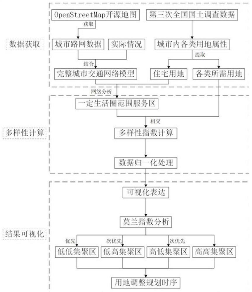
[0042] Step 1: Data Acquisition and Collation of the Third National Land Survey
[0043] 1.1 The third national land survey data acquisition: from the urban natural resources and planning department.
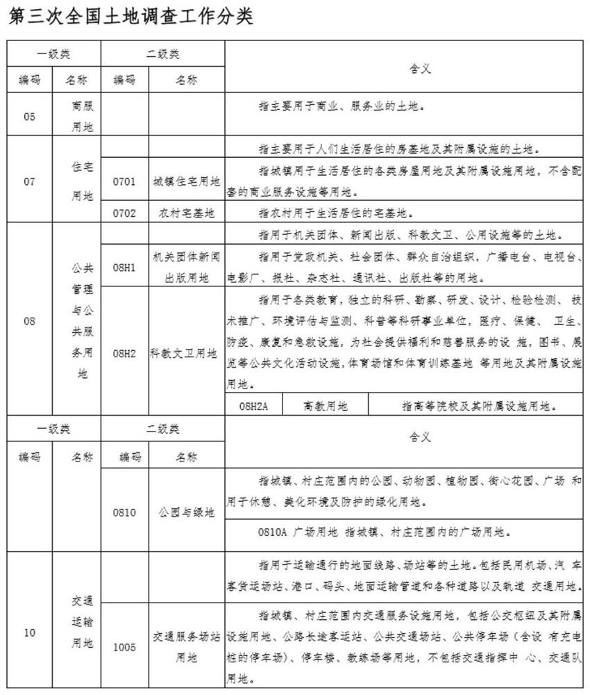
[0044] 1.2 Data collation of the third national land survey: select the land use classification and summary data in the land survey data (see figure 2 ), imported into ArcGIS, and used the clipping tool of ArcGIS to capture the old urban area of Wu'an City as the research area.
[0045] Step 2: Construct a complete traffic network model of Wu'an City
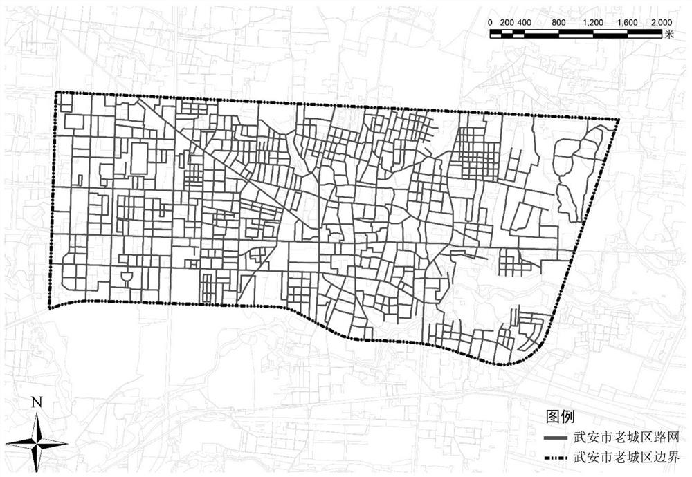
[0046]2.1 Data preparation for the construction of the traffic network: Obtain the road network data of the old urban area of Wu'an City through OpenStreetMap open source maps and crawler tools, and improve the road network system of Wu'an City through data comparison and calibration, combined with actual research conditions. The road network data structure mainly includes the fields of road alignment, road grade, and road ...
PUM
 Abstract
Description
Claims
Application Information
 - R&D
- Intellectual Property
- Life Sciences
- Materials
- Tech Scout
- Unparalleled Data Quality
- Higher Quality Content
- 60% Fewer Hallucinations
Browse by: Latest US Patents, China's latest patents, Technical Efficacy Thesaurus, Application Domain, Technology Topic, Popular Technical Reports.
© 2025 PatSnap. All rights reserved.Legal|Privacy policy|Modern Slavery Act Transparency Statement|Sitemap|About US| Contact US: help@patsnap.com


