Method and system for collecting, transmitting and processing three-dimensional laser surveying and mapping data of building
A three-dimensional laser and data acquisition technology, applied in the field of architectural surveying and mapping, can solve problems such as inconsistent work progress, redundant data, and missing data, and achieve the effects of avoiding data acquisition errors, reducing software and hardware requirements, and enhancing versatility
- Summary
- Abstract
- Description
- Claims
- Application Information
AI Technical Summary
Problems solved by technology
Method used
Image

Examples
Embodiment Construction
[0032] Further detailed explanation through specific implementation mode below:
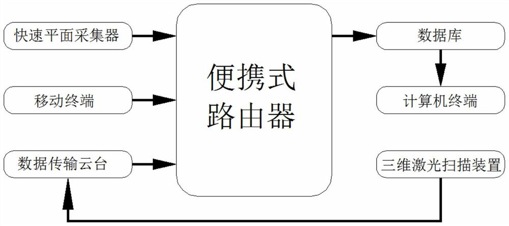
[0033] Such as figure 1As shown, the system for acquisition, transmission and processing of building three-dimensional laser surveying and mapping data includes a mobile terminal, a fast plane collector, a three-dimensional laser scanner, a portable router, a data transmission platform, a computer terminal and a database; the fast plane collector uses its built-in The WiFi module of the mobile terminal is wirelessly connected. After the fast plane collector collects the building plane data and transmits it to the mobile terminal, the mobile terminal is connected to the local area network formed by the portable router, and the portable router is connected to the data transmission cloud. The platform is connected through a network cable, a three-dimensional laser scanner is installed at the data transmission platform, and the data transmission platform and the three-dimensional laser scanner are el...
PUM
 Abstract
Description
Claims
Application Information