

Laser radar SLAM algorithm and inertial navigation fusion positioning method
A laser radar, fusion positioning technology, applied in surveying and navigation, navigation, road network navigator and other directions, to achieve the effect of wide use prospects
- Summary
- Abstract
- Description
- Claims
- Application Information
AI Technical Summary
Problems solved by technology
Method used
Image

Examples
Embodiment Construction
[0021] Preferred embodiments of the present invention will be specifically described below in conjunction with the accompanying drawings, wherein the accompanying drawings constitute a part of the application and are used together with the embodiments of the present invention to explain the principle of the present invention.
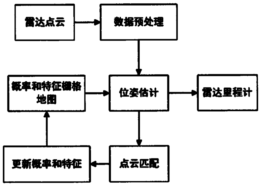
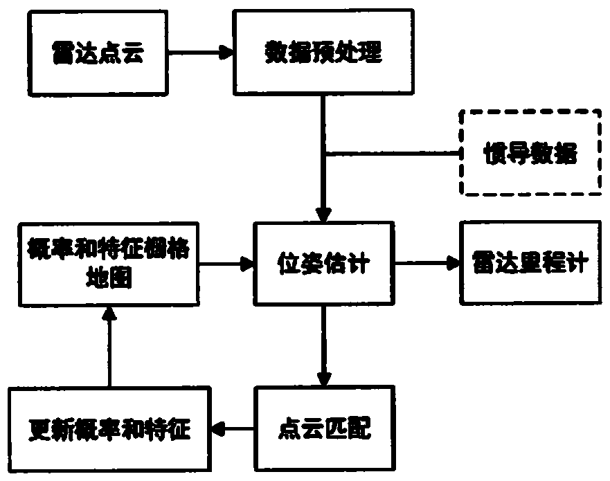
[0022] A specific embodiment of the present invention discloses a lidar mileage calculation method based on a characteristic probability grid map, such as figure 1 shown, including the following steps:
[0023] Data preprocessing, feature probability map update, point cloud and map matching and update pose.
[0024] Data preprocessing is the preliminary processing, downsampling and classification of the lidar point cloud;
[0025] The main function of the feature probability map update part is to manage the map, extract point cloud distribution features, update the grid, etc.;
[0026] Point cloud matching and pose update is through the data associati...
PUM
 Abstract
Description
Claims
Application Information