Construction method of three-dimensional ocean current real-time rapid analysis system based on satellite remote sensing

A rapid analysis and satellite remote sensing technology, applied in the field of marine information, can solve the problems of obtaining three-dimensional real-time ocean current analysis fields, etc., and achieve the effects of improving marine environmental protection capabilities, high processing efficiency, and wide application range

Active Publication Date: 2021-07-09
TIANJIN UNIV
View PDF6 Cites 7 Cited by
  • Summary
  • Abstract
  • Description
  • Claims
  • Application Information

AI Technical Summary

Problems solved by technology

However, there are still few researches on the method of obtaining 3D real-time ocean current analysis field

Method used


Image

  • Construction method of three-dimensional ocean current real-time rapid analysis system based on satellite remote sensing
  • Construction method of three-dimensional ocean current real-time rapid analysis system based on satellite remote sensing
  • Construction method of three-dimensional ocean current real-time rapid analysis system based on satellite remote sensing

Examples


Embodiment Construction

[0043] The present invention will be described in further detail below in conjunction with the accompanying drawings and specific embodiments. It should be understood that the specific embodiments described here are only used to explain the present invention, not to limit the present invention.

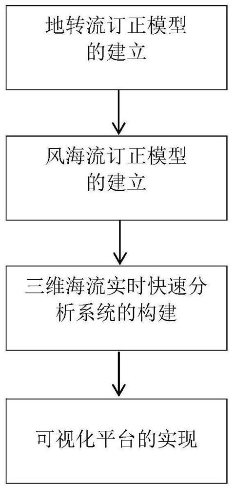
[0044] figure 1 It is the construction flowchart of the three-dimensional ocean current real-time rapid analysis system of the present invention, combined with figure 1 Describe the system construction process and principle.

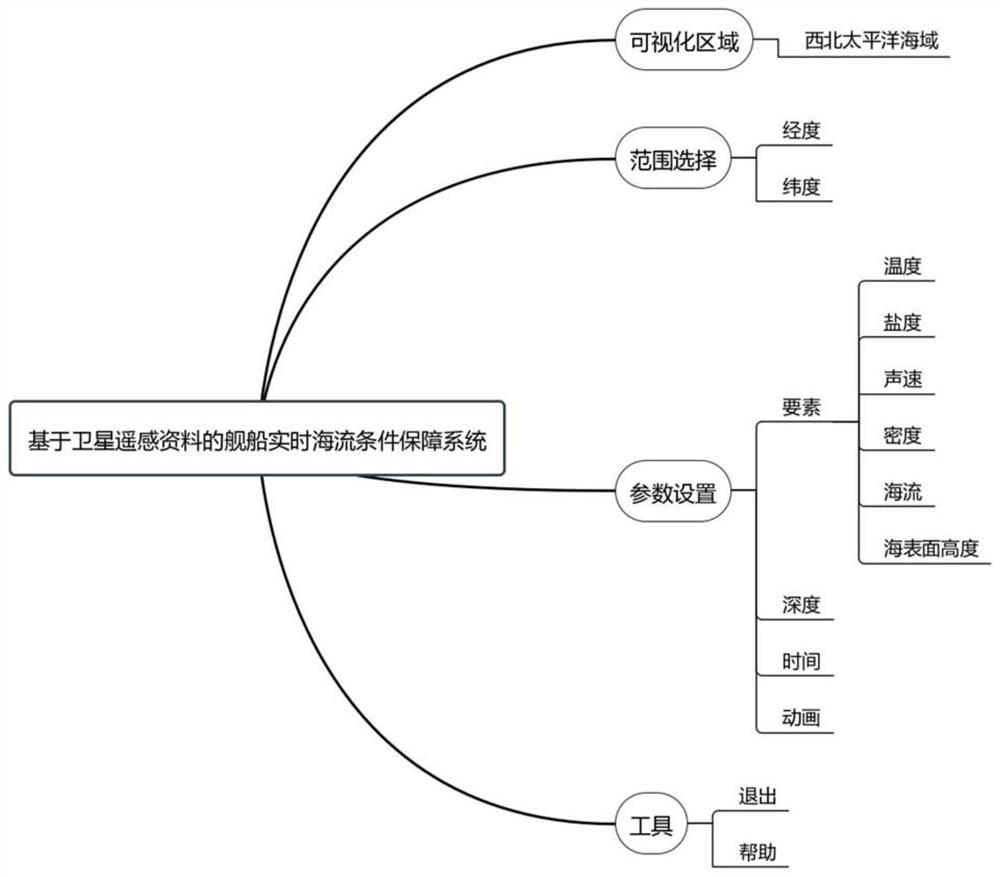
[0045] In this embodiment, the sea area of ​​the Northwest Pacific Ocean (99°E-150°E, 10°S-52°N) is used as the test sea area, which mainly includes two tasks of real-time and rapid analysis system of three-dimensional ocean current and visualization platform construction.

[0046] Build a real-time rapid analysis system for 3D ocean currents and realize platform visualization through the following steps:

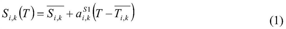
[0047] Step 1. Establishment of geostrophic flow cor...


PUM


Abstract

The invention discloses a construction method of a three-dimensional ocean current real-time rapid analysis system based on satellite remote sensing; the method comprises the steps: assimilating on-site observation temperature and salinity profile data through a three-dimensional temperature and salinity field obtained through the vertical inversion of real-time satellite observation sea surface temperature (SST), sea surface salinity (SSS) and sea surface height anomaly (SSHa), and obtaining a three-dimensional temperature and salinity analysis field; and carrying out earth current conversion correction on the three-dimensional ocean current reanalysis background field, observing a sea surface wind field by using a satellite to calculate a wind ocean current, carrying out wind ocean current correction on the three-dimensional ocean current reanalysis background field, and constructing a three-dimensional ocean current real-time rapid analysis system based on a visual platform. The system has the characteristics of miniaturization and rapid analysis, and can be loaded on a ship to provide real-time marine environment condition guarantee for the ship, including sea surface height, three-dimensional ocean current, temperature, salinity, sound field and the like.

Description

technical field [0001] The present invention belongs to the technical field of ocean information, and specifically relates to providing a three-dimensional ocean current real-time analysis field as the goal, and building a three-dimensional ocean current real-time rapid analysis system (Quick Real-Time Ocean Current Analysis System) as a technical support, and through a visual interface to integrate the above analysis system An ocean current condition guarantee system that outputs results in real time for display. Background technique [0002] As an important element of the marine environment, ocean currents have been applied to many civil and military fields, such as navigation safety of ships at sea, search and rescue, oil spill disaster disposal, and weapon platforms. In terms of the navigation safety of civil ships, ship safety has always been a matter of great concern to the shipping industry. For a long time, the world's shipping countries have done a lot of work on s...

Claims


Application Information

Patent Timeline
Patent Type & Authority Applications(China)
IPC IPC(8): G06F30/28G01C13/00G06F16/26G06F16/2458G06F113/08G06F119/08G06F119/14
CPCG06F30/28G01C13/00G06F16/26G06F16/2477G06F2113/08G06F2119/14G06F2119/08Y02A90/10
Inventor 耿倩倩李威韩雨辰梁康壮韩桂军郭晓娅荆天董婉秋刘帅
Owner TIANJIN UNIV
Why Eureka
Try Eureka