

Monitoring Method of Regional Actual Irrigated Area Based on Optical and Radar Remote Sensing Data
A technology of remote sensing data and irrigation area, applied in data processing applications, image data processing, machine learning, etc., can solve problems such as poor response to changes, changes in backscatter coefficients, and coarse spatial resolution, so as to promote irrigation detection and eliminate The effect of uncertainty
- Summary
- Abstract
- Description
- Claims
- Application Information
AI Technical Summary
Problems solved by technology
Method used
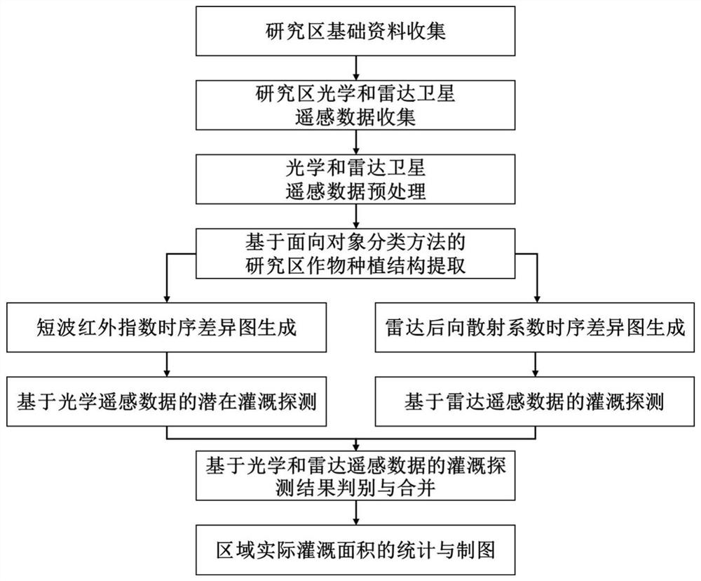
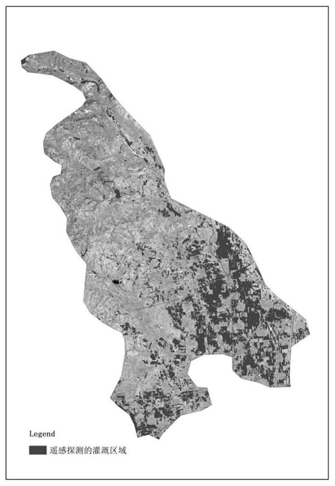
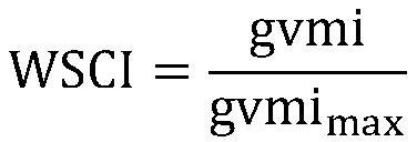
Image

Examples
Embodiment 1
[0064] (1) Collection of basic data in the study area
[0065] Determine the geographical location and boundary of the research area according to the research needs. Collect the main crops planted in the region and the phenological periods of the main crops, and collect the agricultural calendar information of the main crops in the region. The agricultural calendar information of the main crops in the research area includes the perennial irrigation time of the main crops. In this embodiment, a lookup table of perennial irrigation time for main crops in the research area will be made based on the survey information. Based on this lookup table, the fast query of the main irrigation time of corresponding crops can be realized.
[0066] (2) Optical and radar satellite remote sensing data collection in the study area
[0067] Collect optical and radar satellite remote sensing data in the research area according to the needs of the research area. The method mentioned in the pres...
PUM
 Abstract
Description
Claims
Application Information