
Ozone concentration estimation method fusing satellite remote sensing and ground monitoring data

A technology for ozone concentration and monitoring data, which is applied to image detector methods, image signal processing, neural learning methods, and measurement devices, can solve problems such as high uncertainty in conclusions and complex calculations, and achieve enhanced versatility and operation Simple, Accuracy-Enhancing Effects

Active Publication Date: 2021-07-30
XI AN JIAOTONG UNIV
View PDF8 Cites 4 Cited by
  • Summary
  • Abstract
  • Description
  • Claims
  • Application Information

AI Technical Summary

Problems solved by technology

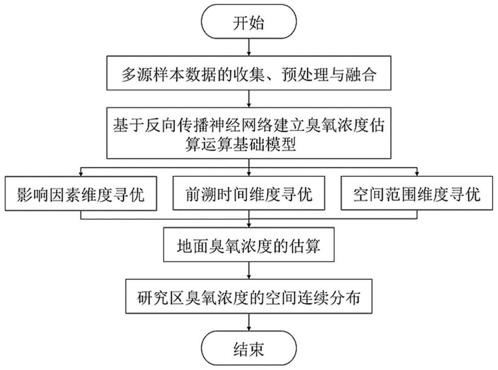
[0004] In order to overcome the shortcomings of the above-mentioned prior art, the object of the present invention is to provide a method for estimating ozone concentration by fusing satellite remote sensing and ground monitoring data. The method for estimating ozone concentration based on machine learning has high accuracy, strong reliability and simple operation , which solves the problems of high uncertainty and complex calculation of the conclusions obtained by the existing ozone concentration estimation methods

Method used


Image

  • Ozone concentration estimation method fusing satellite remote sensing and ground monitoring data
  • Ozone concentration estimation method fusing satellite remote sensing and ground monitoring data
  • Ozone concentration estimation method fusing satellite remote sensing and ground monitoring data

Examples


Embodiment Construction

[0036] In order to enable those skilled in the art to better understand the solutions of the present invention, the following will clearly and completely describe the technical solutions in the embodiments of the present invention in conjunction with the drawings in the embodiments of the present invention. Obviously, the described embodiments are only It is an embodiment of a part of the present invention, but not all embodiments. Based on the embodiments of the present invention, all other embodiments obtained by persons of ordinary skill in the art without making creative efforts shall fall within the protection scope of the present invention.

[0037] It should be noted that the terms "first" and "second" in the description and claims of the present invention and the above drawings are used to distinguish similar objects, but not necessarily used to describe a specific sequence or sequence. It is to be understood that the data so used are interchangeable under appropriate ...


PUM


Abstract

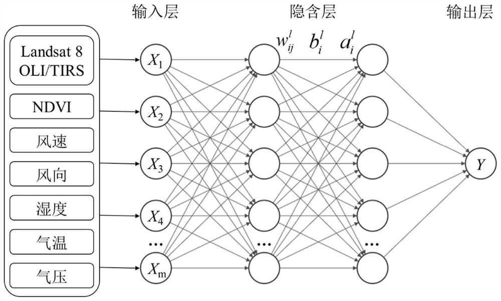
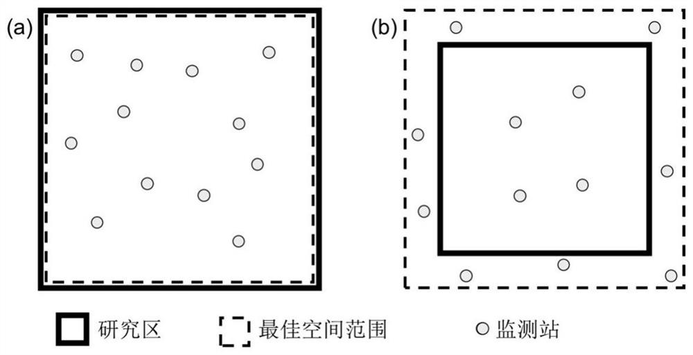
The invention discloses an ozone concentration estimation method fusing satellite remote sensing and ground monitoring data, and belongs to the technical field of environment monitoring. The method comprises the steps of 1, collecting, preprocessing and fusing multi-source sample data to obtain input parameters; 2, based on a multilayer mapping back propagation neural network, establishing an ozone concentration estimation operation basic model; and 3, based on the influence factors, the forward time and the spatial range, searching an optimal input parameter combination of the obtained ozone concentration estimation operation basic model, and accurately estimating the ground ozone concentration according to the obtained optimal input parameter combination to obtain the spatial continuous distribution condition of the ozone concentration, and realize the ozone concentration estimation method fusing satellite remote sensing and ground monitoring data. The method has the advantages of high accuracy, high reliability and simplicity in operation, the used multi-source sample data are free and open-source, the universality is enhanced, the ozone concentration can be quickly estimated, and a continuous distribution diagram of the ozone concentration in a target area can be drawn.

Description

technical field [0001] The invention belongs to the technical field of environmental monitoring and relates to a method for estimating ozone concentration by fusing satellite remote sensing and ground monitoring data. Background technique [0002] With the acceleration of urbanization and industrialization, the problem of air pollution is becoming more and more serious. Ozone has become the primary pollutant affecting ambient air quality, and directly affects human physical and mental health. Therefore, monitoring and revealing the regularity of the continuous distribution of ozone in time and space is of great significance to the prevention and treatment of ozone pollution and its harm to health. [0003] At present, common ozone monitoring methods include ground monitoring and remote sensing monitoring. Ground monitoring is based on monitoring stations for all-weather continuous observation, which can directly obtain accurate information on the ozone concentration in the ...

Claims


Application Information

Patent Timeline
Patent Type & Authority Applications(China)
IPC IPC(8): G01N21/17G01S17/89G01S17/95G06N3/04G06N3/08
CPCG01N21/17G01S17/89G01S17/95G06N3/084G01N2021/1795G01N2021/1765G06N3/045Y02A90/10
Inventor 杨晓婷张猛张博
Owner XI AN JIAOTONG UNIV
Learn More