Inertial navigation and double-antenna GNSS (Global Navigation Satellite System) external parameter calibration method
A calibration method and dual-antenna technology, applied in the field of satellite navigation, can solve problems such as difficulty, limited measurement accuracy, and complex measurement, and achieve the effect of improving efficiency and saving costs
- Summary
- Abstract
- Description
- Claims
- Application Information
AI Technical Summary
Problems solved by technology
Method used
Image


Examples
Embodiment
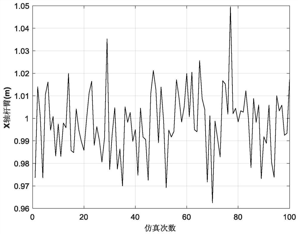
[0180] The method of the present invention is verified experimentally in the form of simulation. The simulation conditions are set as follows: gyro constant drift is 10° / h, random drift is 10° / h; accelerometer constant zero bias is 1mg, random drift is 1mg; GNSS position measurement error is 5cm, velocity measurement error is 0.05m / s , the heading measurement error is 0.1°; the lever arms of IMU and GNSS are 1m, 0.5m, 0.8m, and the heading deviation angle is 1°; the sampling frequency of gyro and accelerometer is 100Hz, and the sampling frequency of GNSS is 5Hz.
[0181] figure 2 It is a simulated track map for the vehicle, including acceleration and deceleration, turning, climbing, etc.
[0182] 100 Monte Carlo simulation tests were carried out, and the experimental results are as follows: image 3 , Figure 4 , Figure 5 and Image 6 As shown, it can be seen that the estimated external parameters all oscillate around the theoretical value, and the accuracy is high. Th...
PUM
 Abstract
Description
Claims
Application Information
 - R&D
- Intellectual Property
- Life Sciences
- Materials
- Tech Scout
- Unparalleled Data Quality
- Higher Quality Content
- 60% Fewer Hallucinations
Browse by: Latest US Patents, China's latest patents, Technical Efficacy Thesaurus, Application Domain, Technology Topic, Popular Technical Reports.
© 2025 PatSnap. All rights reserved.Legal|Privacy policy|Modern Slavery Act Transparency Statement|Sitemap|About US| Contact US: help@patsnap.com