
Marsh wetland remote sensing extraction method and system based on soil humidity

A technology of soil moisture and extraction method, which is applied in image enhancement, instrumentation, and material analysis through optical means, etc. It can solve the problems of ignoring the core parameters of swamp wetlands, the large impact of sensor type and data resolution, and low recognition efficiency

Pending Publication Date: 2021-09-14
MINISTRY OF ECOLOGY & ENVIRONMENT CENT FOR SATELLITE APPL ON ECOLOGY ENVIRONMENT
View PDF3 Cites 1 Cited by
  • Summary
  • Abstract
  • Description
  • Claims
  • Application Information

AI Technical Summary

Problems solved by technology

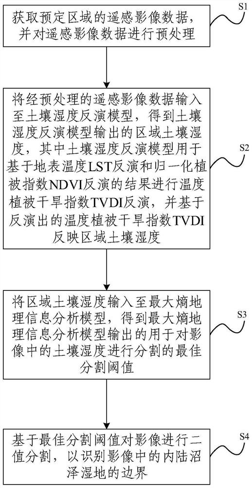
[0005] By coupling the soil moisture inversion model and the maximum entropy geographic information analysis model, the present invention proposes a remote sensing extraction method and system for swamp wetlands based on soil moisture, aiming to solve the problem that the recognition efficiency of swamp wetland range in the prior art is still low, And it is greatly affected by the sensor type and data resolution, resulting in a relatively small problem of applicability, and overcomes the defect of ignoring the core parameters of swamp wetlands (ie soil moisture) in the prior art

Method used


Image

  • Marsh wetland remote sensing extraction method and system based on soil humidity
  • Marsh wetland remote sensing extraction method and system based on soil humidity
  • Marsh wetland remote sensing extraction method and system based on soil humidity

Examples


Embodiment Construction

[0059] In order to make the purpose, technical solutions and advantages of the present invention clearer, the technical solutions in the present invention will be clearly and completely described below in conjunction with the accompanying drawings in the present invention. Obviously, the described embodiments are part of the embodiments of the present invention , but not all examples. Based on the embodiments of the present invention, all other embodiments obtained by persons of ordinary skill in the art without creative efforts fall within the protection scope of the present invention.

[0060] Various terms or phrases used in the present invention have common meanings known to those skilled in the art, even so, the present invention still hopes to give a more detailed description and explanation to these terms or phrases. If the terms and phrases involved herein are inconsistent with the known meanings, the meanings expressed in the present invention shall prevail; and if th...


PUM


Abstract

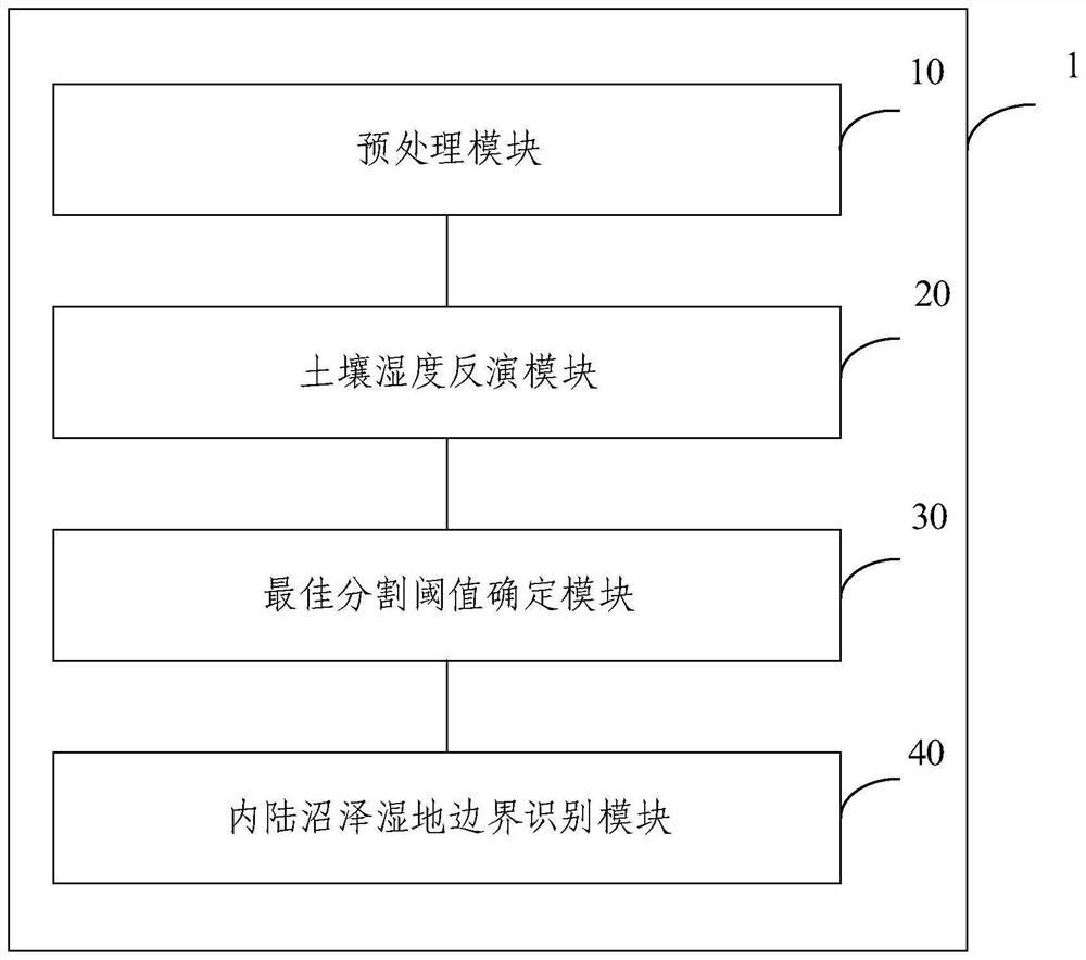
The invention provides a marsh wetland remote sensing extraction method and system based on soil humidity. The method comprises the following steps: acquiring remote sensing image data of a predetermined area, and preprocessing the remote sensing image data; inputting the preprocessed remote sensing image data into a soil humidity inversion model, the regional soil humidity output by the soil humidity inversion model is obtained, wherein the soil humidity inversion model is used for temperature vegetation drought index TVDI inversion based on the results of land surface temperature LST inversion and normalized vegetation index NDVI inversion, and the regional soil humidity is reflected based on the inverted temperature vegetation drought index TVDI; inputting the regional soil humidity into a maximum entropy geographic information analysis model to obtain an optimal segmentation threshold value which is output by the maximum entropy geographic information analysis model and is used for segmenting the soil humidity in the image; and performing binary segmentation on the image based on the optimal segmentation threshold to identify the boundary of the inland marsh wetland in the image.

Description

technical field [0001] The invention relates to the application field based on remote sensing, in particular to a remote sensing extraction method and system for swamp wetland based on soil moisture. Background technique [0002] Marsh wetlands are transitional ecosystems before terrestrial ecosystems and aquatic ecosystems, and are known as the world's three major ecosystems together with forests and oceans. Marsh wetland is a natural geographical unit with thin layer of water or often over-humidity, peat layer or gleization layer in soil, and growth of moisture-loving and water-loving marsh plants. It provides supply, regulation, support and culture for human society. Ecosystem services play an extremely important role in ensuring national and regional ecological security and the sustainable development of human society. However, due to the "transitional" characteristics of marsh wetlands, how to identify and determine the geographical boundaries of marsh wetlands in hori...

Claims


Application Information

Patent Timeline
Patent Type & Authority Applications(China)
IPC IPC(8): G06F17/18G06T7/11G06T7/136G01N21/84
CPCG06F17/18G06T7/11G06T7/136G01N21/84G06T2207/10032
Inventor 侯鹏候静付卓肖如林翟俊陈妍金点点
Owner MINISTRY OF ECOLOGY & ENVIRONMENT CENT FOR SATELLITE APPL ON ECOLOGY ENVIRONMENT
Learn More