Unmanned aerial vehicle remote sensing river entrance discharge port identification method and device
An identification method and remote sensing technology, which are applied in the field of identification methods and devices for remote sensing of unmanned aerial vehicles (UAVs) into rivers and discharge outlets, and can solve the problems of unprovided solutions, affecting target identification and classification results, and high cost.
- Summary
- Abstract
- Description
- Claims
- Application Information
AI Technical Summary
Problems solved by technology
Method used
Image


Examples
Embodiment 1
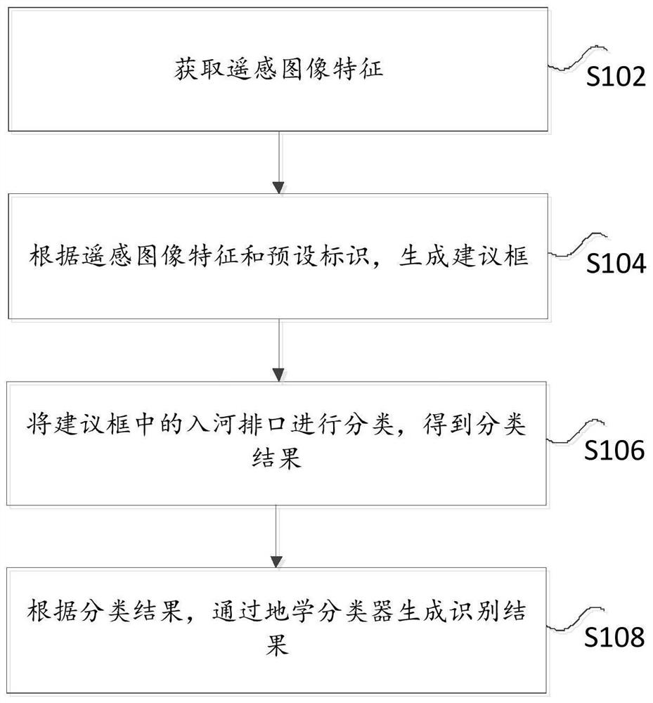
[0029] figure 1 It is a flow chart of a method for identifying a river outlet by remote sensing of an unmanned aerial vehicle according to an embodiment of the present invention, such as figure 1 As shown, the method includes the following steps:
[0030] Step S102, acquiring remote sensing image features.
[0031]Specifically, the embodiment of the present invention aims to solve the problem that the prior art cannot use the inherent geoscience-related information of the target concerned in the above-mentioned fields such as remote sensing except for the spectral information of the image itself: the spatial distribution characteristics of the target, such as Distribution of river outlets along the water system; spatial correlation characteristics between targets, such as distribution of plants around river outlets, distribution of factories and other sewage units, etc.; spatial shape of targets, such as river outlets in three-dimensional space The characteristics of the dep...
Embodiment 2
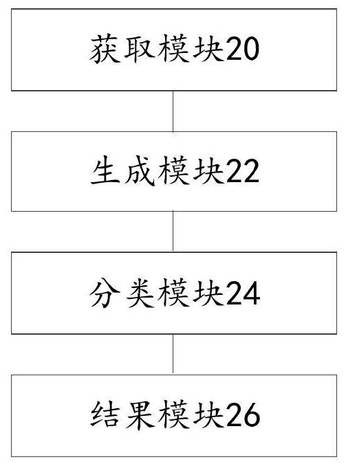
[0048] figure 2 It is a structural block diagram of an unmanned aerial vehicle river outlet identification device according to an embodiment of the present invention, such as figure 2 As shown, the device includes:
[0049] The obtaining module 20 is used to obtain remote sensing image features.
[0050] Specifically, the embodiment of the present invention aims to solve the problem that the prior art cannot use the inherent geoscience-related information of the target concerned in the above-mentioned fields such as remote sensing except for the spectral information of the image itself: the spatial distribution characteristics of the target, such as Distribution of river outlets along the water system; spatial correlation characteristics between targets, such as distribution of plants around river outlets, distribution of factories and other sewage units, etc.; spatial shape of targets, such as river outlets in three-dimensional space The characteristics of the depressions...
PUM
 Abstract
Description
Claims
Application Information
 - R&D Engineer
- R&D Manager
- IP Professional
- Industry Leading Data Capabilities
- Powerful AI technology
- Patent DNA Extraction
Browse by: Latest US Patents, China's latest patents, Technical Efficacy Thesaurus, Application Domain, Technology Topic.
© 2024 PatSnap. All rights reserved.Legal|Privacy policy|Modern Slavery Act Transparency Statement|Sitemap