
Instantaneous ocean reflector model correction positioning method and system for GNSS-R specular reflection points

A technology of specular reflection and model correction, applied in the cross field to achieve the effect of accurate results

Pending Publication Date: 2021-11-09
CHINA ACADEMY OF SPACE TECHNOLOGY
View PDF0 Cites 0 Cited by
  • Summary
  • Abstract
  • Description
  • Claims
  • Application Information

AI Technical Summary

Problems solved by technology

[0004] The technical problem of the present invention is to overcome the deficiencies in the prior art, and provide a method and system for correcting and positioning the instantaneous ocean reflection surface model of GNSS-R specular reflection points, aiming at correcting the specular reflection points to realize GNSS-R The quantification and correction of R sea state errors can offset the low positioning accuracy of the GNSS-R altimetry reflector model caused by the sea surface terrain elevation error and the vertical deviation slope error, thereby improving the positioning accuracy of the GNSS-R altimetry reflector model

Method used


Image

  • Instantaneous ocean reflector model correction positioning method and system for GNSS-R specular reflection points
  • Instantaneous ocean reflector model correction positioning method and system for GNSS-R specular reflection points
  • Instantaneous ocean reflector model correction positioning method and system for GNSS-R specular reflection points

Examples


Embodiment Construction

[0077] In order to make the object, technical solution and advantages of the present invention clearer, the embodiments disclosed in the present invention will be further described in detail below in conjunction with the accompanying drawings.

[0078] The reflection path of the GNSS-R altimetry reflector model is: from the GNSS satellite transmitter to the specular reflection point defined by the reference reflector, and then to the GNSS-R satellite receiver phase center. Among them, the elevation and slope of the reference reflector determine the position of the specular reflection point, which in turn determines the reflection path of the GNSS-R altimetry reflector model, and the model reflection delay determined based on the reflection path. Therefore, in order to obtain model reflection delay without sea state error, it is necessary to construct an ideal smooth sea surface model whose elevation and slope are close to the instantaneous sea surface at the time and position o...


PUM


Abstract

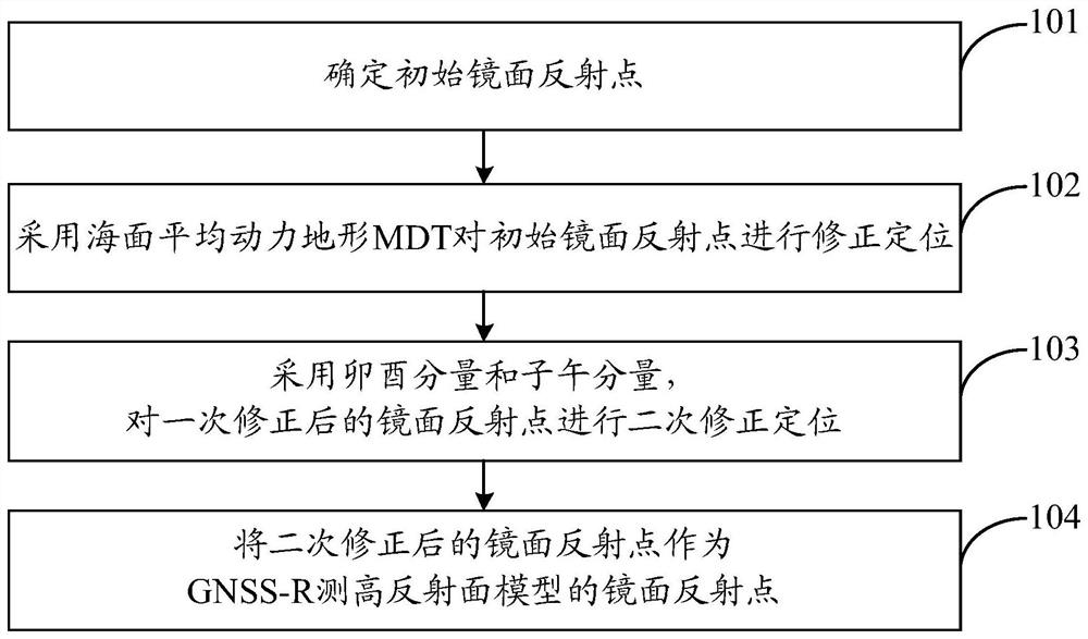
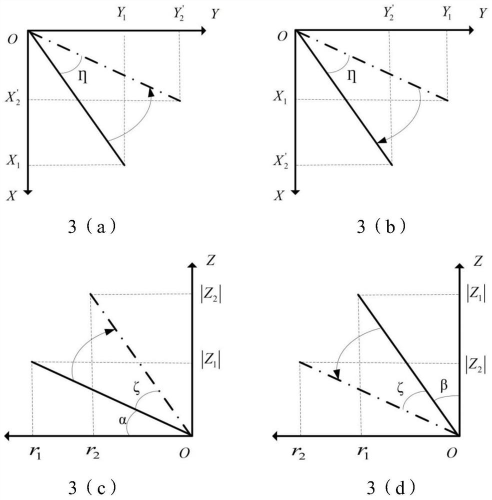
The invention discloses an instantaneous ocean reflector model correction positioning method and system for GNSS-R specular reflection points. The method comprises the following steps: determining an initial specular reflection point; correcting and positioning the initial specular reflection point by adopting sea surface average dynamic topography MDT to obtain a specular reflection point after primary correction; adopting a prime component eta and a meridian component zeta to perform secondary correction positioning on the primarily corrected specular reflection point, and positioning the primarily corrected specular reflection point on the instantaneous sea surface to obtain a secondarily corrected specular reflection point; and taking the mirror reflection point after the secondary correction as the mirror reflection point of the GNSS-R height measurement reflection surface model so as to improve the positioning precision of the GNSS-R height measurement reflection surface model. According to the method, the mirror reflection points are corrected, so that the problem of low positioning precision of the GNSS-R height measurement reflecting surface model caused by sea surface terrain elevation errors and vertical line deviation gradient errors is solved, and the positioning precision of the GNSS-R height measurement reflecting surface model is further improved.

Description

technical field [0001] The invention belongs to the intersecting technical fields of satellite altimetry and marine surveying and mapping, and in particular relates to a method and system for correcting and positioning an instantaneous ocean reflection surface model of a GNSS-R mirror reflection point. Background technique [0002] GNSS-R altimetry can be used as an auxiliary means of traditional altimeters to provide much-needed global high-coverage sea surface height observations for global ocean mesoscale and sub-mesoscale processes, as well as global climate change research. Due to the presence of waves on the sea surface, the actual sea surface is rough, skewed and rapidly changing, especially for the wavelength of the GNSS signal. The signal does not undergo specular reflection on the sea surface, which leads to a deviation in the position of the specular reflection point on the reflected power waveform, thereby introducing an error to the delay of the reflected signal...

Claims


Application Information

Patent Timeline
Patent Type & Authority Applications(China)
IPC IPC(8): G01S19/23
CPCG01S19/23Y02A90/10
Inventor 吴凡郑伟
Owner CHINA ACADEMY OF SPACE TECHNOLOGY
Learn More