Slope ecological restoration monitoring method
- Summary
- Abstract
- Description
- Claims
- Application Information
AI Technical Summary
Problems solved by technology
Method used
Image
Examples
Embodiment
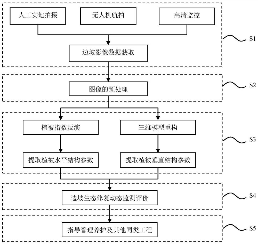
[0049] Such as figure 1 As shown, the slope ecological restoration monitoring method proposed by the present invention is based on the image data of close-range photogrammetry, including the following steps:
[0050] Step S1: Slope image data acquisition. Obtaining slope image data from a variety of sources, including manual images, UAV aerial photography, high-definition video surveillance, etc., can monitor the growth dynamics of slope vegetation in a timely, fast, accurate and continuous manner. For high and steep dangerous slopes and high-density plant communities, it greatly reduces the difficulty of vegetation survey. At the same time, multi-source image data can play a role of mutual confirmation and supplement, ensuring the comprehensiveness and accuracy of the original image data.
[0051] Step S2: Preprocessing of images. It refers to the preliminary screening, classification, and proofreading of the acquired multi-source image data, which are divided into various...
PUM
 Abstract
Description
Claims
Application Information
 - R&D
- Intellectual Property
- Life Sciences
- Materials
- Tech Scout
- Unparalleled Data Quality
- Higher Quality Content
- 60% Fewer Hallucinations
Browse by: Latest US Patents, China's latest patents, Technical Efficacy Thesaurus, Application Domain, Technology Topic, Popular Technical Reports.
© 2025 PatSnap. All rights reserved.Legal|Privacy policy|Modern Slavery Act Transparency Statement|Sitemap|About US| Contact US: help@patsnap.com


