Rice planting distribution extraction method based on wind cloud satellite data

A technology of satellite data and extraction methods, applied in image data processing, data processing applications, image analysis, etc.

Inactive Publication Date: 2021-11-30
CHINESE ACAD OF METEOROLOGICAL SCI
View PDF0 Cites 2 Cited by
  • Summary
  • Abstract
  • Description
  • Claims
  • Application Information

AI Technical Summary

Problems solved by technology

[0004] The purpose of this application is to provide a method for extracting rice planting distribution based on Fengyun satellite data, so as to solve the problems in the prior art, make up for the technical gap in the extraction of rice planting distribution information based on Fengyun satellite data, and achieve a high level of rice planting distribution. precision extraction

Method used


Image

  • Rice planting distribution extraction method based on wind cloud satellite data
  • Rice planting distribution extraction method based on wind cloud satellite data

Examples


Embodiment Construction

[0032] Next, the technical scheme in the present application embodiment will be described in the present application embodiment, and it is understood that the described embodiments are merely the embodiments of the present application, not all of the embodiments. Based on the embodiments in the present application, one of ordinary skill in the art is in the scope of the present application without making creative labor premistence.

[0033] In order to make the above objects, features, and advantages of the present application, the present application will be described in detail below with reference to the accompanying drawings and embodiments.

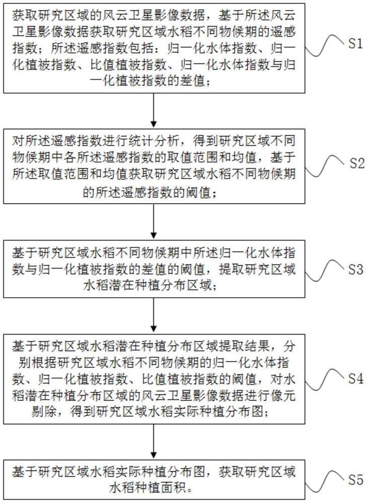
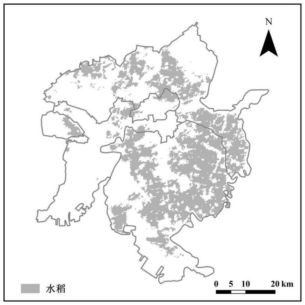
[0034] Refer figure 1 As shown, this embodiment provides a method of extracting a rice planting distribution based on wind and satellite data, including:

[0035] S1, get the wind and satellite image data of the research area, based on the wind and satellite image data acquisition research area rice different mawarding index; the remote s...


PUM


Abstract

The invention discloses a rice planting distribution extraction method based on wind cloud satellite data. The method comprises the following steps: acquiring remote sensing indexes of rice in different phenological periods in a research area based on wind cloud satellite image data, wherein the remote sensing indexes comprise a normalized water body index, a normalized vegetation index, a ratio vegetation index and a difference value between the normalized water body index and the normalized vegetation index; according to a threshold value of a difference value between the normalized water body index and the normalized vegetation index, extracting a rice potential planting distribution area; performing pixel elimination on the wind cloud satellite image data of the potential rice planting distribution area according to thresholds of the normalized water body index, the normalized vegetation index and the ratio vegetation index of the rice in different phenological periods in the research area to obtain an actual rice planting distribution map in the research area; and obtaining the rice planting area of the research region based on the actual rice planting distribution diagram of the research region. The technical blank of rice planting distribution information extraction based on wind cloud satellite data is filled, and high-precision extraction of rice planting distribution is realized.

Description

Technical field [0001] The present application relates to the field of raw planting distribution remote sensing extraction, and in particular, there is a method of extracting rice planting distribution based on wind and satellite data. Background technique [0002] Rice is the second largest crop type in China, and timely and accurately grasp the planting area and spatial distribution of rice, it is important in realistic meaning of macro-guided rice production, reasonable development of agricultural policies. Due to the advantages of satellite remote sensing technology, it has the advantages of timely, timely economical, efficient, and has become the main technical means of obtaining information on rice area spatial distribution, and is mostly based on Landsat, MODIS and other foreign remote sensing data sources. In recent years, my country's satellite remote sensing technology has developed rapidly, and many independent research and development satellites have been launched, bu...

Claims


Application Information

Patent Timeline
Patent Type & Authority Applications(China)
IPC IPC(8): G06K9/00G06Q10/06G06Q50/02G06T7/11G06T7/136G06T7/62
Inventor 周广胜张悦琦任鸿瑞周莉
Owner CHINESE ACAD OF METEOROLOGICAL SCI
Why Eureka
Try Eureka