

Landscape-scale plant diversity evaluation method with time-space consistency
An evaluation method and a variety of technologies, applied to instruments, character and pattern recognition, computer components, etc., can solve problems such as horizontal and vertical comparison, expansion, and impact assessment of limited service functions, achieving low cost and easy operation Effect
- Summary
- Abstract
- Description
- Claims
- Application Information
AI Technical Summary
Problems solved by technology
Method used
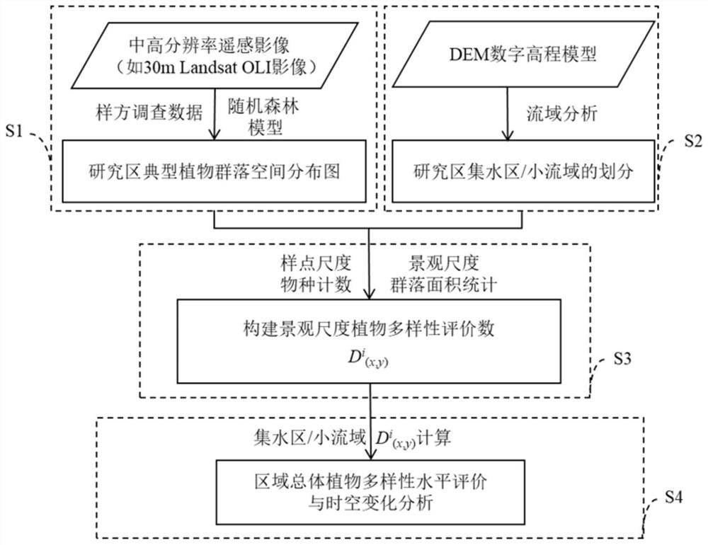
Image

Examples
Embodiment 1
[0043] Take Poyang Lake Wetland, a typical wetland ecosystem, as an example.
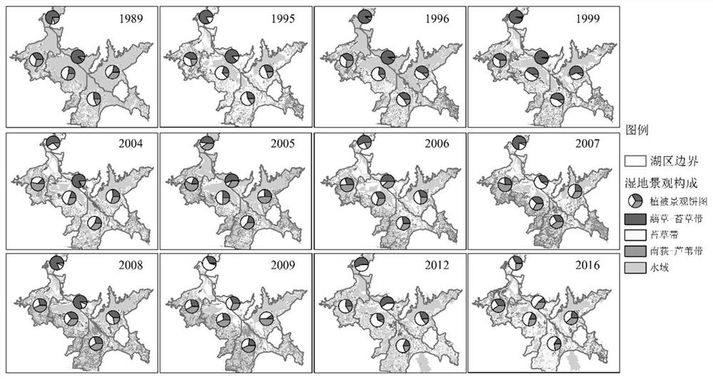
[0044] figure 2 Spatial distribution map of typical plant communities in Poyang Lake Wetland from 1989 to 2016 interpreted by random forest method. The specific steps include downloading the 30m resolution Landsat TM / ETM / OLI images covering the entire study area during the vegetation growth period of Poyang Lake wetland (April-June in spring and October-December in autumn), sorting the cloud cover, and selecting the The remote sensing images with the least cloud cover, combined with the survey data of vegetation samples in the same period, established a random forest classifier to interpret the spatial distribution map of typical plant communities in Poyang Lake Wetland. and Nandi-reed community.
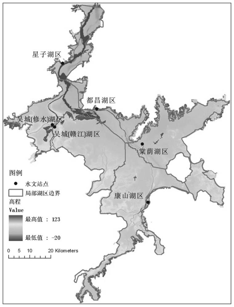
[0045] image 3 It is the spatial distribution map of Poyang Lake wetland catchment area / small watershed delineated according to the digital elevation model DEM. The specific steps are to conduct wat...
PUM
 Abstract
Description
Claims
Application Information