

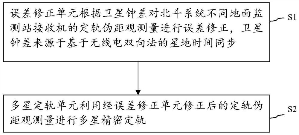
Navigation satellite multi-satellite orbit determination system and method based on satellite-ground bidirectional clock difference constraint
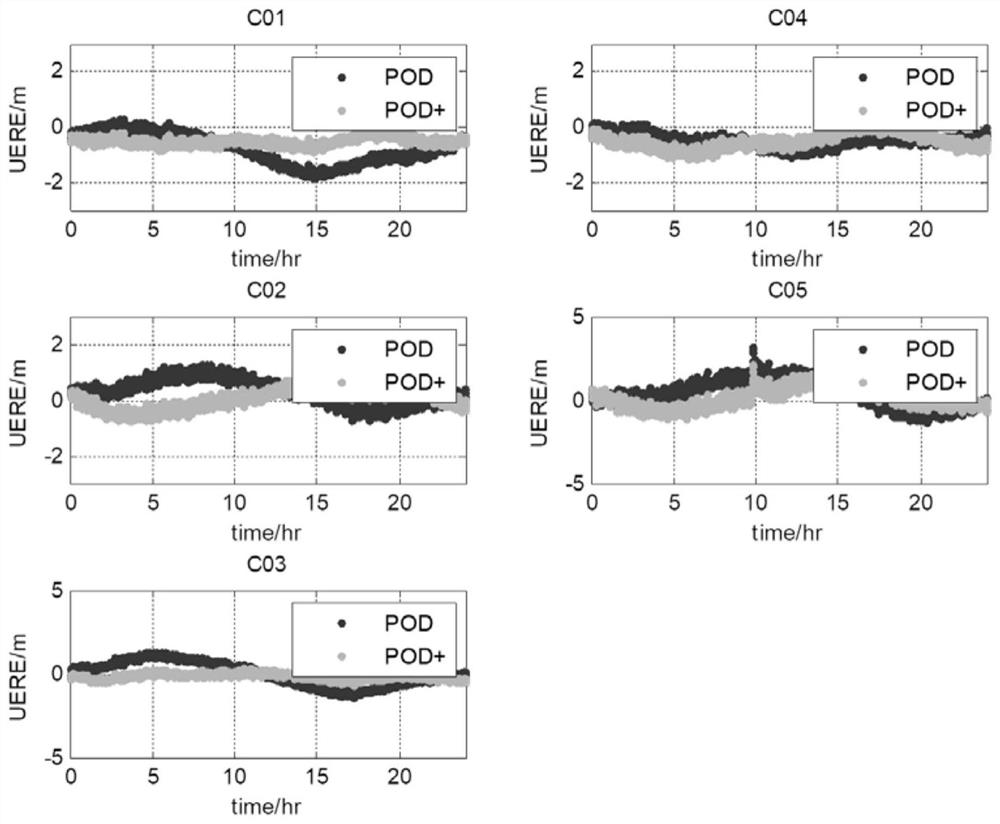
A technology for navigation satellites and satellite clock errors, applied in the field of navigation satellites, can solve problems such as the limitations of precise orbit determination of navigation satellites, and achieve the effects of reducing correlation, improving orbit determination accuracy, and improving availability.
- Summary
- Abstract
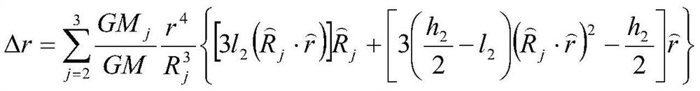
- Description
- Claims
- Application Information
AI Technical Summary
Problems solved by technology
Method used
Image

Examples
Embodiment Construction
[0051] The present invention will be further described below in conjunction with specific embodiments with reference to the accompanying drawings.
[0052] It should be noted that components in the various figures may be shown exaggerated for the purpose of illustration and are not necessarily true to scale. In the various figures, identical or functionally identical components are assigned the same reference symbols.
[0053] In the present invention, unless otherwise specified, "arranged on", "arranged on" and "arranged on" do not exclude the presence of intermediates between the two. In addition, "arranged on or above" only means the relative positional relationship between two parts, and under certain circumstances, such as after the product direction is reversed, it can also be converted to "arranged under or below", and vice versa Of course.
[0054] In the present invention, each embodiment is only intended to illustrate the solutions of the present invention, and sho...
PUM
 Abstract
Description
Claims
Application Information