
Method for identifying GIS sleeve of specified equipment in infrared image and storage medium

An infrared image and infrared spectrum technology, applied in the field of image processing, can solve the problems of complex outdoor environment, low efficiency of historical data use and analysis, useless background information in the area, etc., and achieve the effect of improving the accuracy.

Pending Publication Date: 2022-01-28
STATE GRID CHONGQING ELECTRIC POWER CO ELECTRIC POWER RES INST +2
View PDF0 Cites 1 Cited by
  • Summary
  • Abstract
  • Description
  • Claims
  • Application Information

AI Technical Summary

Problems solved by technology

[0003] However, the efficiency of manual detection is low, the outdoor environment is complex, and the detection results cannot be given in real time. In addition, the format of manual annotation is not standardized, and the image data after annotation will not help to improve the detection efficiency and recognition rate in the future, which makes the use of historical data analysis. The efficiency is low, and it cannot be a powerful help for future inspection and identification work
[0004] In order to solve the problems of manual detection and labeling, related technologies are screened by image recognition technology. However, due to the problem of the shooting angle of infrared pictures, a large-scale picture is required as a training sample set, and the recognition results are often not according to the GIS casing in the picture. Angle is marked, and most of the useless background information exists in the marked area

Method used


Image

  • Method for identifying GIS sleeve of specified equipment in infrared image and storage medium
  • Method for identifying GIS sleeve of specified equipment in infrared image and storage medium

Examples


Embodiment

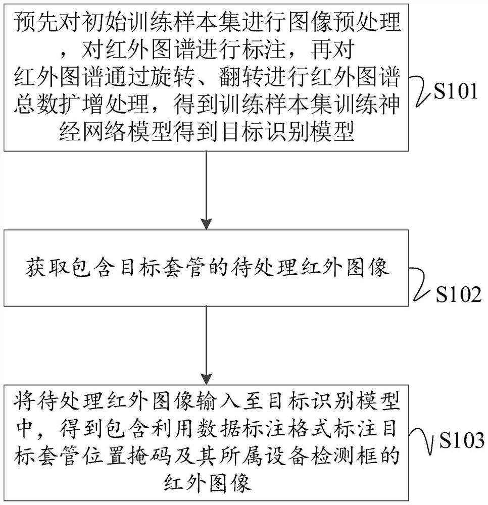
[0026] Such as figure 1 and 2 As shown, a method for identifying the GIS bushing of a specified device in an infrared image, specifically includes the following steps:

[0027] S101: Perform image preprocessing on the initial training sample set in advance, mark the infrared spectrum, and then perform rotation and flipping on the infrared spectrum to amplify the total number of infrared spectrum, obtain the training sample set, train the neural network model to obtain the target recognition model;

[0028] Each infrared sample image in the initial training sample set contains a corresponding label, and the label is used to represent the target device and its GIS casing in the picture. For example, it can include 2 sets of labels, which are equipment type label groups. For example, BLQ represents the arrester equipment, that is, the label of the specified equipment; the GIS casing label group of the specified equipment, such as BLQ_TG represents the GIS casing of the lightning...


PUM


Abstract

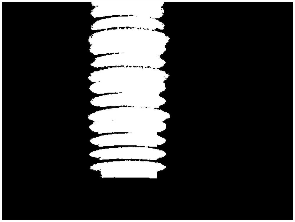
The invention discloses a method for identifying a GIS sleeve of specified equipment in an infrared image and a storage medium, and the method specifically comprises the following steps: S101, carrying out the image preprocessing of an initial training sample set in advance, labeling an infrared spectrum, carrying out the amplification processing of the total number of the infrared spectrum through the rotation and overturning of the infrared spectrum, and obtaining a training sample set to train a neural network model to obtain a target recognition model; S102, obtaining a to-be-processed infrared image containing the target GIS sleeve; S103, inputting the to-be-processed infrared image into the target recognition model to obtain an infrared image containing the target GIS bushing mask labeled by using the data labeling format and the equipment detection frame to which the target GIS bushing mask belongs. According to the method, the GIS sleeve in the infrared image can be effectively marked in real time by using the target recognition model obtained based on the training sample set through deep learning, and the detection position of the GIS sleeve in the infrared image and the accuracy of real target GIS sleeve detection are improved.

Description

technical field [0001] The invention belongs to the technical field of image processing, and specifically relates to a method and a storage medium for identifying a GIS casing of a designated device in an infrared image. Background technique [0002] With the wide application of infrared equipment in live detection, power supply companies have accumulated a large amount of infrared image data for operation and maintenance. Currently, they manually screen whether there are GIS casings in the infrared images, and manually mark the GIS casing in the infrared image. The location in the image for later storage and statistics. [0003] However, the efficiency of manual detection is low, the outdoor environment is complex, and the detection results cannot be given in real time. In addition, the format of manual annotation is not standardized, and the image data after annotation will not help to improve the detection efficiency and recognition rate in the future, which makes the use...

Claims


Application Information

Patent Timeline
Patent Type & Authority Applications(China)
IPC IPC(8): G06T7/00G06T7/11G06V10/26G06V10/764G06V10/82G06K9/62G06N3/04G06N3/08
CPCG06T7/0004G06T7/11G06N3/08G06T2207/10048G06T2207/20081G06T2207/20084G06T2207/30108G06N3/045G06F18/241
Inventor 李小平郭思华钱基业朱珠刘佳廖玉祥王谦刘家权陈伟余欣玺赵宇琪彭姝迪
Owner STATE GRID CHONGQING ELECTRIC POWER CO ELECTRIC POWER RES INST
Learn More