Real-time route planning method based on decision tree

A route planning and decision tree technology, applied in navigation calculation tools, special data processing applications, design optimization/simulation, etc., can solve problems such as uncertainty in dangerous areas, complex low-altitude environments, and insufficient planning flexibility, and reduce detours. , strong flexibility, strong security effect

Pending Publication Date: 2022-02-11
HANGZHOU INNOVATION RES INST OF BEIJING UNIV OF AERONAUTICS & ASTRONAUTICS +1
View PDF4 Cites 3 Cited by
  • Summary
  • Abstract
  • Description
  • Claims
  • Application Information

AI Technical Summary

Problems solved by technology

[0004] In order to solve the problems of complex low-altitude environment, uncertain dangerous areas and insufficient planning flexibility in the route planning of general aviation flight, the present i...

Method used


Image

  • Real-time route planning method based on decision tree
  • Real-time route planning method based on decision tree
  • Real-time route planning method based on decision tree

Examples


Embodiment Construction

[0035] The present invention will be further elaborated and described below in combination with specific embodiments. The technical features of the various implementations in the present invention can be combined accordingly on the premise that there is no conflict with each other.

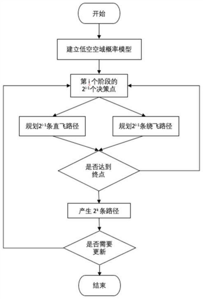
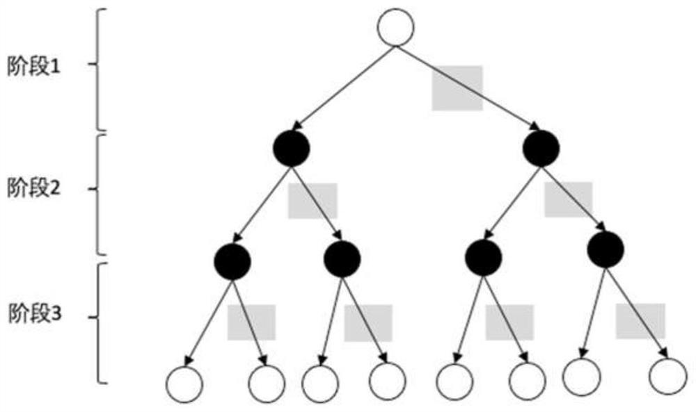
[0036] Such as figure 1 Shown, a kind of real-time route planning method based on decision tree provided by the present invention, it comprises the following steps:

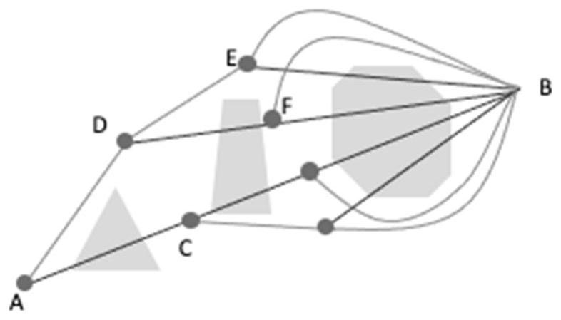
[0037] Step 1: Establish a low-altitude airspace probability model, and the dangerous areas in the model include no-fly zones and high-risk areas. No-fly zones include terrain obstacles, control areas, etc.; high-risk areas are mainly severe weather areas in weather forecasts. The three-dimensional airspace is represented by a two-dimensional grid model for path planning in the horizontal direction. Each grid is a rectangle with a certain length and width. Each grid point is assigned a value between 0 and 1, indicating The cost va...


PUM


Abstract

The invention discloses a real-time route planning method based on a decision tree. The method comprises the following steps: firstly, a low-altitude airspace probability model is established, a three-dimensional continuous space is expressed by using a discrete two-dimensional space, namely, a planning space is expressed as a discrete grid chart with a certain longitude difference and latitude difference, a dangerous area is divided into a no-fly area and a high-risk area, and then the cost value of each node in the model is calculated; secondly, initial route planning is carried out, a direct flight path and a fly-around path are planned for a high-risk area, only the fly-around path is planned for a no-fly area, a route decision tree is generated, and an initial route set is determined; according to the actual situation in flight, the planned route set is selected, and the planning result is updated in real time. Threatening factors such as terrain obstacles and severe weather are comprehensively considered, and the method is safer; the route decision-making tree comprising a plurality of routes is planned in consideration of uncertainty of prior information of a dangerous area, and the method is more practical; and according to the actual situation in flight, the planning result is updated in real time, which is more flexible.

Description

technical field [0001] The invention belongs to the technical field of route planning and relates to a real-time route planning method based on a decision tree. Background technique [0002] The flying altitude of general aviation aircraft is usually below 3,000 meters, and the activities in the low-altitude airspace below the relative altitude of 1,000 meters account for the vast majority. Compared with the flight environment of civil aviation airliners, this airspace is more complicated. On the one hand, the low-altitude atmosphere has the characteristics of strong convection, relatively severe weather changes, local local weather and obvious microclimate, while the navigable aircraft is slow and small in size, and its ability to resist strong weather is weak; on the other hand, in the low-altitude environment The geographical environment is complex, and the flight of the aircraft is easily affected by terrain and obstacles. [0003] At present, there have been many studi...

Claims


Application Information

Patent Timeline
IPC IPC(8): G01C21/20G06F30/20
CPCG01C21/20G06F30/20
Inventor 罗喜伶白天玥王宇鹏
Owner HANGZHOU INNOVATION RES INST OF BEIJING UNIV OF AERONAUTICS & ASTRONAUTICS
Why Eureka
Try Eureka