

Natural shoreline automatic acquisition method and device based on laser point cloud data and average large tide surface, medium and product
A technology for automatic acquisition of laser point cloud data, applied in data processing applications, image data processing, image analysis, etc., can solve problems such as heavy workload, difficulty in finding mistakes and errors, and errors in the definition of coastline elements, and improve work efficiency. , high degree of automation, high current effect
- Summary
- Abstract
- Description
- Claims
- Application Information
AI Technical Summary
Problems solved by technology
Method used
Image

Examples
Embodiment Construction
[0031] Below, the present invention will be further described in conjunction with the accompanying drawings and specific implementation methods. It should be noted that, under the premise of not conflicting, the various embodiments described below or the technical features can be combined arbitrarily to form new embodiments. .
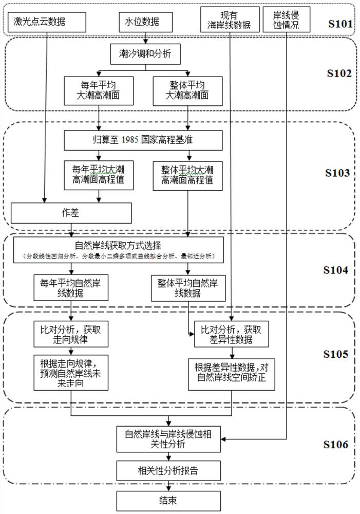
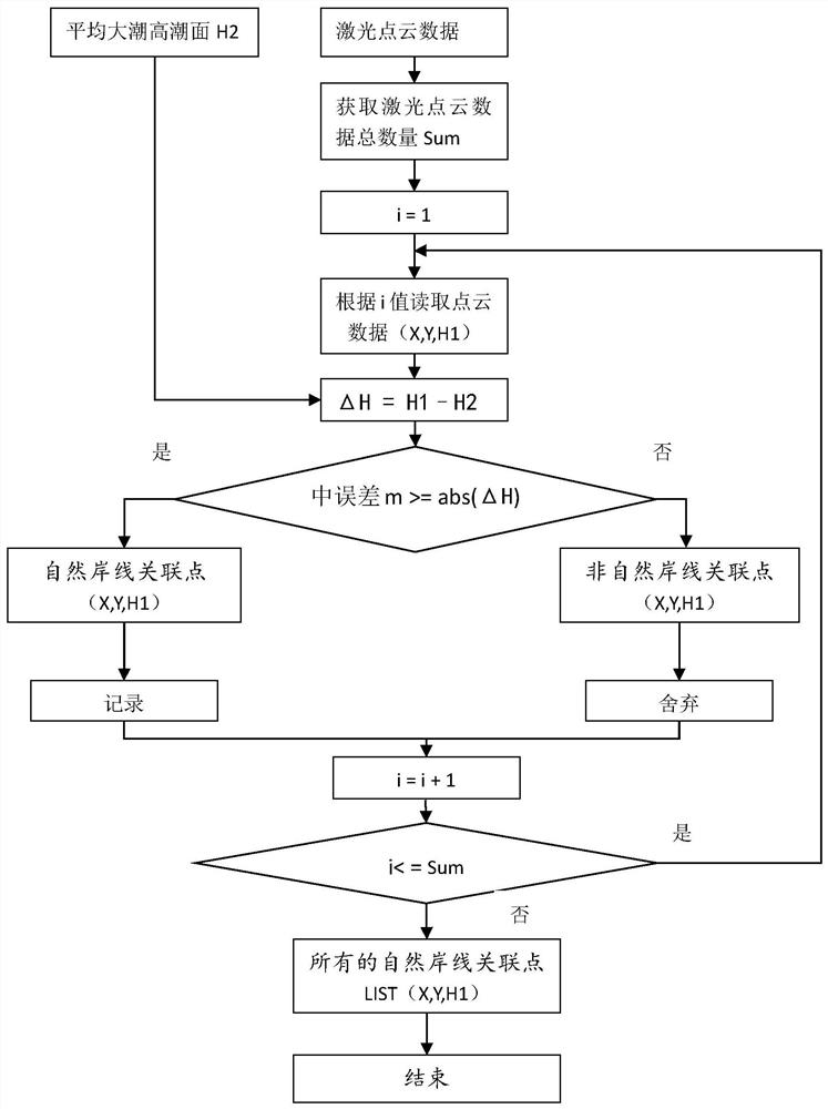
[0032] The automatic acquisition method of natural coastline based on laser point cloud data and average high tide surface, such as figure 1 shown, including the following steps:
[0033] To obtain laser point cloud data, use UAV airborne lidar, low-altitude remote sensing equipment, and ground remote sensing equipment to obtain laser point cloud data from the land to the intertidal zone when the ocean ebbs; the laser point cloud data includes latitude and longitude coordinates (X, Y ), elevation H1, measurement error m and other necessary information. Since the natural coastline is the trace line of the average spring tide and high tide, in order to...
PUM
 Abstract
Description
Claims
Application Information