Road point cloud extraction method based on scanning line and sliding least square fitting

A least squares and extraction method technology, applied in the field of remote sensing surveying and mapping, can solve problems such as the lack of efficient and stable solutions, and achieve the effects of reducing the amount of point cloud data, improving robustness, and improving efficiency

Pending Publication Date: 2022-04-12
INST OF DEFENSE ENG ACADEMY OF MILITARY SCI PLA CHINA
View PDF0 Cites 0 Cited by
  • Summary
  • Abstract
  • Description
  • Claims
  • Application Information

AI Technical Summary

Problems solved by technology

[0005] To sum up, although many scholars at home and abroad have carried out research on the road surface point cloud extraction of vehicle / UAV point cloud and made a lot of progress, they all have their own limitations and lack the ability to apply to different roads. type, efficient and stable solution

Method used


Image

  • Road point cloud extraction method based on scanning line and sliding least square fitting
  • Road point cloud extraction method based on scanning line and sliding least square fitting
  • Road point cloud extraction method based on scanning line and sliding least square fitting

Examples


Embodiment Construction

[0044] The following will clearly and completely describe the technical solutions in the embodiments of the present invention with reference to the accompanying drawings in the embodiments of the present invention. Obviously, the described embodiments are only some, not all, embodiments of the present invention. Based on the embodiments of the present invention, all other embodiments obtained by persons of ordinary skill in the art without making creative efforts belong to the protection scope of the present invention.

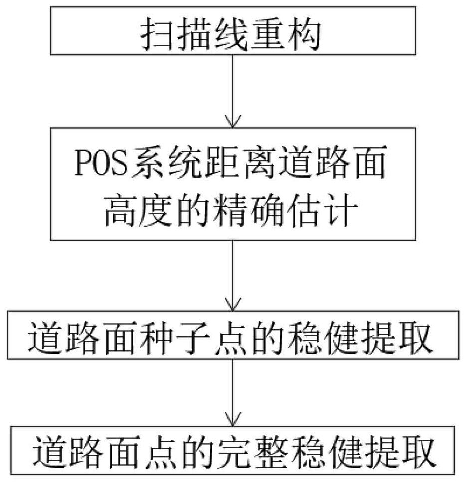
[0045] see Figure 1-5 , the present invention provides a kind of technical scheme: the road point cloud extraction method based on scanning line and sliding least squares fitting, comprises the following steps:

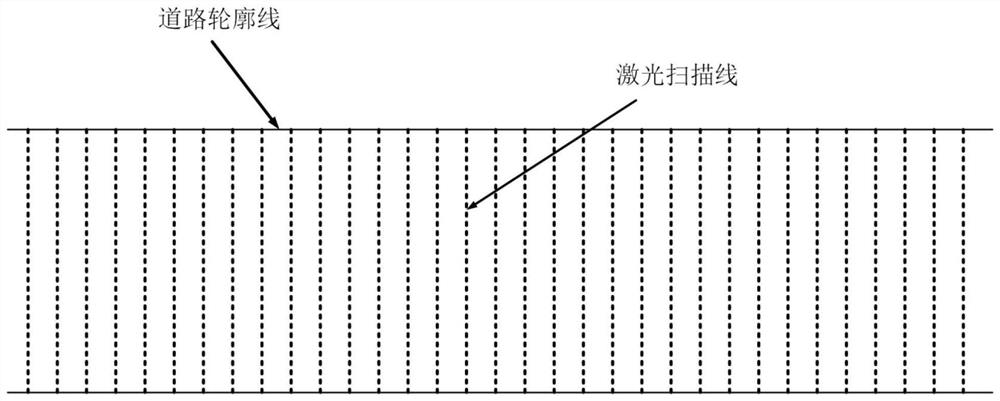
[0046] S1. Scanning line reconstruction: according to the scanning angle of each laser point in the scanner coordinate system, the original laser point cloud is reconstructed into different scanning lines;

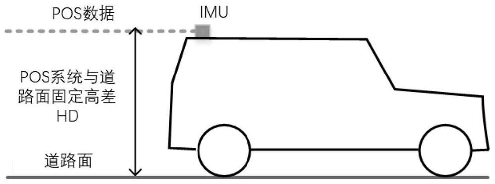
[0047] S2. Accurate estimation of the hei...


PUM


Abstract

The invention discloses a road point cloud extraction method based on scanning lines and sliding least square fitting. The method comprises the following steps: reconstructing the scanning lines; accurately estimating the height from the POS system to the road surface; robust extraction of road surface seed points; complete and robust extraction of road pavements; according to the efficient road surface point extraction method based on the scanning lines, road surface point cloud extraction is performed by scanning lines one by one, so that the road surface point extraction efficiency is improved; priori knowledge is fully utilized, and a foundation is laid for robust extraction of road pavements; robust extraction of road surface seed points is carried out, clustering is carried out based on critical row most seed alternative points of alternative points in scanning lines, and the robustness of road surface seed point extraction is effectively improved; local road points are fitted by adopting sliding weighted least squares, a fitting method and a weight fixing method are determined, and the method can effectively realize local optimal fitting of the road surface points in the scanning lines and realize robust complete road surface point extraction.

Description

technical field [0001] The invention relates to the technical field of remote sensing surveying and mapping, and the specific field is a road point cloud extraction method based on scanning lines and sliding least squares fitting. Background technique [0002] The vehicle-mounted / UAV laser scanning system can efficiently obtain the three-dimensional space information and attribute information of ground objects during the movement of the platform. The vehicle / UAV laser point cloud contains indiscriminate sampling of various ground objects such as ground and vegetation, and the specific surface object information required to extract from the vehicle / UAV laser point cloud is the vehicle / UAV laser point cloud. Necessary processing steps for efficient application in various industries. [0003] Road points are an important part of the vehicle / UAV laser point cloud, and are reliable data sources for applications such as road condition survey, road geometric parameter extraction, ...

Claims


Application Information

Patent Timeline
Patent Type & Authority Applications(China)
IPC IPC(8): G06K9/00G06K9/62
Inventor 李春海魏丽娟朱海峰周校余松林
Owner INST OF DEFENSE ENG ACADEMY OF MILITARY SCI PLA CHINA
Why Eureka
Try Eureka