High and cold wetland degradation degree monitoring method based on remote sensing data
A technology for remote sensing data and degradation degree, applied in data processing applications, complex mathematical operations, scattering characteristics measurement, etc.
- Summary
- Abstract
- Description
- Claims
- Application Information
AI Technical Summary
Problems solved by technology
Method used
Image
Examples
Embodiment 1
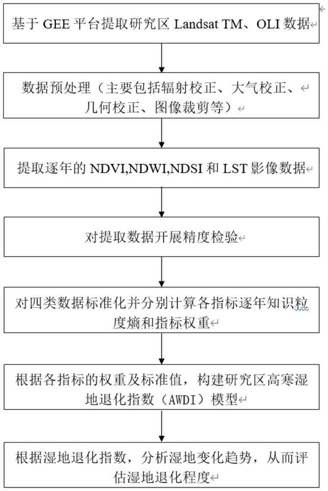
[0060] see figure 1 , an embodiment of the present invention is a method for monitoring the degree of degradation of alpine wetlands based on remote sensing data, comprising the following steps:
[0061] S1 uses the GEE platform to extract landsat data and obtain the annual NDVI, NDWI, NDSI and LST image data. The four data represent the four indicators of humidity, greenness, dryness and heat respectively. NDVI is one of the best indicators to characterize vegetation growth and vegetation coverage. It is a quantitative value of surface vegetation status calculated from the spectral information received by remote sensing sensors. It is closely related to plant biomass, leaf area index and vegetation coverage. Calculation The formula is as follows:
[0062]
[0063] where p nir ,p red ,p blu It is the surface reflectance value of LandsatTM, OLI mid-near infrared (NIR) (0.77-0.90μm), red (0.63-0.69μm), blue (0.45-0.52μm) bands. The range of this NDVI value is in the (-1,...
Embodiment 2
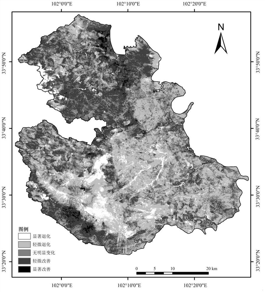
[0102] The embodiment of this paper is based on the method provided in Example 1, taking Maqu County, Gannan Tibetan Autonomous Prefecture, Gansu Province as the research area, and using the method for monitoring the degradation degree of alpine wetlands based on remote sensing data proposed by the present invention to evaluate and monitor the Maqu area from 1990 to 2020 The main steps of the degradation degree of alpine wetland are as follows:
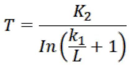
[0103] (1) Based on the Google Earth Engine (GEE) platform, the LandsatTM, ETM, OLI (remote sensing data) data of the study area from 1990 to 2020 were obtained, with a spatial resolution of 30×30m. Subsequently, based on the GEE platform, preprocessing, cropping, mosaic and other operations were performed on the data, and the remote sensing images of the study area were synthesized to extract the vegetation index, water body index, soil index and heat index. The calculation formula in this study area is as follows:
[0104]
[01...
PUM
 Abstract
Description
Claims
Application Information
 - R&D
- Intellectual Property
- Life Sciences
- Materials
- Tech Scout
- Unparalleled Data Quality
- Higher Quality Content
- 60% Fewer Hallucinations
Browse by: Latest US Patents, China's latest patents, Technical Efficacy Thesaurus, Application Domain, Technology Topic, Popular Technical Reports.
© 2025 PatSnap. All rights reserved.Legal|Privacy policy|Modern Slavery Act Transparency Statement|Sitemap|About US| Contact US: help@patsnap.com


