Satellite quantitative remote sensing method of offshore weather visibility
A visibility and satellite technology, applied in the field of satellite quantitative remote sensing, which can solve the problems of limited density of observational data and difficulty in the layout of visibility observation sites.
- Summary
- Abstract
- Description
- Claims
- Application Information
AI Technical Summary
Problems solved by technology
Method used
Image

Examples
Embodiment Construction
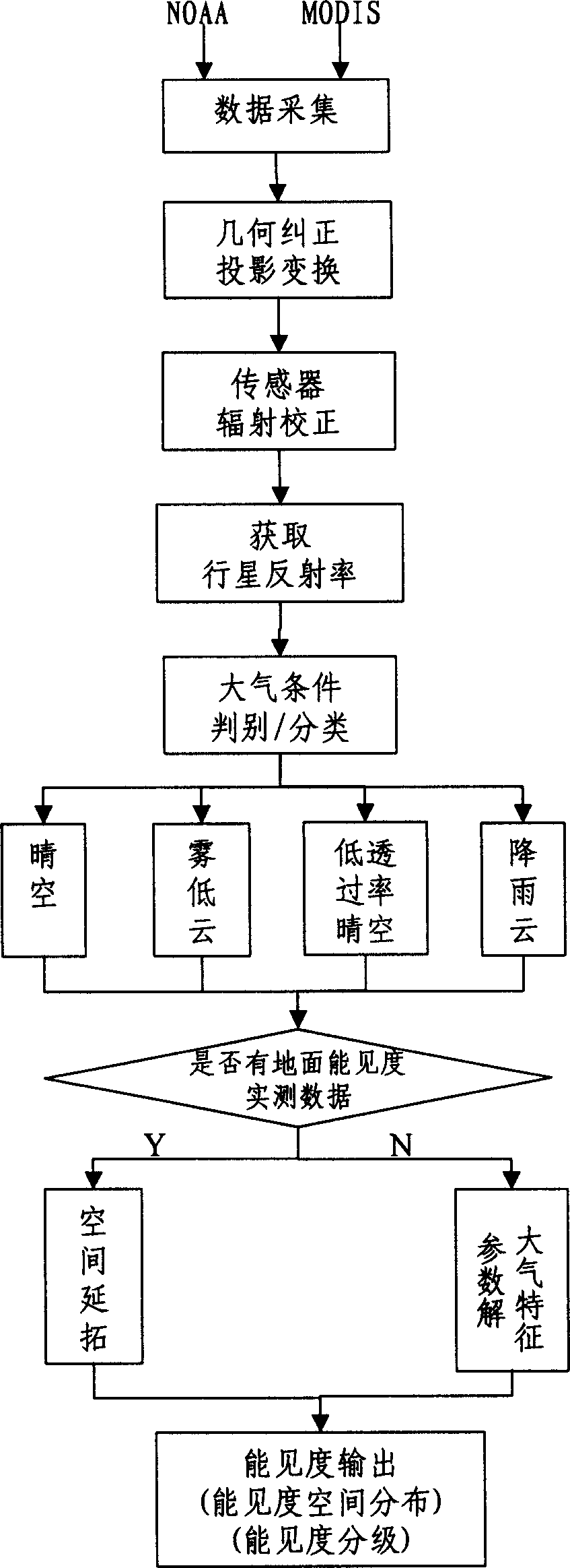
[0017] The present invention provides a detailed process from data collection to visibility spatial distribution and quantitative grading result output, and the specific implementation methods are as follows:
[0018] (1) Data acquisition—Use the data acquisition card (or data acquisition software) of the existing NOAA and MODIS data receiving stations to receive NOAA and MODIS satellite electrical signals when the satellites are in transit, and convert them into digital signals, and then press 1B level image data format output.
[0019] (2) Geometric correction and projection transformation—from the satellite positioning data (pixel longitude and latitude) provided in the digital signal, the pixel-by-pixel coordinate (longitude and latitude) positioning of the image data——geometric correction, and then using the general Mercator cylinder Projection converts the latitude and longitude of the image coordinates into the plane coordinate system, re-acquires the gray value of the ...
PUM
 Abstract
Description
Claims
Application Information
PatSnap Eureka turns technology decisions into work you can execute. Powered by our Innovation Knowledge Graph, it runs expert workflows across engineering, life sciences, materials and intellectual property. Get your review-ready output in minutes.


