Method for carrying out city grid unit information administration by employing digital technology

A grid unit and information management technology, applied in the field of urban information management, can solve problems such as poor communication, lagging urban management, inaccurate geographical location, etc., to improve security, improve system protection capabilities, and quickly store and access data. Effect

Inactive Publication Date: 2005-09-07
北京市东城区信息中心
View PDF0 Cites 9 Cited by
  • Summary
  • Abstract
  • Description
  • Claims
  • Application Information

AI Technical Summary

Problems solved by technology

[0004] The purpose of the present invention is to provide a method for establishing urban grid unit information management based on digital technology, so as to solve the s

Method used


Image

  • Method for carrying out city grid unit information administration by employing digital technology
  • Method for carrying out city grid unit information administration by employing digital technology
  • Method for carrying out city grid unit information administration by employing digital technology

Examples


Embodiment Construction

[0044] Taking the implementation in Dongcheng District, Beijing as an example to illustrate, this method includes the following processes: Process 1, formulate geographic location codes for urban areas and components, including the following steps:

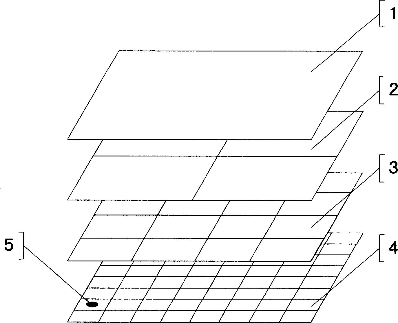
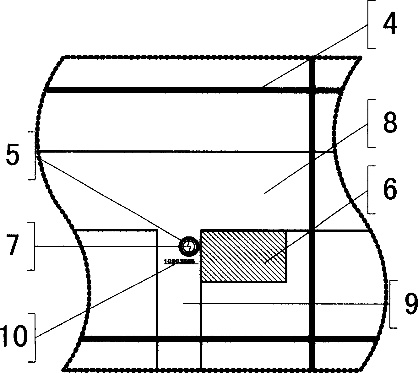
[0045] Step 1) as in Figure 1A , divide the region 1 into several levels of grids, and code the grids at all levels, that is, divide them into sub-district offices 2, communities 3, and unit grids 4 to form a grid coding map to determine the location of each grid , Figure 1A The areas of the grids at all levels shown are equal squares. During actual division, according to the terrain and the convenience of management, they are divided into irregular polygons with roughly equal areas. The area of ​​each unit grid 4 is about 10,000 square meters.

[0046] The regional grid coding method is: use 6 digits to represent; the 1st and 2nd digits represent the street office 2; the 3rd and 4th digits represent the community 3; the 5th and ...


PUM


Abstract

This invention relates to a city grid unit information managing method by means of digit technology, characterized by the following courses: first, making urban area and component grid coding map and storing it into data base; second, building information system including information collecting device, data interface transferring device, data optical fabric exchanging device and memory device, data exchanging and route device, voice switching-in device and so on; third, personnel with information collecting patrolling in regulated grid and collecting problems found out newly by the collecting device and sending them various using unit. The method can make information communicate without obstacles.

Description

technical field [0001] The invention relates to a city information management technology, in particular to a method for establishing city grid unit information management based on digital technology. Background technique [0002] With the acceleration of urban modernization, the appearance of cities has undergone tremendous changes, but the lagging of urban management has almost become a common problem in all countries and cities. After more than 20 years of reform and opening up in China, great changes have taken place in urban construction. There is also the problem of relatively lagging urban management. The main reason is that the management system is unreasonable and information is not timely, which leads to slow problem solving; it is not easy to supervise. Taking Dongcheng District of Beijing as an example, in the past, the reporting procedure for major problems generally went through community neighborhood committees, sub-district offices, departments, bureaus of pro...

Claims


Application Information

Patent Timeline
IPC IPC(8): G09B29/00
Inventor 陈平
Owner 北京市东城区信息中心
Why Eureka
Try Eureka