Digital map position information communication method, program for executing the same, program product therefor, system therefor, and apparatus therefor

A technology for location information and digital maps, applied in traffic control systems, traffic control systems for road vehicles, maps/plans/charts, etc., to solve problems such as frequent errors and ineffective means

Active Publication Date: 2006-09-06
PANASONIC INTELLECTUAL PROPERTY CORP OF AMERICA
View PDF6 Cites 2 Cited by
  • Summary
  • Abstract
  • Description
  • Claims
  • Application Information

AI Technical Summary

Problems solved by technology

However, this method is not effective at branching off from the main road, such as transfer ramps or connecting roads, because the same type of road is adjacent to and parallel to the main road
In particular, in the case where one map represents roads with two lines for up and down roads, and the other map represents roads with one line for both directions, when position information is transferred between the two maps, in the place recognition process Frequent errors occur in

Method used


Image

  • Digital map position information communication method, program for executing the same, program product therefor, system therefor, and apparatus therefor
  • Digital map position information communication method, program for executing the same, program product therefor, system therefor, and apparatus therefor
  • Digital map position information communication method, program for executing the same, program product therefor, system therefor, and apparatus therefor

Examples


no. 1 example

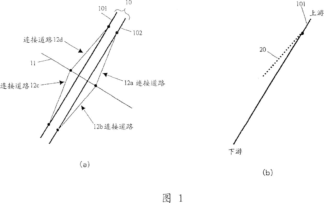
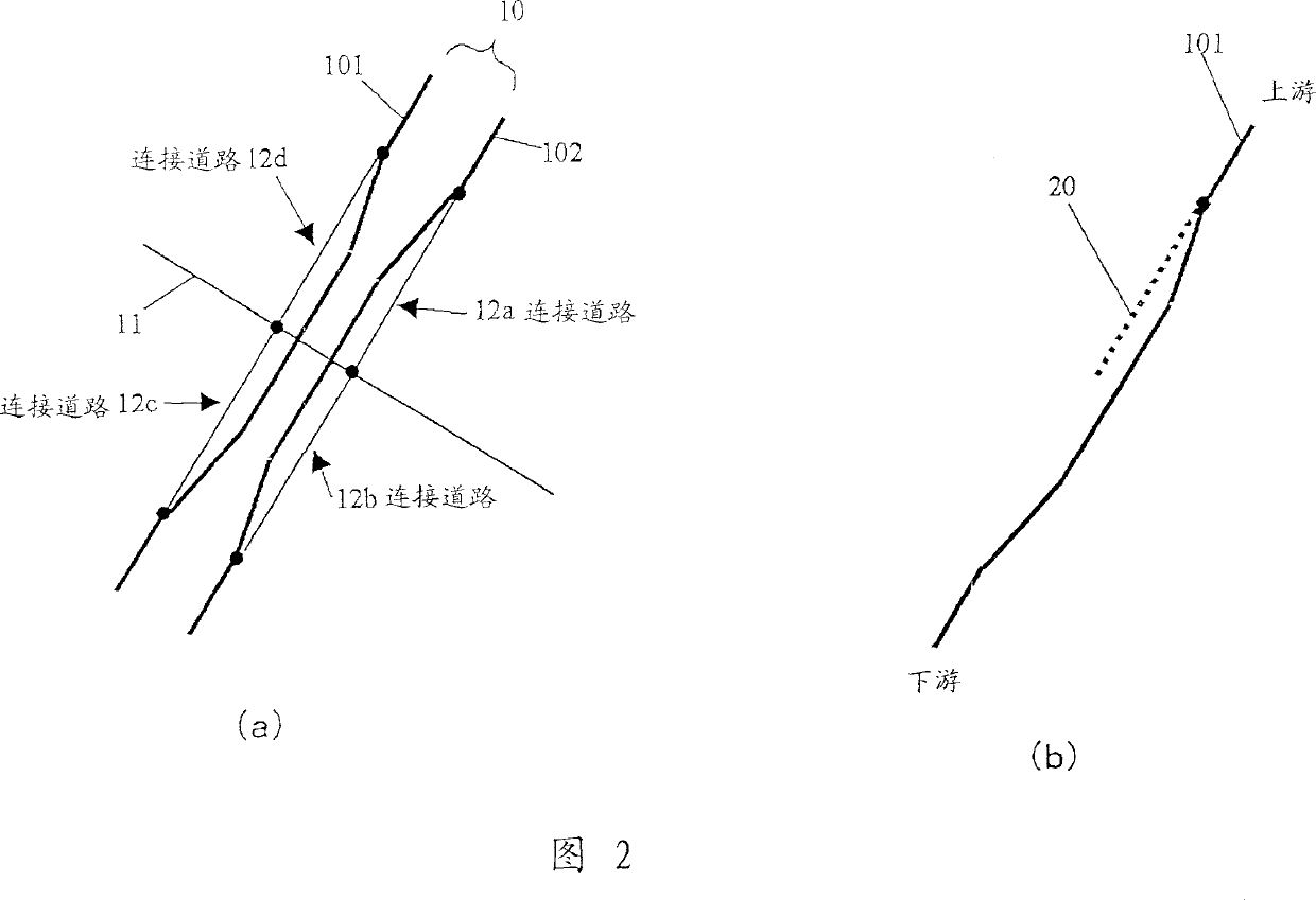
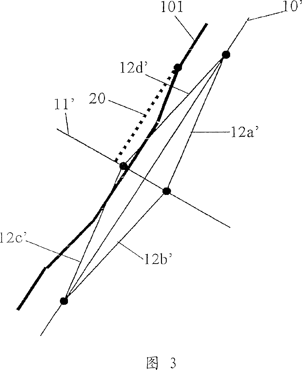
[0086] In the location information transmission method of the embodiment of the present invention, the transmitting side not only transmits the road shape data of the target road which is prone to spot recognition errors, but also the branch part of the road which is separated from the target road at a predetermined angle. Alternatively, shape data of a portion intersecting the target road (these two points will be collectively referred to as "branch") is transmitted as auxiliary information or reference information. In short, "branches" are roads (or connecting roads) connected to roads (ie, object roads) of the main object to be transferred. At the time of point recognition, the receiving side refers to the branch shape and specifies the target road. "Spot recognition" defines an action of pointing out the position of an object road on a digital map or recognizing a corresponding road on a digital map. This also includes the concepts of so-called "map matching" and "pattern...

no. 2 example

[0145] Hereinafter, a second embodiment of the present invention is explained in conjunction with another method for determining an evaluation value representing the similarity between an object road candidate and a branch candidate (ie, an auxiliary candidate, which will be omitted below) and an original shape.

[0146] In this method:

[0147] (1) As shown in Fig. 17 (a), the coordinates of the point that advances Ln along the object road of the original shape from the branch point On of the branch are represented by Pn(Xn, Yn), and are represented by Qn(Vn, Wn) Indicates the coordinates of the point that progressed Ln along the branch of the original shape. In addition, the coordinates of a point advancing Ln along the target road candidate k are represented by Pkn(Xkn, Ykn), and the coordinates of a point advancing Ln along the branch candidate are represented by Qkn(Vkn, Wkn);

[0148] (2) The angle θn of Pn→On→Qn (with positive and negative signs) and the angle θkn of P...

no. 3 example

[0155] The third embodiment of the present invention will be described in connection with another method of calculating the comprehensive evaluation value of the target road candidate.

[0156] In this method:

[0157] (1) As shown in Fig. 18(a), calculate the intersection point Pn between a circle whose branch point is the center O and whose radius is Rn and the object road, and the distance between the circle and the branch in the original shape intersection point Qn;

[0158] (2) Calculate the vector of pn→Qn. This vector may be represented by relative coordinates ΔXn and ΔYn, as shown in the first embodiment, or it may be represented by the angle θn between Pn→O→Qn and Rn;

[0159] (3) As shown in FIGS. 18(b) and 18(c), starting from the intersection point Pkn between a circle with the branch point of the branch candidate as the center O and radius Rn and the target road candidate k, and using Vector Pn→Qn, set Qkn′;

[0160] (4) According to the road network other tha...


PUM


Abstract

A transmission side transmits the road shape data of an object road 101 to be transmitted, and the branch shape data of a branch 20 intersecting with or branching from the object road 101. A reception side specifies the object road 101 on its own digital map with reference to the branch 20. In this method, the information indicating the shape of a branch or an intersection, which is liable to be erroneously identified, is transmitted as branch shape data to the reception side, so that the reception side can avoid the erroneous location identification. The branch shape 20 makes it possible to discriminate the object road 101 and a parallel road and to discriminate a discrepancy in the longitudinal direction of the object road 101, so that the erroneous location identification to the parallel road or the erroneous location identification in the longitudinal direction of the object road 101 can also be prevented.

Description

technical field [0001] The present invention relates to a position information transmission method for transmitting a road position on a digital map such as an object road of traffic information or a recommended route to a destination, and a program, a program product, and a program for executing the method. Systems and devices enabling accurate transmission of road positions. Background technique [0002] Traditionally, VICS (Vehicle Information and Communication System) provides a service of providing road traffic information indicating congested road sections and travel time to vehicle navigation equipment carrying a digital map database through FM multicast or signal lights. The car navigation device receives the road traffic information, thereby displays the congested road sections in colors on the map displayed on the screen, and calculates and displays the time to reach the destination. [0003] In the case of providing road traffic information in this way, it is nec...

Claims


Application Information

Patent Timeline
Patent Type & Authority Applications(China)
IPC IPC(8): G09B29/00G01C21/26G08G1/0969
CPCG08G1/0969G01C21/26G01C21/3844G01C21/3819G06Q50/00
Inventor 足立晋哉
Owner PANASONIC INTELLECTUAL PROPERTY CORP OF AMERICA
Why Eureka
Try Eureka