Simulation algorithm of echo waveform of laser pulse with large footprint

A laser pulse and echo waveform technology, applied in the re-radiation of electromagnetic waves, radio wave measurement systems, and the use of re-radiation, etc., can solve the problem of not being able to easily do a satellite flight test, the lack of shared information in lunar exploration, and the high test cost. question

Inactive Publication Date: 2007-05-09
SHANGHAI INST OF TECHNICAL PHYSICS - CHINESE ACAD OF SCI +1
View PDF0 Cites 15 Cited by
  • Summary
  • Abstract
  • Description
  • Claims
  • Application Information

AI Technical Summary

Problems solved by technology

[0003] However, due to the limitations of experimental conditions and the lack of information shared internationally on lunar exploration, it is not easy to conduct a satellite flight test to verify some theoretical research. Know some features, get some prior knowledge theoretically
However, at present, the simulation of laser altimetry echo waveforms at home and abroad is mainly focused on airborne laser altimetry. In this case, the distance between the laser altimeter and the measured target is only a few kilometers, resulting in a small laser spot (ie, laser footprint) , the general area is less than 1m 2 , and it is easy to test, and the simulation model...

Method used


Image

  • Simulation algorithm of echo waveform of laser pulse with large footprint
  • Simulation algorithm of echo waveform of laser pulse with large footprint
  • Simulation algorithm of echo waveform of laser pulse with large footprint

Examples


Embodiment Construction

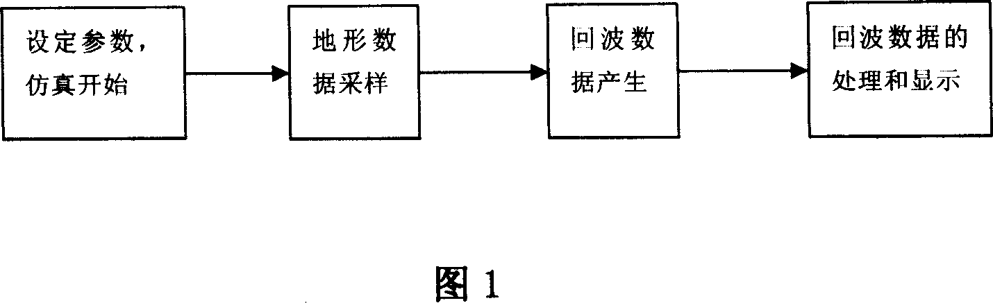
[0071] An embodiment of the simulation algorithm is introduced below in combination with FIGS. 1-5 .

[0072] Referring to the basic parameters of the laser altimeter of the Chang'e-1 lunar exploration satellite produced by the Shanghai Institute of Technical Physics, the Chinese Academy of Sciences, the height of the altimeter from the nadir point is H = 200km, the beam width of 1 / 2 of the laser is 0.3mrad, and the peak power is 50mw. The pulse width of the peak power is 7ns, because there is no atmosphere on the surface of the moon, so the atmospheric transmission parameter TA=1. In the case of not affecting the experimental results, all other parameters are set to 1. The algorithm is realized by using matlab software programming, and the simulation process of this embodiment is shown in FIG. 1 .

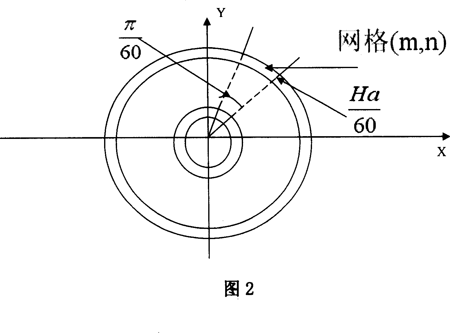
[0073] 1. Terrain data sampling

[0074] In this embodiment, the corresponding large footprint is a circle with a radius of 60 m, and its segmentation algorithm is shown in FIG....


PUM


Abstract

An echo waveform artificial algorithm of wide foot print laser pulse includes decomposing emitted laser pulse to be innumerable Gauss pulses incoming to various points on wide footprint, receiving these Gauss pulses by laser height gauge after said Gauss pulses are emitted by corresponding point of wide footprint in order to obtain product formula of echo power corresponding to laser pulse, carrying out topographic division to obtain simple formula of said echo power and programming to obtain waveform of wide footprint laser pulse echo.

Description

Technical field: [0001] The invention relates to high-level simulation of space-borne laser altimeter measurement in aerial exploration, in particular to a simulation algorithm for large-footprint laser pulse-echo waveforms. Background technique: [0002] In aerospace science and technology, it is an indispensable technology to obtain the height data of the detection target through laser altimetry. For example, the laser altimeter, one of the important payloads of the spacecraft "Chang'e-1" satellite in the first phase of China's "Chang'e" lunar exploration project, will use active laser altimetry technology to measure the distance from the satellite to the nadir point on the lunar surface, and obtain After the data is processed by the ground application system, the height data of the lunar surface can be obtained, and combined with the photographed lunar texture photos, the three-dimensional terrain of the moon can be obtained. This not only further deepens the understandi...

Claims


Application Information

Patent Timeline
IPC IPC(8): G01S7/487G01S17/06G01S17/08G01S17/32
Inventor 王建宇陈伟马艳华舒嵘
Owner SHANGHAI INST OF TECHNICAL PHYSICS - CHINESE ACAD OF SCI
Why Eureka
Try Eureka