System and method for generating tactical routes

a technology of tactical routes and routes, applied in direction controllers, navigation instruments, instruments, etc., can solve the problems of not being good enough, not being able to guarantee that the intelligence used to plan the route has not changed drastically, and requiring great effort to achieve the effect of maximizing any advantages in weapons range, and minimizing the amount of new terrain

Active Publication Date: 2019-12-31
POLARIS IND INC
View PDF46 Cites 4 Cited by
  • Summary
  • Abstract
  • Description
  • Claims
  • Application Information

AI Technical Summary

Benefits of technology

The patent describes a system that helps soldiers plan and execute safe and efficient routes in tactical environments. It blends speed and concealment during route generation, allowing soldiers to reach their destination quickly and unobserved. The system also mimics the way soldiers actually plan concealed tactical routes, minimizing the amount of new terrain to which they are exposed during travel. It maximizes the advantages in weapon range, allowing soldiers to move in open areas where their weaponry is maximized, while also minimizing the distance travelled to maximize visibility. The system also facilitates efficient searching between waypoints, allowing soldiers to travel between two points while maximizing visibility per unit distance travelled. Overall, the system helps soldiers plan and execute safer and more efficient routes in tactical environments.

Problems solved by technology

Creating these routes is a challenging process that requires great effort with no guarantee of desired results.
At this point, a primary route has been planned, but that is not good enough; on top of that, soldiers will generate at least one more, and typically three more routes to account for contingent and emergency situations.
When soldiers finally embark on the route, there is usually no guarantee that the intelligence used to plan the route has not since changed drastically.
From the above description of tactical route planning, it is easy to see that planning tactical routes correctly is extremely difficult.
First, the amount of time and effort spent analyzing intelligence is decreased because the tool analyzes every single terrain cell.
However, soldiers have not had access to such a tactical route planning tool in the past.
While many civilians benefit daily from analogous route planning tools (MapQuest, Google Maps, and Microsoft Streets and Trips) that help them plan fast and short routes along highway networks, soldiers have simply not had access to that kind of tool for military purposes.
Although the state of the art for path planning and terrain awareness in the field of aviation is well-developed, the state of the art in providing similar tools for ground-based maneuvers is lacking.
Few tools currently exists that suggest intelligent schemes of maneuver on the ground that utilize terrain information such as land cover maps and digital elevation models.
However, the state of the art commonly generates routes that aim to maximize concealment or speed with no thought as to how these factors could be blended to provide a more usable route.
As a result, tactical routes created using state of the art methods often suffer from being too exposed when maximizing speed or too slow when maximizing concealment.

Method used


Image

  • System and method for generating tactical routes
  • System and method for generating tactical routes
  • System and method for generating tactical routes

Examples


Embodiment Construction

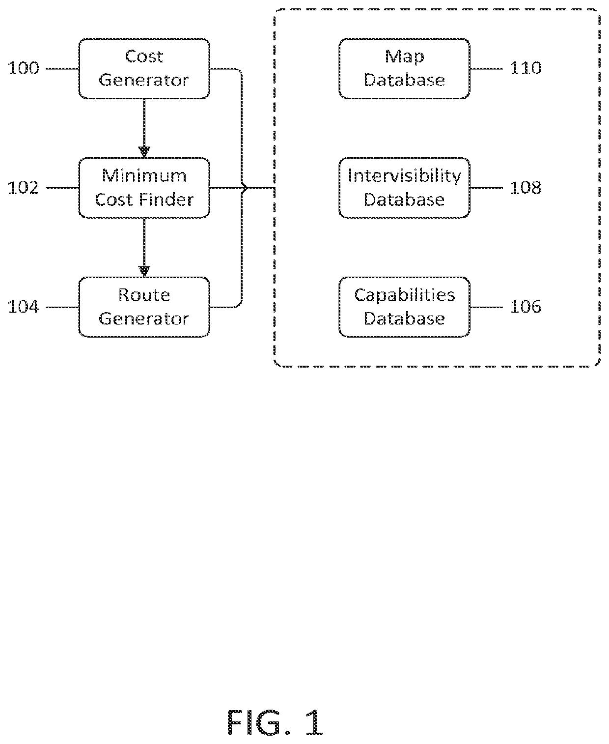
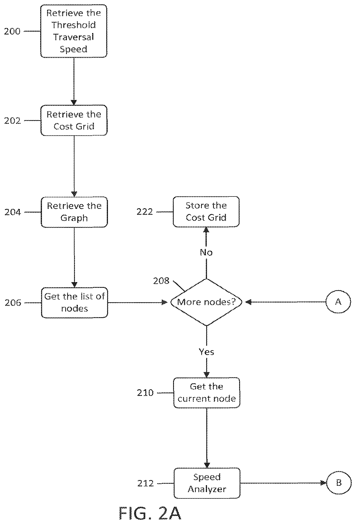
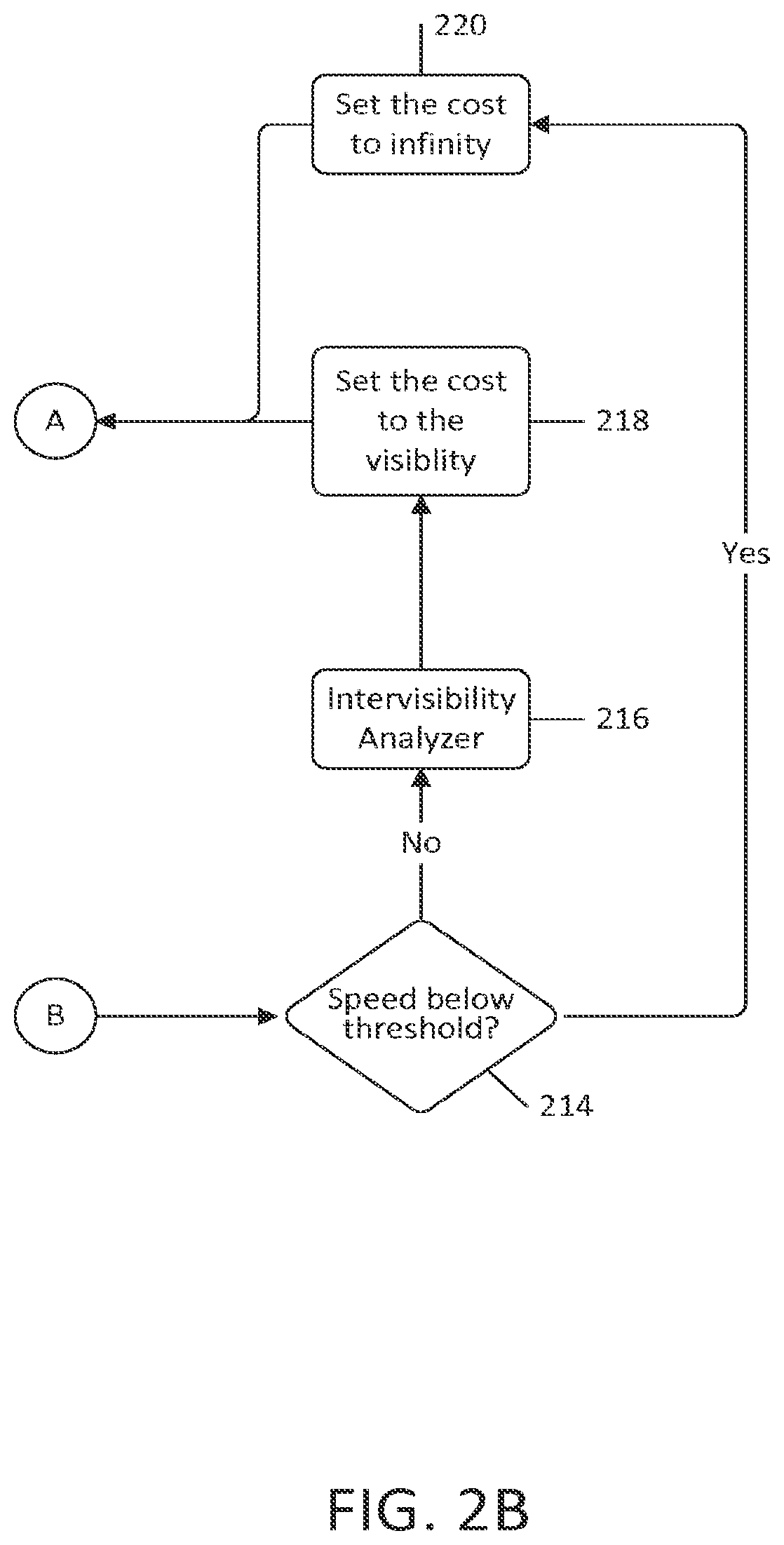
[0042]An exemplary embodiment for generating tactical routes is one that minimizes the path's intervisibility union while meeting speed constraints by avoiding slow terrain. By minimizing the path's intervisibility union, travelers are exposed to a minimal amount of previously-unexposed terrain after beginning travel, thereby reducing the risk of encountering enemies in unexposed terrain. By avoiding slow terrain below an arbitrary threshold, travelers can travel at or above the speed threshold at every node on the path, rendering it difficult for enemies to engage the traveler in combat.

[0043]Referring now to the drawings, FIG. 1 illustrates the system's main components of the exemplary embodiment for generating routes that minimize the path's intervisibility union while meeting speed constraints by avoiding slow terrain. The Cost Generator 100 uses speed and visibility information to create a blended cost grid for generating tactical routes. The Minimum Edge Cost Finder 102 search...


PUM


Abstract

A method and system for generating tactical routes includes an intervisibility database pre-populated with pre-computed optical lines of sight between locations or nodes in geographic terrain, an intervisibility analyzer for analyzing propagation of the pre-computed optical lines of sight between the locations or nodes in the geographic terrain, a speed analyzer for analyzing speeds of travelers across the locations or nodes in the geographic terrain, a cost generator for generating a blended cost grid using said intervisibility and speed analyses, and a route generator for generating routes that facilitate tactical movement based on said blended cost grid. The route generator computes intervisibility unions at the locations or nodes in the geographic terrain and minimizing intervisibility unions along the generated route.

Description

CROSS-REFERENCE TO RELATED APPLICATIONS[0001]This application is a continuation of U.S. application Ser. No. 12 / 920,580, filed on Sep. 1, 2010, which is a U.S. National Phase Application of PCT International Application No. PCT / US2008 / 069314, filed on Jul. 7, 2008, the disclosures of which are expressly incorporated by reference herein.BACKGROUND OF THE INVENTION[0002]Field of the Invention[0003]The present invention generally relates to generation of tactical routes, and more particularly to a method and system for generating geographic terrain routes that balance speed and exposure to potential threats.[0004]Discussion of the Background[0005]Soldiers planning tactical routes must ensure that each route allows them to remain concealed from enemy observers yet move quickly at the same time. Creating these routes is a challenging process that requires great effort with no guarantee of desired results.[0006]First, soldiers must gather intelligence on the terrain to be traversed. Often...

Claims


Application Information

Patent Timeline
Patent Type & Authority Patents(United States)
IPC IPC(8): F41G7/00F41H11/00F41H11/16G06F17/00G01C21/34G01C21/20
CPCG01C21/3461G01C21/20
Inventor MILBERT, RANDY L.FREED, ERIK S.ESTES, KYLE K.
Owner POLARIS IND INC
Why Eureka
Try Eureka