Method for determining the course of the road for a motor vehicle

a technology for motor vehicles and roads, applied in traffic control systems, complex mathematical operations, computations using non-denominational number representations, etc., can solve problems such as long runtimes and model errors, and achieve the effects of reducing state space, being more robust and efficien

Active Publication Date: 2020-09-15
CONTI TEMIC MICROELECTRONIC GMBH
View PDF57 Cites 6 Cited by
  • Summary
  • Abstract
  • Description
  • Claims
  • Application Information

AI Technical Summary

Benefits of technology

[0007]An aspect of the invention provides a method of the type mentioned at the beginning that is improved as against the known method and that can detect the transition points of the course of the curvature of the road and thus correctly model the course of the lane right into the far range.
[0013]According to this inventive method, all structures that are parallel to the road, such as lane markings, curbstones, structures on the roadside, crash barriers and the like, are used to estimate the course of the lane without having to additionally introduce filtering quantities for the estimation method. Furthermore, this inventive method is not dependent on the lateral distance of the structures that are parallel to the road nor is it necessary to estimate a deviation from the middle of the lane for the motor vehicle so that the number of the degrees of freedom is small which results in an estimation method that is more robust, more efficient with respect to runtime and less error-prone. Thus, the course of the lane can be modeled over the entire considered distance range by means of a lane model with extremely precise estimated values, wherein all lane models that result in continuously differentiable functions are suitable. Such lane models include, aside from a clothoid road model, the circular-arc model, the double-clothoid model and the spline model, for example.
[0019]This shows that the inventive method results in a reduction of the state space because the inventive method is not dependent on the lane width or on the deviation of the vehicle from the middle of the lane, whereby the method is made more robust and more efficient with respect to runtime. This partitioning of the state space into a near range and a far range prevents changes of the width of the lane, e.g., lane widening or exit ramps, from negatively influencing the lane model parameters. The lane width and the deviation of the vehicle from the middle of the lane can be restricted to the relevant near range and do not have to be estimated and averaged for the entire measuring range.

Problems solved by technology

The disadvantage of this known method according to U.S. Pat. No. 6,718,259 B1 consists in the high complexity of the filter bank made up of Kalman filters and results in long runtimes. The transition point is not detected but filtered out so that the model error remains present.

Method used


Image

  • Method for determining the course of the road for a motor vehicle

Examples


Embodiment Construction

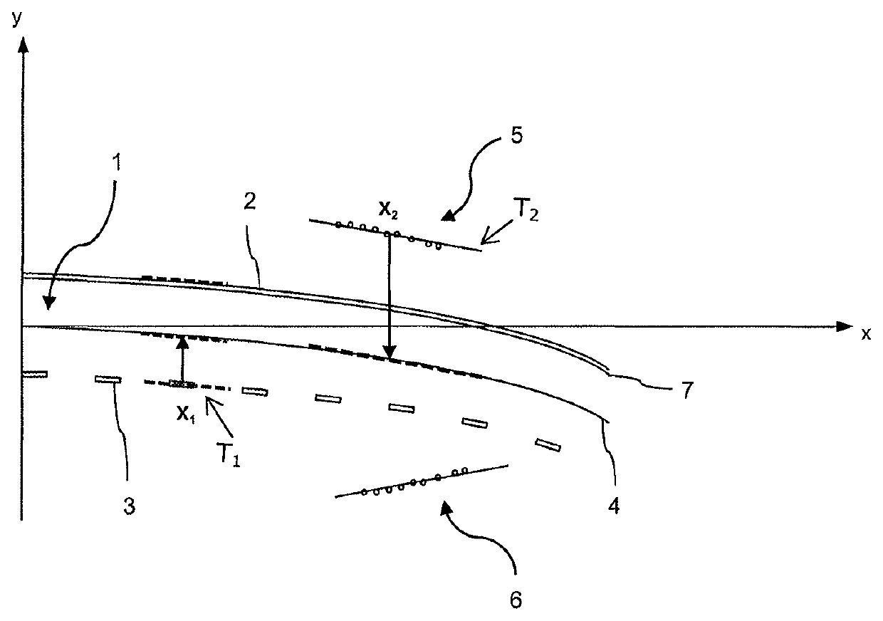
[0022]A surroundings sensor system that may be a camera, a radar or lidar sensor as well as a digital map with GPS (e.g., within a navigation system) provides sensor data for an evaluation unit by means of which the inventive method is carried out.

[0023]Said sensor data are used to carry out a feature extraction by the detection of structures that are parallel to the road, such as crash barriers, verges, lane markings, curbstones or other demarcating structures that are parallel to the road.

[0024]For example, an edge detection method is used to this end during video processing, by means of which method the contours of such structures that are parallel to the road can be detected, wherein an edge is regarded as a change of the gray-scale values, i.e., the gray-scale gradients are determined and evaluated by means of a Hough transform.

[0025]To this end, the sensor data are subdivided into search areas having surroundings-related horizontal and vertical boundaries, wherein the lane det...


PUM


Abstract

A method for determining the course of the road for a moving motor vehicle having a surroundings sensor system. Sensor data generated by the surroundings sensor system are evaluated to detect lane-relevant features. A lane model having at least one lane model parameter that determines the course of the lane is generated for the road, structures of at least one distance range that are parallel to the road are detected in the sensor data, the tangential direction of at least the one structure that is parallel to the road is determined, and the value of the tangential direction of the structure that is parallel to the road is adopted as the value of the direction of the tangent line at the point of contact with the structure that is parallel to the road to determine at least the one lane model parameter by predictive estimation in the lane model.

Description

CROSS REFERENCE TO RELATED APPLICATIONS[0001]This application is the U.S. National Phase Application of PCT / DE2011 / 000359, filed Mar. 31, 2011, which claims priority to European Patent Application No. 10401058.2, filed Apr. 20, 2010 and German Patent Application No. 10 2010 020 984.8, filed May 19, 2010, the contents of such applications being incorporated by reference herein.FIELD OF THE INVENTION[0002]The invention relates to a method for determining the course of a road or a lane of the road for a moving motor vehicle with at least one surroundings sensor system directed toward the road, wherein the sensor data generated by the surroundings sensor system are evaluated to detect lane-relevant features. Furthermore, the invention relates to a motor vehicle with a device for carrying out the inventive method.BACKGROUND OF THE INVENTION[0003]Lane detection is an important component of driver assistance systems that are used, e.g., for longitudinal control or for lane keeping.[0004]Kn...

Claims


Application Information

Patent Timeline
Patent Type & Authority Patents(United States)
IPC IPC(8): G08G1/16G06K9/00G06K9/78
CPCG08G1/167G06K9/00798G08G1/16G06V20/588
Inventor MEIS, URBANWIEDEMANN, CHRISTOPHKLEIN, WLADIMIRBRÜGGEMANN, CHRISTOPH
Owner CONTI TEMIC MICROELECTRONIC GMBH
Why Eureka
Try Eureka