Navigation system for GPS denied environments

a technology of navigation system and environment, applied in navigation instruments, using reradiation, instruments, etc., can solve the problems of not being able to offer capability with current onboard systems, and achieve the effects of eliminating systematic errors, high accuracy, and self-relian

Active Publication Date: 2021-03-02
PSIONIC LLC
View PDF19 Cites 0 Cited by
  • Summary
  • Abstract
  • Description
  • Claims
  • Application Information

AI Technical Summary

Benefits of technology

[0017]The present invention can largely eliminate the systematic error due to the linear accelerometers used for navigation. By combining a good clock, a heading sensor like a compass, a gyroscope, and / or a terrain matching system with Doppler LIDAR (Light, Detection and Ranging) the present invention allows stealthy, self-reliant, accurate navigation over long distances which is not economically possible with current technology.
[0019]The present invention enables accurate, long-term navigation, and sense and avoid decisions using only information obtained from onboard sensors. By combining sensors operating in different modes, critical navigational state parameters are measured continuously without significant systematic errors that allows a vehicle whose initial state is known to execute guidance, navigation, and control (GN&C) functions to reach its desired destination safely.

Problems solved by technology

Combining sensor information from these two velocity sensors and range sensors and other onboard sensors offers capability not possible with current onboard systems.

Method used


Image

  • Navigation system for GPS denied environments
  • Navigation system for GPS denied environments
  • Navigation system for GPS denied environments

Examples


Embodiment Construction

I. Overview of Preferred & Alternative Embodiments the Invention

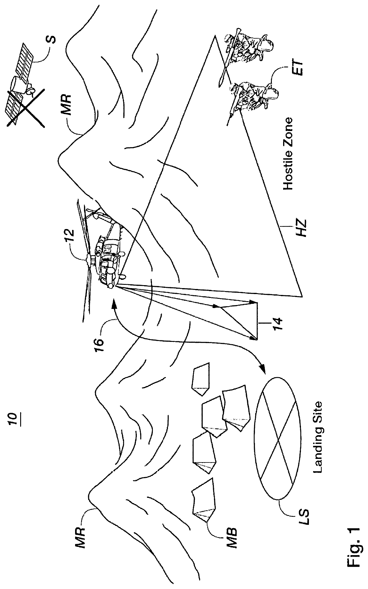
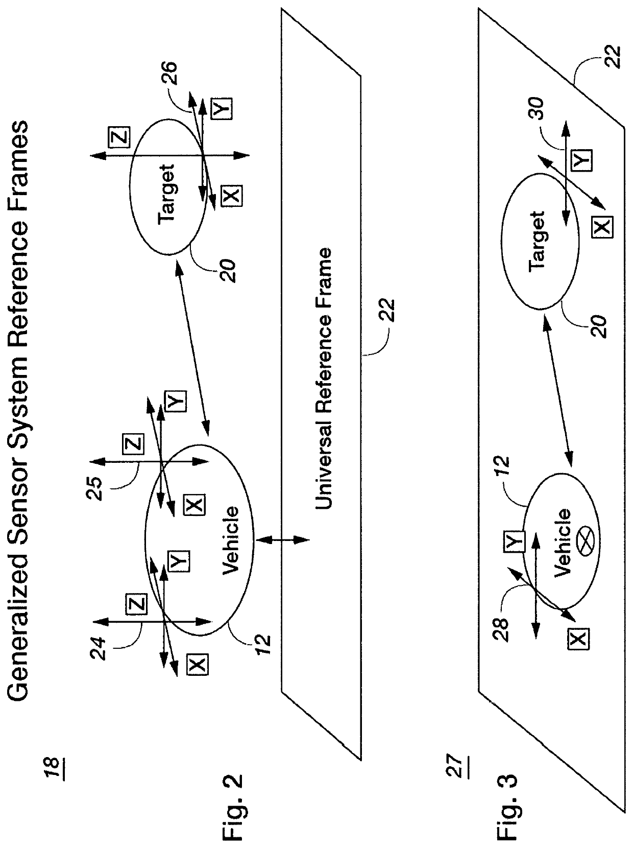
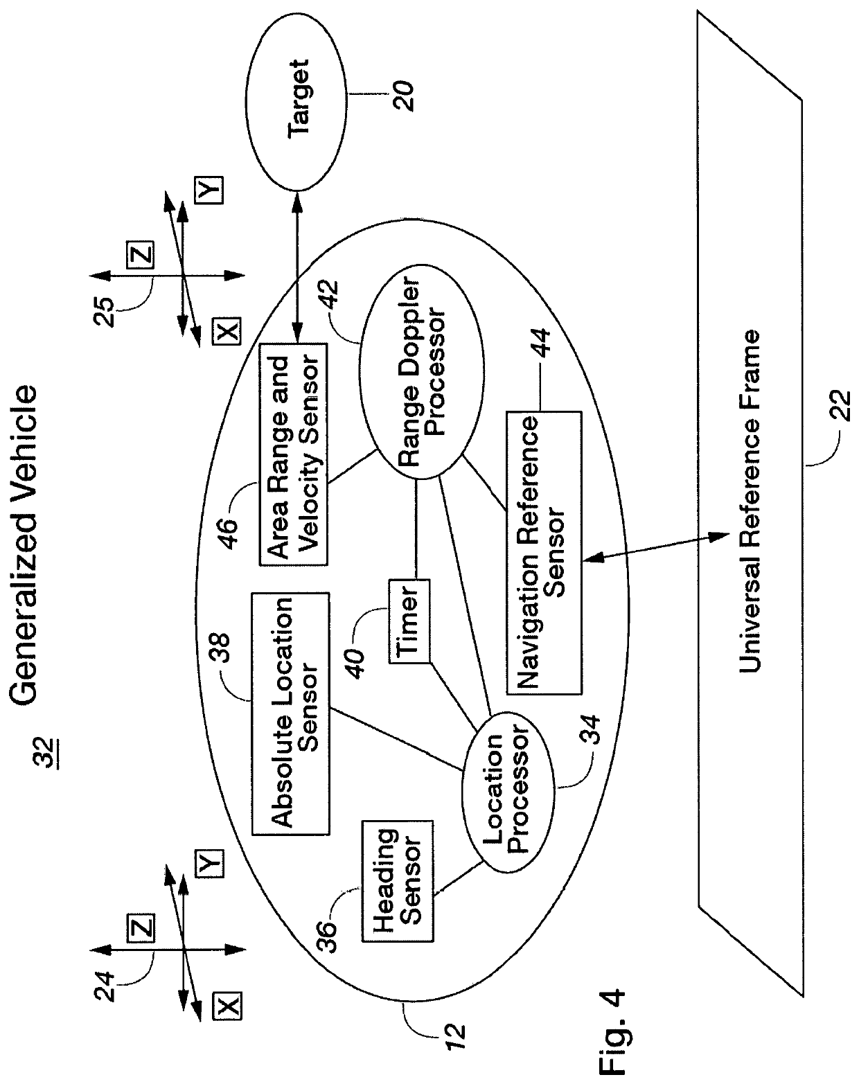
[0042]The present invention enables stealthy, self-reliant, accurate, long-distance navigation by using laser light and coherent receivers configured to provide speed in the sensor frame of reference, and with respect to objects and other vehicles in its environment. The use of laser light means detection by adversaries is extremely difficult and also provides high precision measurements. Coherent receivers allow very high signal-to-noise ratio (SNR) measurements of speed along the laser beam line of sight with very low probability of interference from other nearby laser based signals. For ground and aerial systems distance and velocity measurements are relative to the plane formed by the ground. Using more than one beam, the present invention measures speed with respect to the ground or the other objects / vehicles in more than one direction allowing either 2-D or 3-D position determination as well as other useful vehicl...


PUM


Abstract

Methods and apparatus for providing self-contained guidance, navigation, and control (GN&C) functions for a vehicle moving through an environment on or near the ground, in the air or in space without externally provided information are disclosed. More particularly, one embodiment of the present invention includes a Heading Sensor (36), an Absolute Location Sensor (38), a timer (40), a Range Doppler Processor (42), a Navigation Reference Sensor (44), an Area Range and a Velocity Sensor (46) which provide enhanced navigation information about a universal reference frame (22) and one or more targets (20).

Description

FIELD OF THE INVENTION[0001]One embodiment of the present invention relates to methods and apparatus for obtaining position, orientation, location, altitude, velocity, acceleration or other geodetic, calibration or measurement information in GPS denied environments. More particularly, one embodiment of the invention pertains to the illumination of one or more targets or other objects with LIDAR emissions, receiving one or more reflections from targets or other objects using customized sensors, and then processing the reflections with purposefully designed software to produce information that is presented on a visual display for a user or used by an autonomous controller.CROSS-REFERENCE TO A RELATED PENDING PATENT APPLICATION & CLAIM FOR PRIORITY[0002]None.FEDERALLY SPONSORED RESEARCH OR DEVELOPMENT[0003]None.BACKGROUND OF THE INVENTION[0004]Navigation is a process that ideally begins with an absolute knowledge of one's location. The goal is to reach a destination located somewhere e...

Claims


Application Information

Patent Timeline
Patent Type & Authority Patents(United States)
IPC IPC(8): G01S19/48G01S17/58G01S1/24G01S15/58G01C21/02G01C21/12G01S17/93G01C21/20G01S15/86G01S17/34G01S17/86G01C21/16
CPCG01S19/48G01C21/025G01C21/12G01C21/20G01S1/24G01S15/58G01S15/86G01S17/34G01S17/58G01S17/86G01S17/93G01C21/165G01S19/485G01C21/1652G01C21/1656
Inventor SANDFORD, STEPHEN PARKERPIERROTTET, DIEGO FERNANDO
Owner PSIONIC LLC
Why Eureka
Try Eureka