System and method navigating indoors and outdoors without GPS. utilizing a network of sensors

a technology of indoor and outdoor navigation and network of sensors, applied in direction finders using radio waves, navigation instruments, etc., can solve the problems of inability to use existing mapping that these systems use, limiting its availability and accuracy, and inability to utilize the capabilities of prior art devices to display real-time representation of navigating directly from sensors. to achieve the effect of enhancing the ability of tactical teams

a technology of indoor and outdoor navigation and network of sensors, applied in direction finders using radio waves, navigation instruments, etc., can solve the problems of inability to use existing mapping that these systems use, limiting its availability and accuracy, and inability to utilize the capabilities of prior art devices to display real-time representation of navigating directly from sensors. to achieve the effect of enhancing the ability of tactical teams

US20070001904A1Active Publication Date: 2007-01-04BLUE UMBRELLA LLC

Image

  • System and method navigating indoors and outdoors without GPS. utilizing a network of sensors
  • System and method navigating indoors and outdoors without GPS. utilizing a network of sensors
  • System and method navigating indoors and outdoors without GPS. utilizing a network of sensors

Examples


Embodiment Construction

[0193] In all the figures of the drawings, sub-features and integral parts that correspond to one another bear the same reference symbol.

[0194] Referring now to the drawings in detail and first particularly to FIGS. 1-8 thereof.

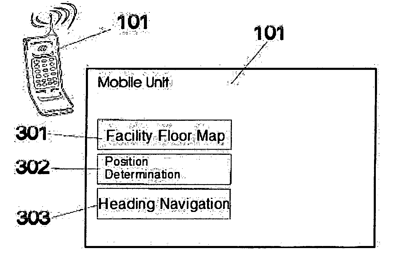
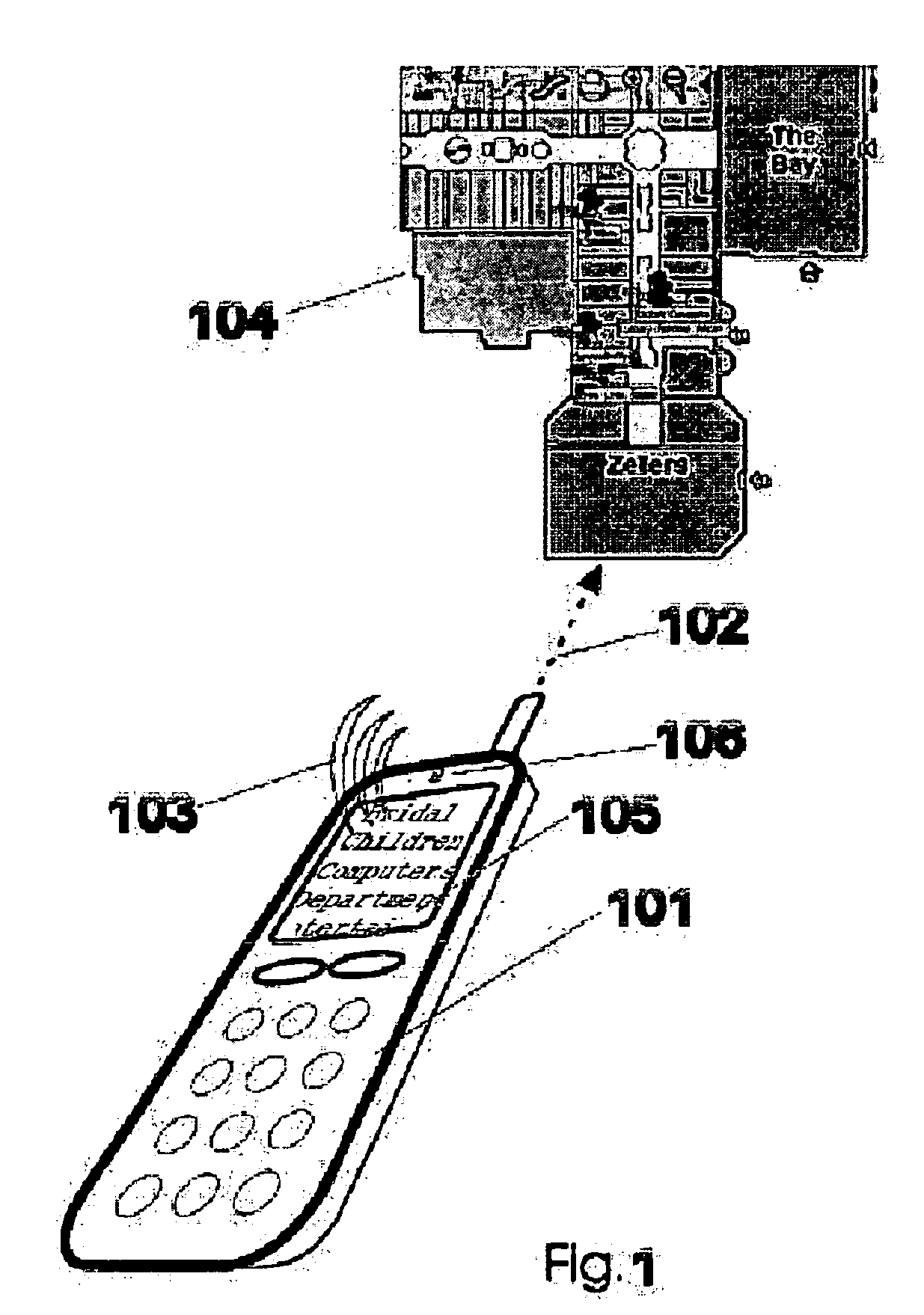
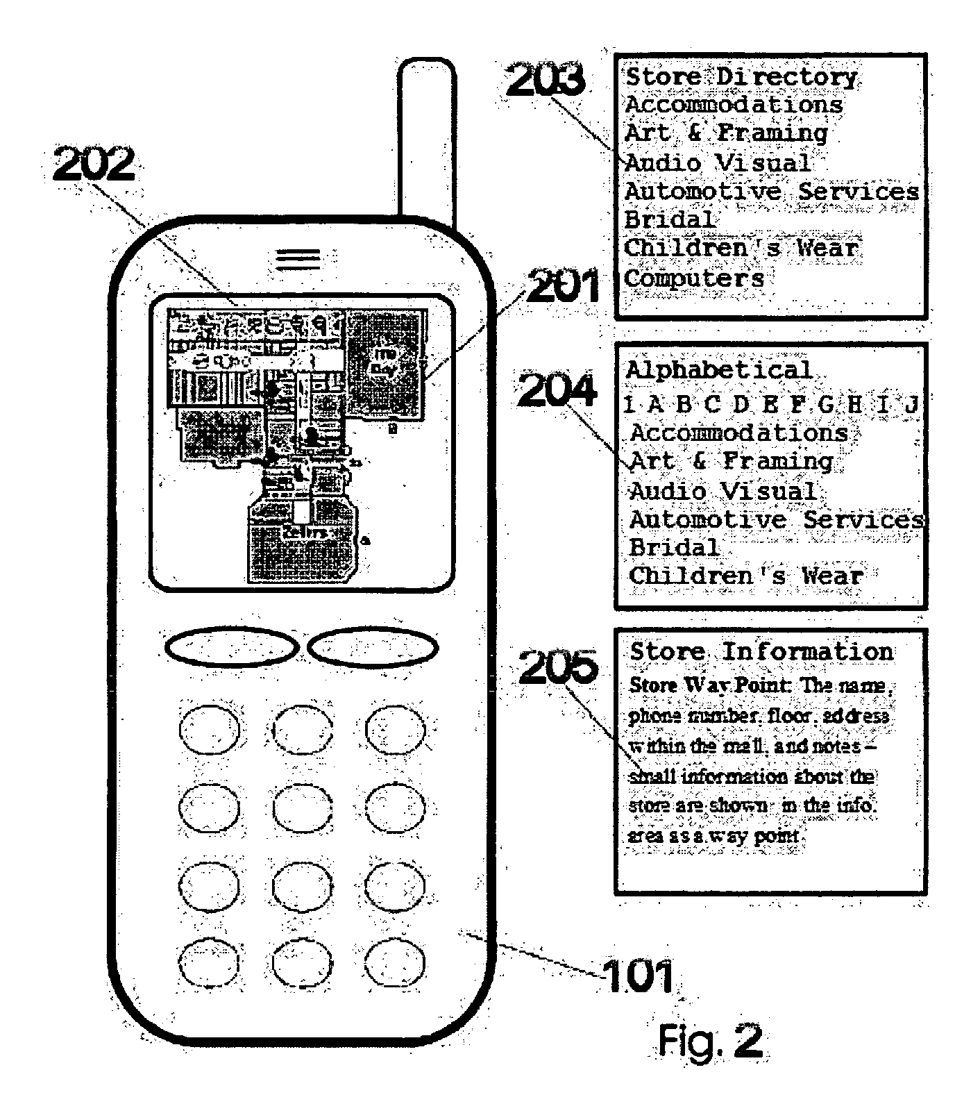
[0195] These figures illustrate the method and system to navigate indoor without GPS using sensor in a network utilizing Bluetooth application on a cellular phone.

[0196] Referring to FIG. 1 This shows the cellular phone 101 with a floating display of information 105 received directly from sensors / tags 107 installed in this illustration in a mall facility 104 the only communication is between the sensors 107 and directly to the cellular phone 101 via a Bluetooth communication 102 where no cellular or any other connection needed at all. We use the cellular phone 101 as a Bluetooth enable device. The application will receive a signal directly from the sensor / tags 107 installed at the facility and allow to calculate and determine the exact location of the “use...


PUM


Abstract

The navigation system method described herein could guide people around urban environments, detect guide and navigate them to destinations, add-on to the portable phone. We have focused on the task of detecting and navigating even in situations in which Global Positioning Systems (GPS) cannot provide this information, such as when the person is indoors or in crowded urban areas where there is no line of site to the GPS satellites. The information will be received directly from RF sensors and will display on the existing cellular phone as Bluetooth application

Description

RELATED APPLICATIONS [0001] This application claims the benefit of US Provisional Application No. US60 / 678,947 filed May 9, 2005.FIELD OF THE INVENTION [0002] This invention is directed generally to the field of “location based navigation” and, more particularly, to such method to be used indoors or outdoors without GPS and utilizing a wireless sensor network. BACKGROUND OF THE INVENTION [0003] Introduction to location based services: [0004] Location based services are rapidly expanding. Outdoor location technologies are mainly based on GPS technologies. GPS cannot perform properly indoors, and is therefore inadequate. As a result, indoor location systems are appearing on the market. [0005] The need for a system such as ours arises from various market segments and applications. One example in the market is the GPS based systems that use integrated positioning and navigation systems based on GPS receivers as the primary positioning technology. Subsequent to the events of September 11...

Claims


Application Information

Patent Timeline
04 Jan 2007
Publication
US20070001904A1
IPC
G01S3/02; H04W4/024; H04W4/33
CPC
G01C21/206; G01S1/68; G01S5/02; G08B7/066; G06Q30/0239; G06Q90/20; H04W4/04; G01S5/0226
Inventors
MENDELSON, EHUD