

Digital map data processing system
- Summary
- Abstract
- Description
- Claims
- Application Information
AI Technical Summary
Benefits of technology
Problems solved by technology
Method used
Image

Examples
case 4
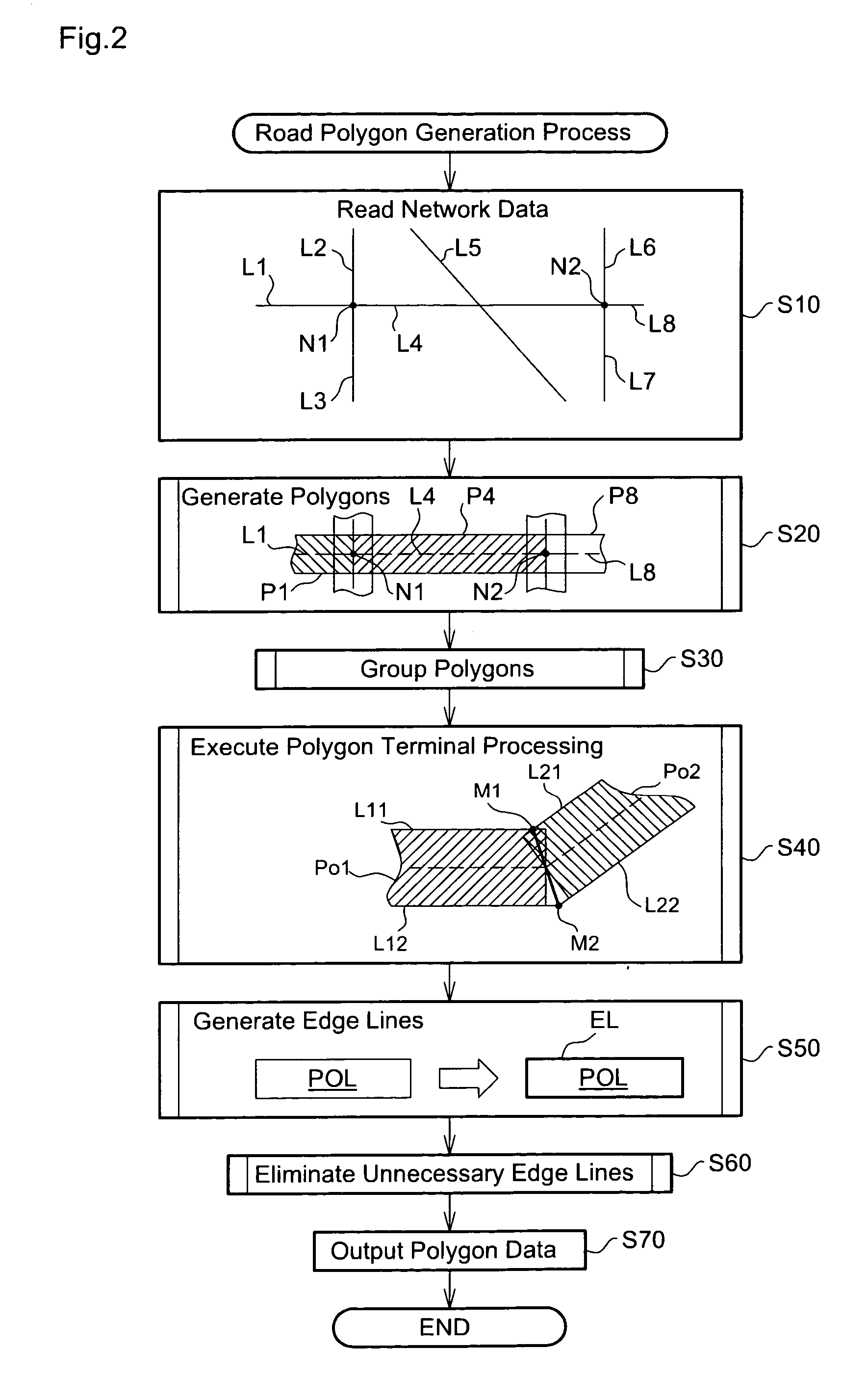
[0159] In Case 4, multiple connection roads at an intersection are the mixture of those in the same road class as and those in a different road class from the object road, and the object road has non-continuity with any connection road. In this case, the polygon convex process is performed individually for the respective roads.
[0160] This modified example executes the polygon terminal processing for three or more roads and accordingly has some difference in the polygon convex process from that of the embodiment (see FIG. 9). The polygon convex process of the modified example is described briefly with reference to the flowchart of FIG. 9. The polygon convex process of the modified example specifies the continuity or non-continuity of connection roads (step S120A) after convexing the terminal geometry of the polygon of the object road (step S120). While the connection status in Case 4 (see FIG. 17) specifies the continuity or non-continuity of an object road with a connection road, th...
PUM
 Abstract
Description
Claims
Application Information