
Method for fusing multiple GPS measurement types into a weighted least squares solution

a technology of weighted least squares and gps, applied in wave based measurement systems, instruments, transmission systems, etc., can solve the problems of numerous measurements, inability to make optimal solutions available, and existing civil and military systems that do not meet the requirements of jpals, so as to achieve optimal accuracy in position solutions and speed and accuracy of position calculations.

Active Publication Date: 2008-02-14
SIERRA NEVADA CORP
View PDF2 Cites 34 Cited by
  • Summary
  • Abstract
  • Description
  • Claims
  • Application Information

AI Technical Summary

Benefits of technology

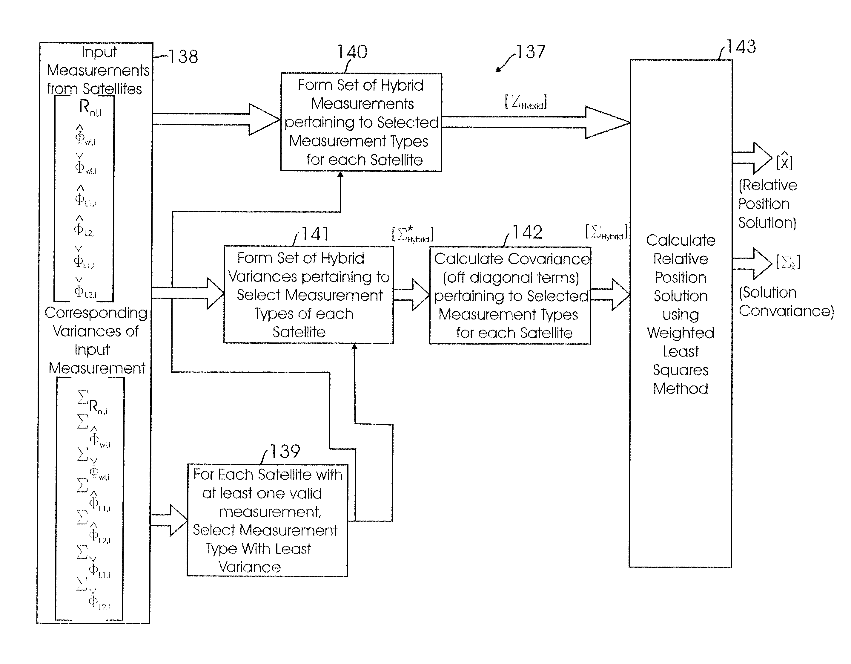
[0011]The present invention provides a novel and effective system and method for a GPS-based airborne navigation system to process the position component of the Relative State Function by fusing different types measurement data, i.e., data representing several different measured parameters. More specifically, the present invention provides an improved method of calculating the position data of aircraft closing in on target locations.
[0012]The present invention enhances the speed and accuracy of such position calculations. This is accomplished by the fusing some or all of the different types of measurement data available in a GPS-based system into a weighted least squares algorithm to determine the appropriate covariance matrix, given the different measurement types. This method allows optimal accuracy in the position solution by including all satellites, and their best available measurements. Moreover, the invention can operate and provide satisfactory results whenever relative position estimation is needed between two vehicles (e.g., an aircraft and a ship).

Problems solved by technology

Existing civil and military systems do not satisfy JPALS requirements because they have a number of shortcomings that limit joint operations.
Among the limitations of conventional systems, especially as applied to calculating position data of an aircraft closing in on a target, is that in order to calculate an aircraft's position, numerous measurements must taken.
Traditionally, four measurements of the same type are needed to be used in a solution; otherwise optimal solutions can not be made available.
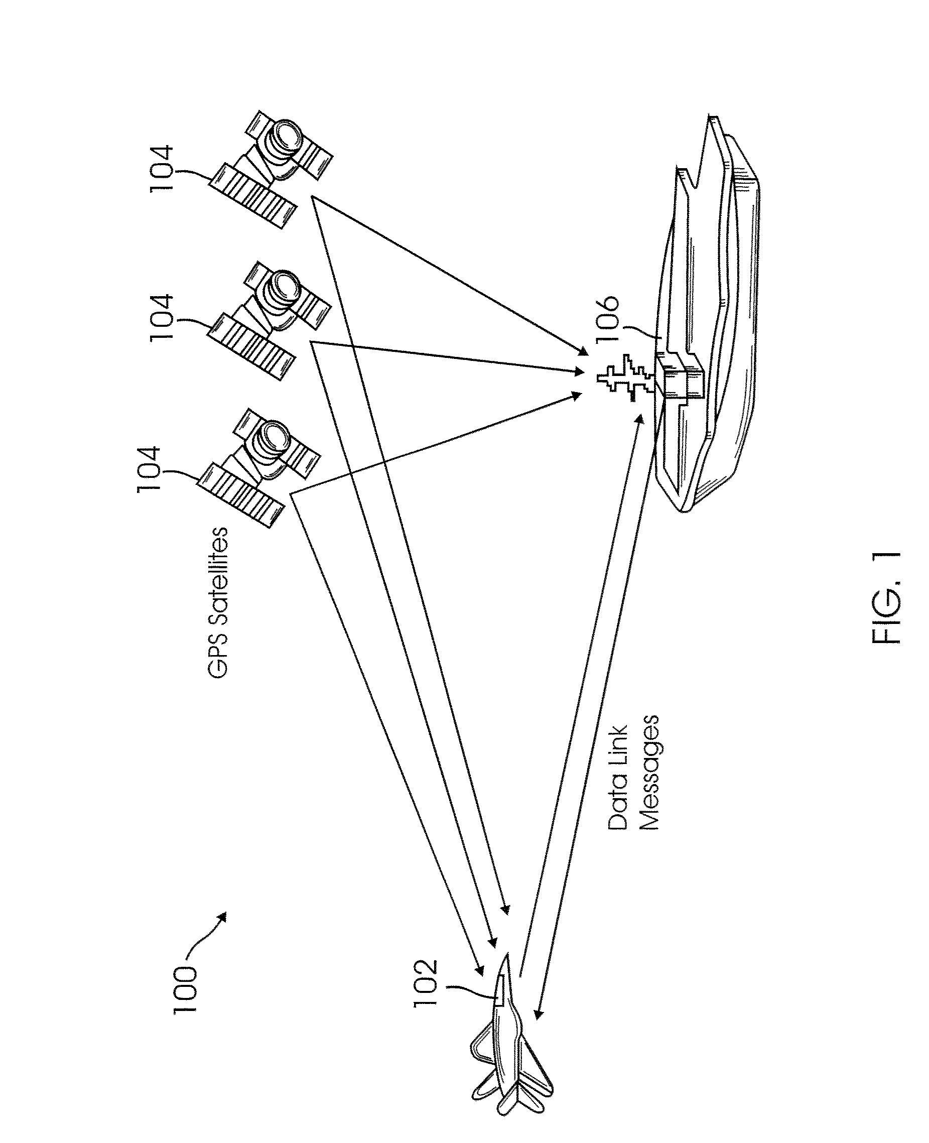
Furthermore, conventional methods have been less than satisfactory when relative position estimation is needed between two moving vehicles (e.g., between an aircraft and a ship).

Method used


Image

  • Method for fusing multiple GPS measurement types into a weighted least squares solution
  • Method for fusing multiple GPS measurement types into a weighted least squares solution
  • Method for fusing multiple GPS measurement types into a weighted least squares solution

Examples


Embodiment Construction

[0017]The following definitions are provided as they are typically (but not exclusively) used in GPS-based navigation systems implementing the various adaptive aspects of the present invention.

[0018]The GPS is a satellite-based navigation system having a constellation of 24 Earth orbiting satellites. These satellites are approximately uniformly dispersed around six circular orbits having four satellites in each orbit. Each GPS satellite transmits at two frequencies: L1 (1575.42 MHz) and L2 (1227.60 MHz). The L1 frequency has two different spread-spectrum codes modulated on it: a coarse acquisition (CA) code, and a Y code. The Y code is also modulated onto the L2 carrier.

[0019]Earth centered, Earth fixed (ECEF) is a Cartesian coordinate system used for GPS. It represents positions as X. Y. and Z coordinates in meters. The point (0.0.0) denotes the center of the earth, hence the name Earth-Centered.

[0020]World Geodetic System of 1984 (WGS 84) a geodetic reference systems used by GPS a...


PUM


Abstract

A method of calculating position data for an airborne aircraft using a GPS-based airborne navigation system includes the processing of a position component of a relative state function by fusing a plurality of different types of measurement data available in the GPS-based system into a weighted least squares algorithm to determine an appropriate covariance matrix for the plurality of different types of measurement data.

Description

CROSS-REFERENCE TO RELATED APPLICATION[0001]This applications claims the benefit under 35 U.S.C. Section 119(e), of co-pending Provisional Application No. 60 / 822,195, filed Aug. 11, 1006, the disclosure of which is incorporated herein by reference in its entirety.FEDERALLY SPONSORED RESEARCH OR DEVELOPMENT[0002]Not ApplicableBACKGROUND[0003]1. Field of the Invention[0004]The present invention relates to Global Positioning System (GPS)-based Relative Navigation Systems, and more particularly to a method for processing the relative state of the position component of an airborne navigation system.[0005]2. Background of the Invention[0006]A need has been found for providing a rapidly deployable, adverse weather, adverse terrain, day-night, survivable, and mobile precision approach and landing capability that supports the principles of forward presence, crisis response and mobility. The capability should enable military forces to land on any suitable surface world wide (land and sea), un...

Claims


Application Information

Patent Timeline
Patent Type & Authority Applications(United States)
IPC IPC(8): H04B7/185G01S1/00G01S5/14G01S19/11G01S19/15G01S19/51
CPCG01S19/51G01S19/15
Inventor HANSEN, JOSEPH H.WRIGHT, WILLIAM G.
Owner SIERRA NEVADA CORP
Learn More