
Software architecture for high-speed traversal of prescribed routes

Inactive Publication Date: 2008-03-06
CARNEGIE MELLON UNIV
View PDF36 Cites 180 Cited by
  • Summary
  • Abstract
  • Description
  • Claims
  • Application Information

AI Technical Summary

Benefits of technology

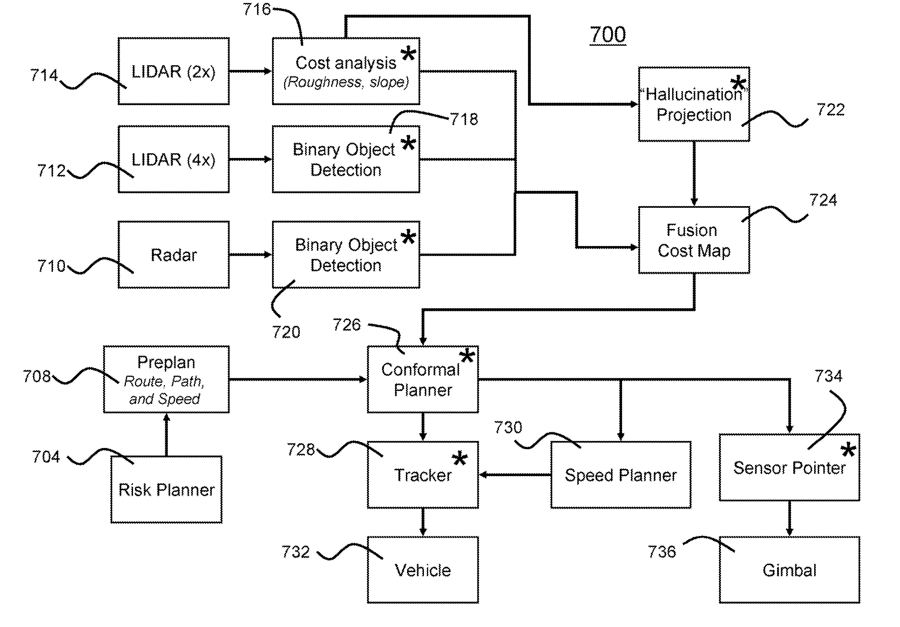
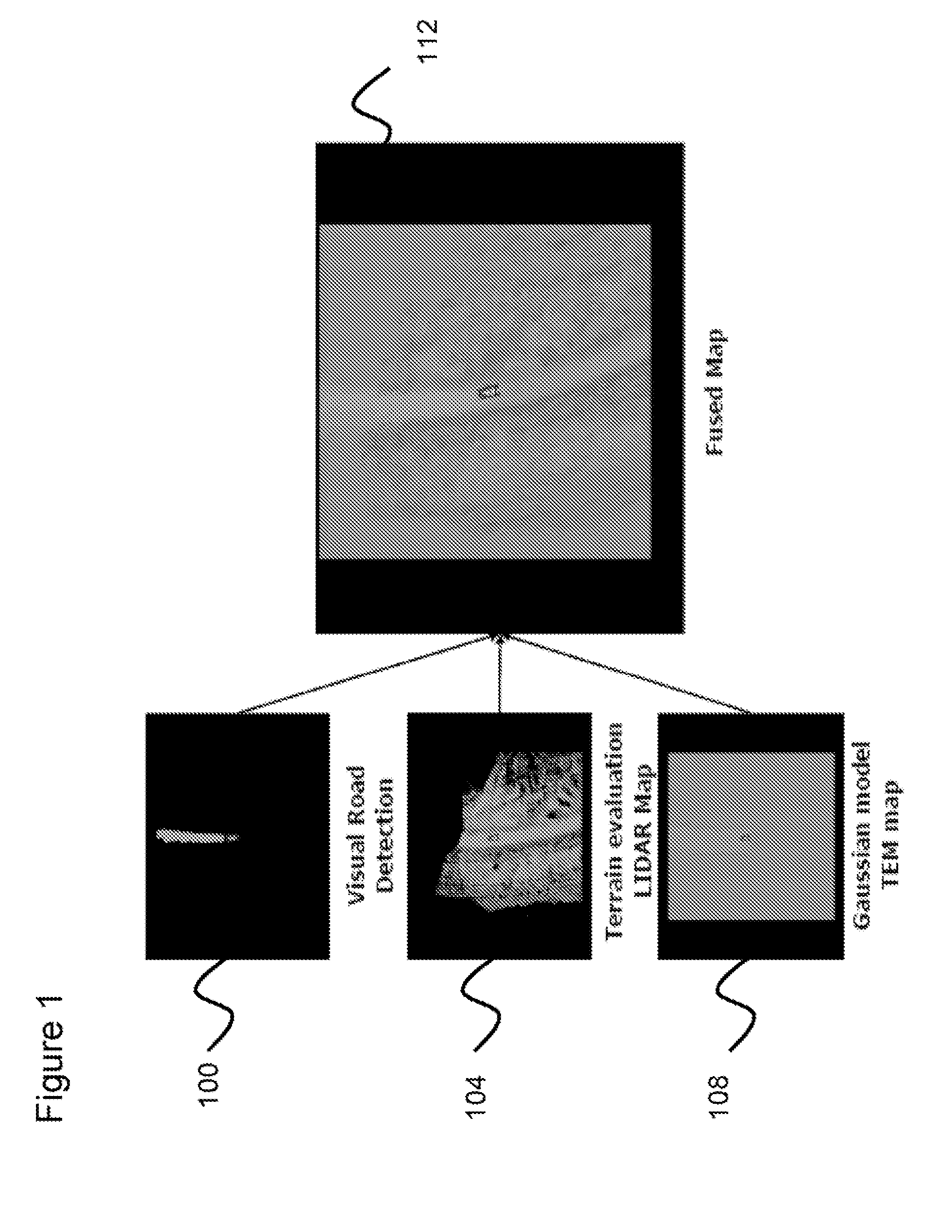
[0018] The present invention preferably encompasses systems, methods, and apparatuses that provide for autonomous high-speed navigation of terrain by an un-manned robot. By preferably employing a pre-planned route, path, and speed; extensive sensor-based information collection about the local environment; and information about vehicle pose, the robots of the present invention evaluate the relative cost of various potential paths and thus arrive at a path to traverse the environment. The information collection about the local environment allows the robot to evaluate terrain and to identify any obstacles that may be encountered. The robots of the present invention thus employ map-based data fusion in which sensor information is incorporated into a cost map, which is preferably a rectilinear grid aligned with the world coordinate system and is centered on the vehicle. The cost map is a specific map type that represents the traversability of a particular environmental area using a numeric value.
[0020] The planned path and route provide information that further allows the robot to orient sensors to preferentially scan the areas of the environment where the robot will likely travel, thereby reducing the computational load placed onto the system. The computational ability of the system is further improved by using map-based syntax between various data processing modules of the present invention. By using a common set of carefully defined data types as syntax for communication, it is possible to identify new features for either path or map processing quickly and efficiently.

Problems solved by technology

Autonomously navigating an environment at high-speeds for long distances is a challenge that has long confronted the robotic field.
The utility of an autonomously navigating robot in military situations is clear; autonomous vehicles may travel through environments that are dangerous for humans.

Method used


Image

  • Software architecture for high-speed traversal of prescribed routes
  • Software architecture for high-speed traversal of prescribed routes
  • Software architecture for high-speed traversal of prescribed routes

Examples


Embodiment Construction

[0021] It is to be understood that the figures and descriptions of the present invention have been simplified to illustrate elements that are relevant for a clear understanding of the invention, while eliminating, for purposes of clarity, other elements that may be well known. The detailed description will be provided hereinbelow with reference to the attached drawings.

[0022] The present invention encompasses systems, methods, and apparatuses for the autonomous and high-speed navigation of terrain by an unmanned robot. The software architectures and computational structures of the present invention accomplish the rapid evaluation of terrain, obstacles, vehicle pose, and vehicle location to allow for the identification of a viable trajectory for navigation by the robot. The present invention accomplishes those goals by employing path-centric navigation structure. The present invention also preferably employs a perception system that employs laser- and RADAR-based scanning to identif...


PUM


Abstract

Systems, methods, and apparatuses for high-speed navigation. The present invention preferably encompasses systems, methods, and apparatuses that provide for autonomous high-speed navigation of terrain by an un-manned robot. By preferably employing a pre-planned route, path, and speed; extensive sensor-based information collection about the local environment; and information about vehicle pose, the robots of the present invention evaluate the relative cost of various potential paths and thus arrive at a path to traverse the environment. The information collection about the local environment allows the robot to evaluate terrain and to identify any obstacles that may be encountered. The robots of the present invention thus employ map-based data fusion in which sensor information is incorporated into a cost map, which is preferably a rectilinear grid aligned with the world coordinate system and is centered on the vehicle. The cost map is a specific map type that represents the traversability of a particular environmental area using a numeric value. The planned path and route provide information that further allows the robot to orient sensors to preferentially scan the areas of the environment where the robot will likely travel, thereby reducing the computational load placed onto the system. The computational ability of the system is further improved by using map-based syntax between various data processing modules of the present invention. By using a common set of carefully defined data types as syntax for communication, it is possible to identify new features for either path or map processing quickly and efficiently.

Description

CROSS-REFERENCE TO RELATED APPLICATION [0001] This application claims the benefit under 35 U.S.C. § 119(e) of the earlier filing date of U.S. Provisional Application Ser. No. 60 / 812,693 filed on Jun. 9, 2006, which is hereby incorporated by reference.BACKGROUND OF THE INVENTION [0002] 1. Field of the Invention [0003] The present invention relates to methods, systems, and apparatuses for the autonomous navigation of terrain by a robot. [0004] 2. Description of the Background [0005] Autonomously navigating an environment at high-speeds for long distances is a challenge that has long confronted the robotic field. One of the fundamental aspects of the problem is how a robot should quickly identify obstacles, undesirable terrain, and preferred paths while at the same time maintaining a high speed. A high-speed robot would also preferably keep track of its location and pose, i.e. robot orientation, speed, etc. A robot traveling at high speed would need to make these perceptions and decisi...

Claims


Application Information

Patent Timeline
IPC IPC(8): G05D1/00
CPCG05D1/0257G05D1/027G05D1/0274G08G1/22G05D1/0293G05D1/0295G08G1/161G05D1/0278G05D1/024
Inventor WHITTAKER, WILLIAM L.URMSON, CHRISPETERSON, KEVINHODGE, VANESSASNIDER, JARROD
Owner CARNEGIE MELLON UNIV
Learn More