

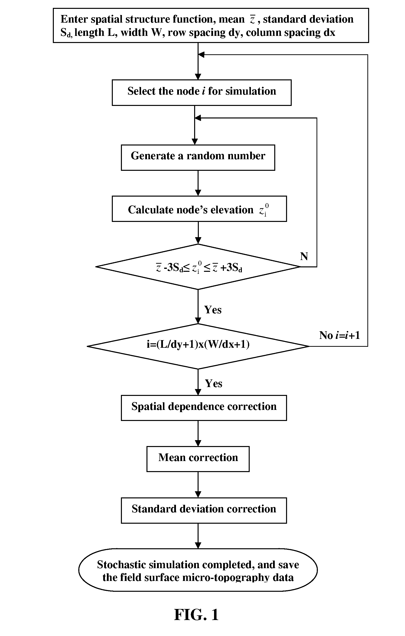
Method for predicting micro-topographic distribution of terrain
a microtopographic and terrain technology, applied in the field of predicting the microtopographic distribution of terrain, can solve the problems of numerical range and lack of spatial distinction, affecting the flexibility and systemic of the surface relative elevation information collection, and ignoring the transverse variability, so as to achieve accurate simulation results and improve evaluation
- Summary
- Abstract
- Description
- Claims
- Application Information
AI Technical Summary
Benefits of technology
Problems solved by technology
Method used
Image

Examples
example
[0130]Surface Irrigation Land Leveling Precision Design
[0131]A lot of 100 m×400 m in Changpin, Beijing requires surface irrigation land leveling precision design. Currently, the standard deviation of its field micro-terrain Sd is 10.5 cm. The irrigation water source is groundwater, and its water yield is 108 m3 / h. A proposal for reasonable land leveling precision through optimum design is required.
[0132]When determining the optimum design for the land leveling, several precision levels are considered, including Sd=6.5 cm, 5.5 cm, 4.5 cm, 3.5 cm, 2.5 cm and 1.5 cm. Using the methodology described in the invention, for each corresponding Sd, one can generate m sets of micro-terrain data, all of which share the same Sd but have different spatial variability of terrain undulation positions. The land leveling cost can be obtained using the land leveling design software.
[0133]The total irrigation volume can be derived from the irrigation model. Based on the established relationship betwee...
PUM
 Abstract
Description
Claims
Application Information