
System and method of simulating with respect to spheroid reference models using local surface coordinates

a reference model and local surface coordinate technology, applied in the field of embedded systems and modeling and simulation systems, can solve the problems of limiting the level of detail of complex formulations, too expensive or too dangerous to test, practice or use to support analytic studies, and affecting the accuracy of simulation results

Inactive Publication Date: 2010-12-16
YASUMI CAPITAL
View PDF4 Cites 8 Cited by
  • Summary
  • Abstract
  • Description
  • Claims
  • Application Information

AI Technical Summary

Problems solved by technology

Certain real-world activities, such as flight training, combat scenarios, missile operations, and fire fighting, are too expensive or too dangerous to test, practice, or use to support analytic studies.
Yet despite this improvement, computational performance still limits the level of detail, and, thus, the degree of realism, attainable in simulation systems.
The coordinate framework used by a simulation system, for example, to simulate motion dynamics and geometric relations, is a principal factor in computational complexity.
Computational complexity means that complex formulations are typically slower to compute than other formulations.
The rectangular coordinates permit simplified mathematical formulation with the promise of acceptable computer runtimes. When employing rectangular coordinates, however, a designer of a typical, computationally intensive application involving Earth geometry makes major modeling compromises, such as gross simplifications to the actual shape of the Earth and to the local environment.
These gross simplifications lead to a loss of fidelity that can endanger lives and require expensive subsequent reparations.
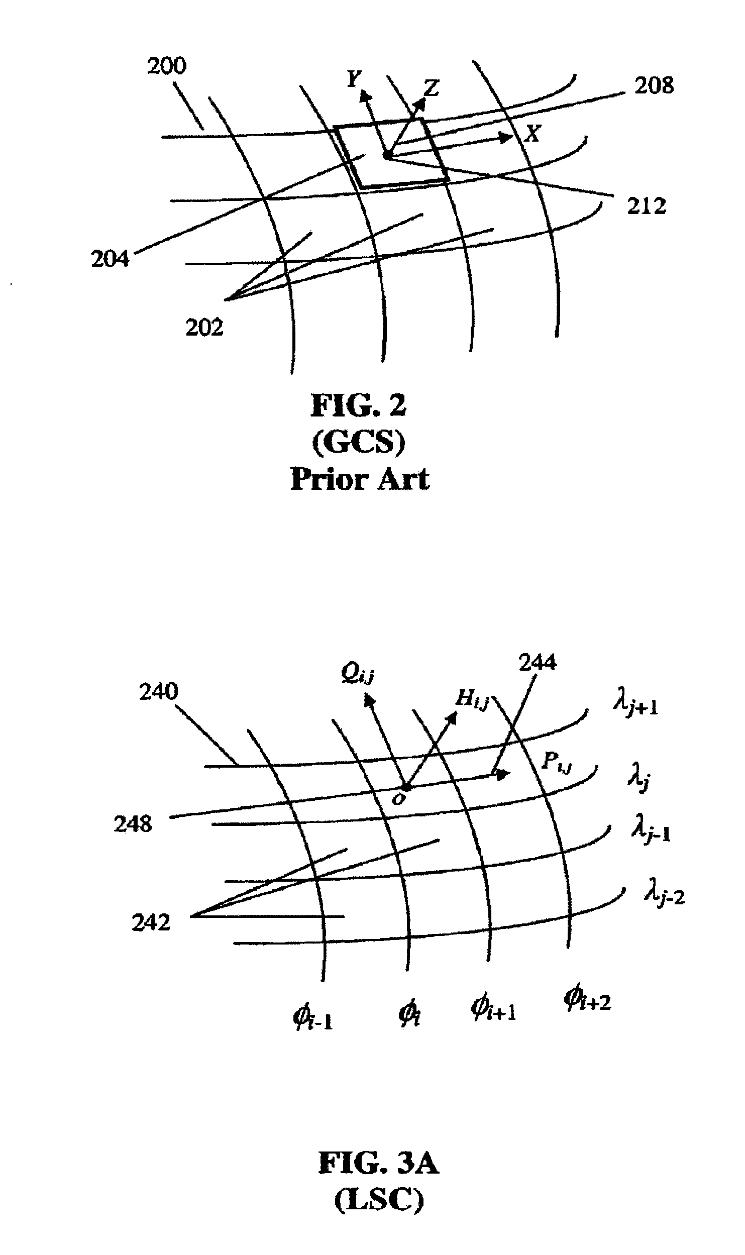
The Global Coordinate System (GCS) is an example of one such system that was designed to permit various simplifications to be made to increase processing speed, but such simplifications still compromise the fidelity of the underlying mathematical models.
One problem with GCS is that the latitude / longitude cells on the surface do not map to rectangles on each coordinate plane of the CLTP.
Another problem is that the curved tessellation cell boundaries do not map to straight lines corresponding to rectangular cells.
When the terrain surface is modeled in GCS, gaps may occur into which modeled entities such as vehicles can “disappear.” Such terrain skin representations can be repaired but at great expense and loss of fidelity.
This results in inaccurate dynamic formulations.

Method used


Image

  • System and method of simulating with respect to spheroid reference models using local surface coordinates
  • System and method of simulating with respect to spheroid reference models using local surface coordinates
  • System and method of simulating with respect to spheroid reference models using local surface coordinates

Examples


Embodiment Construction

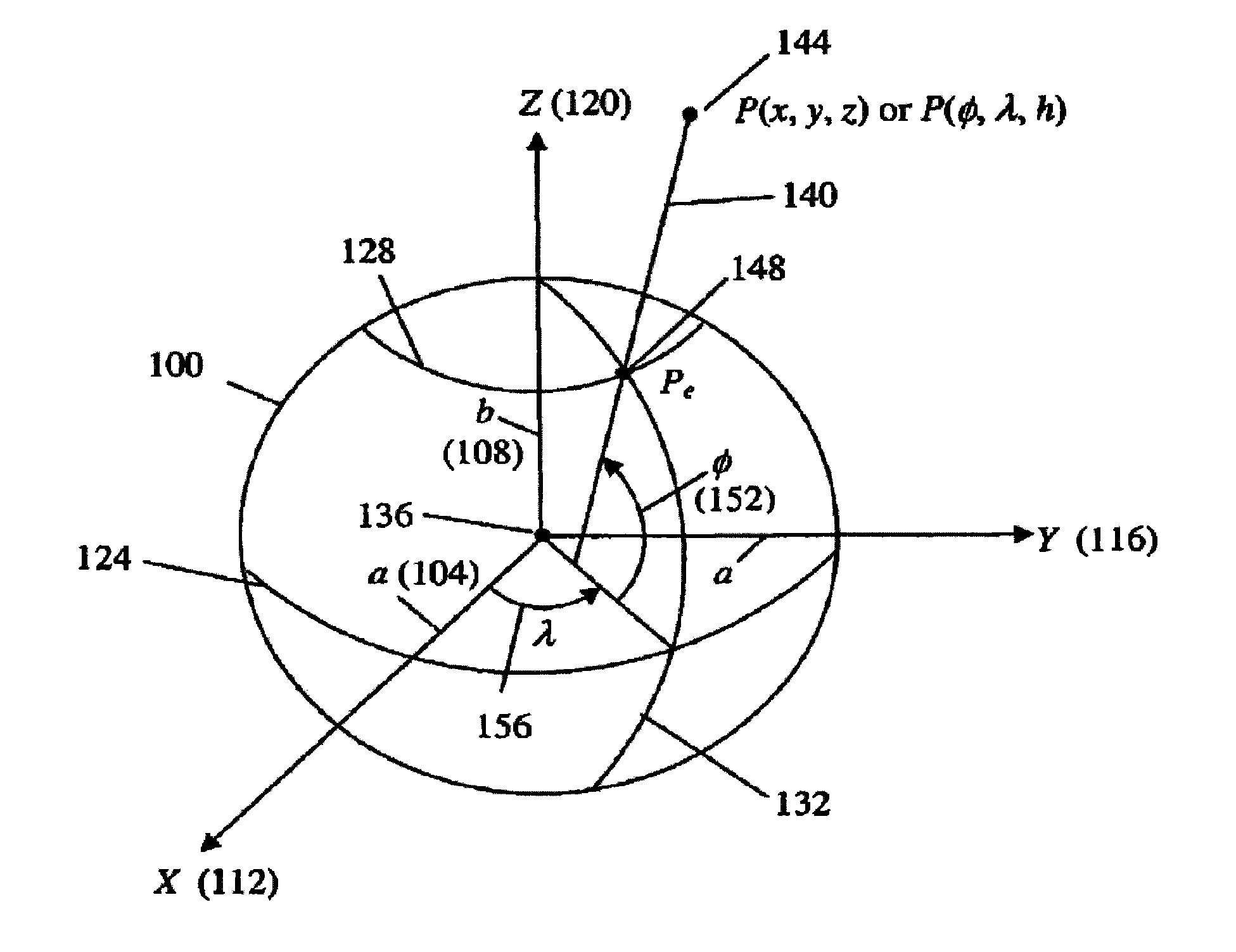
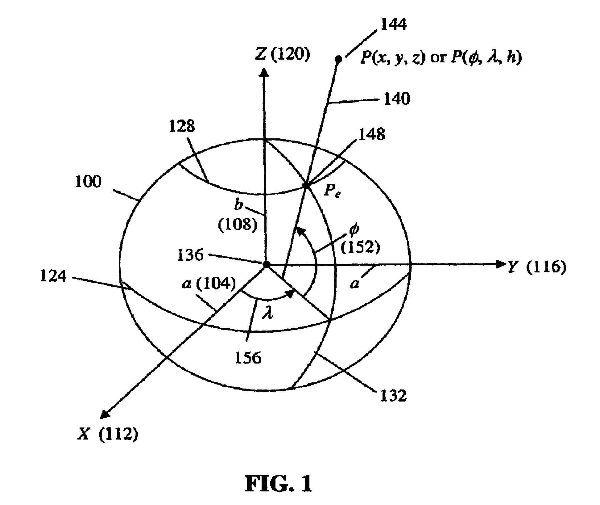
[0024]Many application domains, for example, simulations, simulators, embedded systems, operational planning and assessment tools, real-time mission planning, weather prediction, fire fighting, and emergency response, need to point below, on, or above the surface of the Earth. Applications in these domains create and control elements, referred to as entities. Examples of entities in a combat simulation are aircraft, tanks, missiles, and personnel. Commonly, simulation applications control more than one entity. These applications need a well-defined coordinate system. To this end, the present invention features a curvilinear orthogonal local surface coordinate system that provides a description of the location of entities in a three-dimensional coordinate system with respect to a reference model.

[0025]FIG. 1 shows an embodiment of a reference spheroid 100 used to provide a representative expression of the shape of a planetary body such as the Earth. Generally, the spheroid 100 is a c...


PUM


Abstract

Described are a method and system for describing a position of an entity in a three-dimensional coordinate system with respect to the reference model. The reference model is of a three-dimensional curved surface defined in the three-dimensional coordinate system. The three-dimensional curved surface is divided into a set of cells. Each cell is a subset of the three-dimensional curved surface and has a curved surface. A three-dimensional curvilinear coordinate system is defined for each cellin the set of cells. The three-dimensional curvilinear coordinate system for each cell has a curvilinear axis that extends along the curved surface of that cell.

Description

CROSS-REFERENCE TO RELATED PATENT APPLICATIONS[0001]This application is a Continuation of U.S. application Ser. No. 10 / 213,157, filed Aug. 6, 2002, incorporated herein by reference in its entirety, which claims priority from Provisional Application U.S. Application 60 / 311,412, filed Aug. 10, 2001, incorporated herein by reference in its entirety.FIELD OF THE INVENTION[0002]The invention relates generally to embedded systems and modeling and simulation systems. More particularly, the invention relates to a spatial framework for use by embedded systems and modeling and simulation systems.BACKGROUND OF THE INVENTION[0003]The technical community has long recognized the benefits of modeling and simulation as a major component of simulation systems, simulator systems, and embedded systems. Certain real-world activities, such as flight training, combat scenarios, missile operations, and fire fighting, are too expensive or too dangerous to test, practice, or use to support analytic studies....

Claims


Application Information

Patent Timeline
IPC IPC(8): G06F17/10
CPCG06F17/5009G06F30/20
Inventor TOMS, RALPH M.
Owner YASUMI CAPITAL
Learn More