Re-Configurable Array from Distributed Apertures on Portable Devices
- Summary
- Abstract
- Description
- Claims
- Application Information
AI Technical Summary
Benefits of technology
Problems solved by technology
Method used
Image
Examples
Embodiment Construction
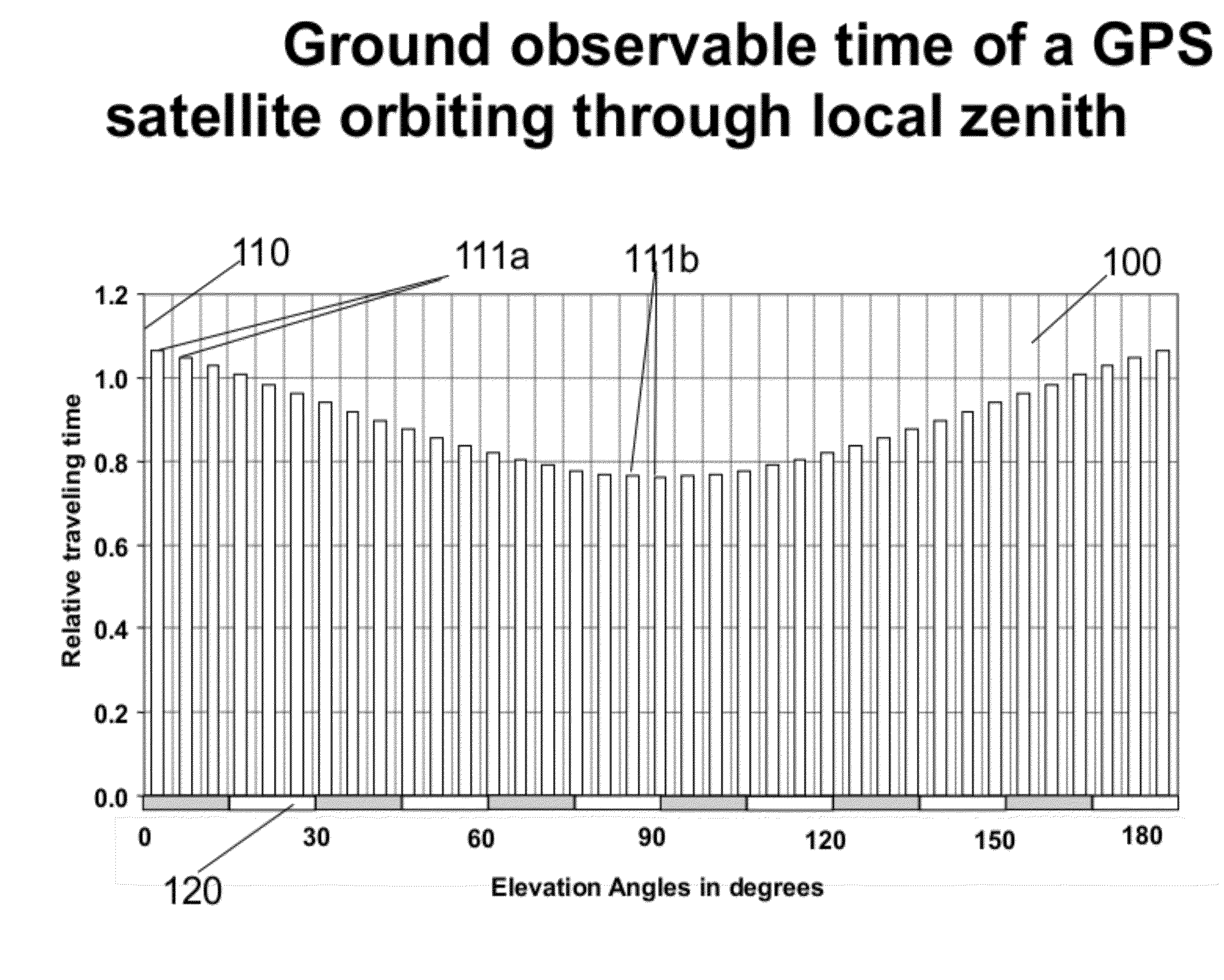
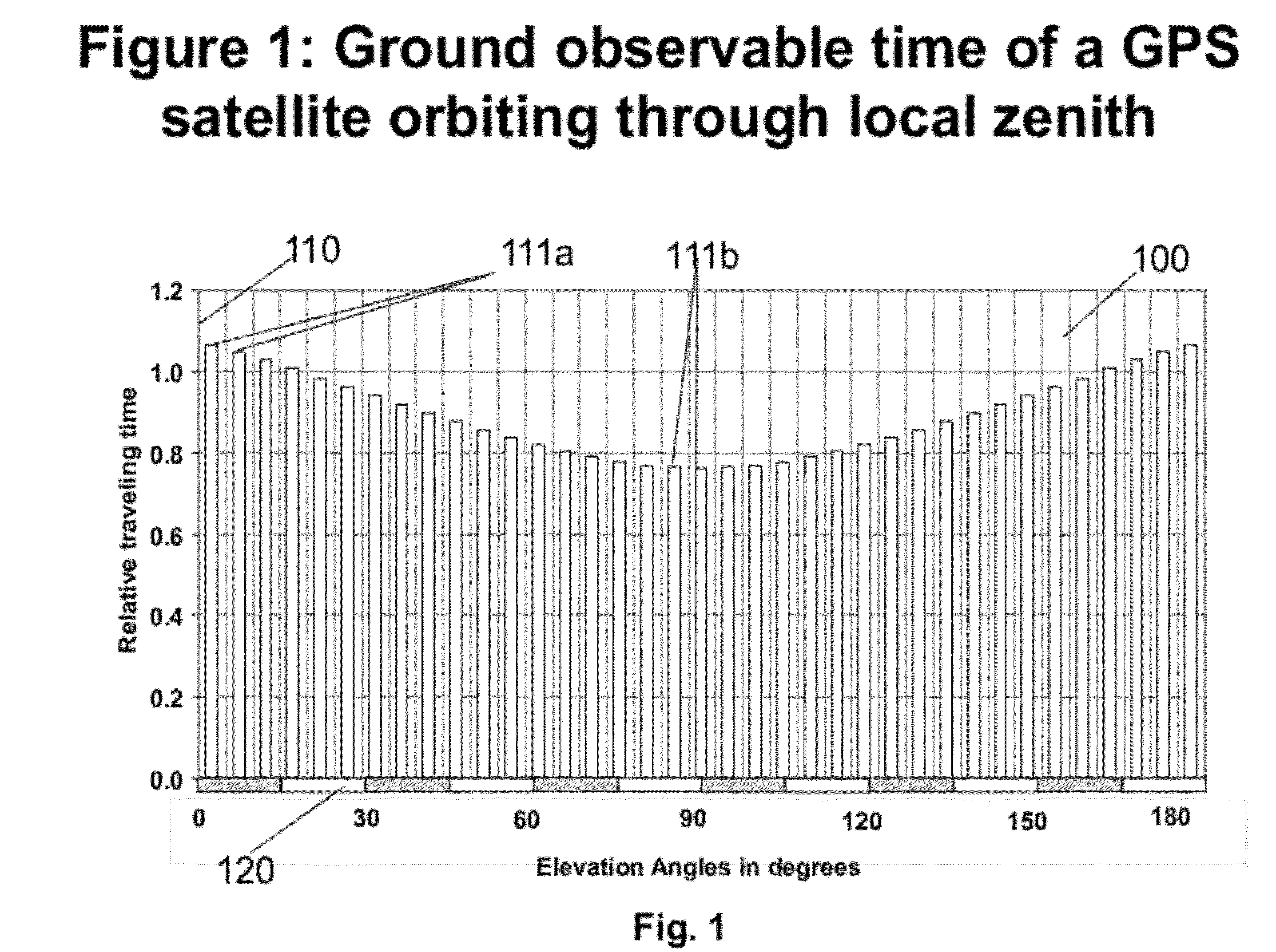
[0074]FIG. 1100 illustrates relative time duration 110 of a GPS satellite orbiting through local zenith as a function of local elevation angle 120. A user has about 40% more time to observe the GPS satellite traveling over low elevations near horizon 111a than that near the local zenith 111b. Naystar GPS satellites are deployed in 6 nearly circular orbital planes, with 4 satellites equally spaced within a plane. The orbital planes are at an inclination of 55 degrees. The GPS satellite series coverage means anywhere from 4 to 12 satellites are above an observers horizon, with satellites being visible for many hours above an observer's horizon.
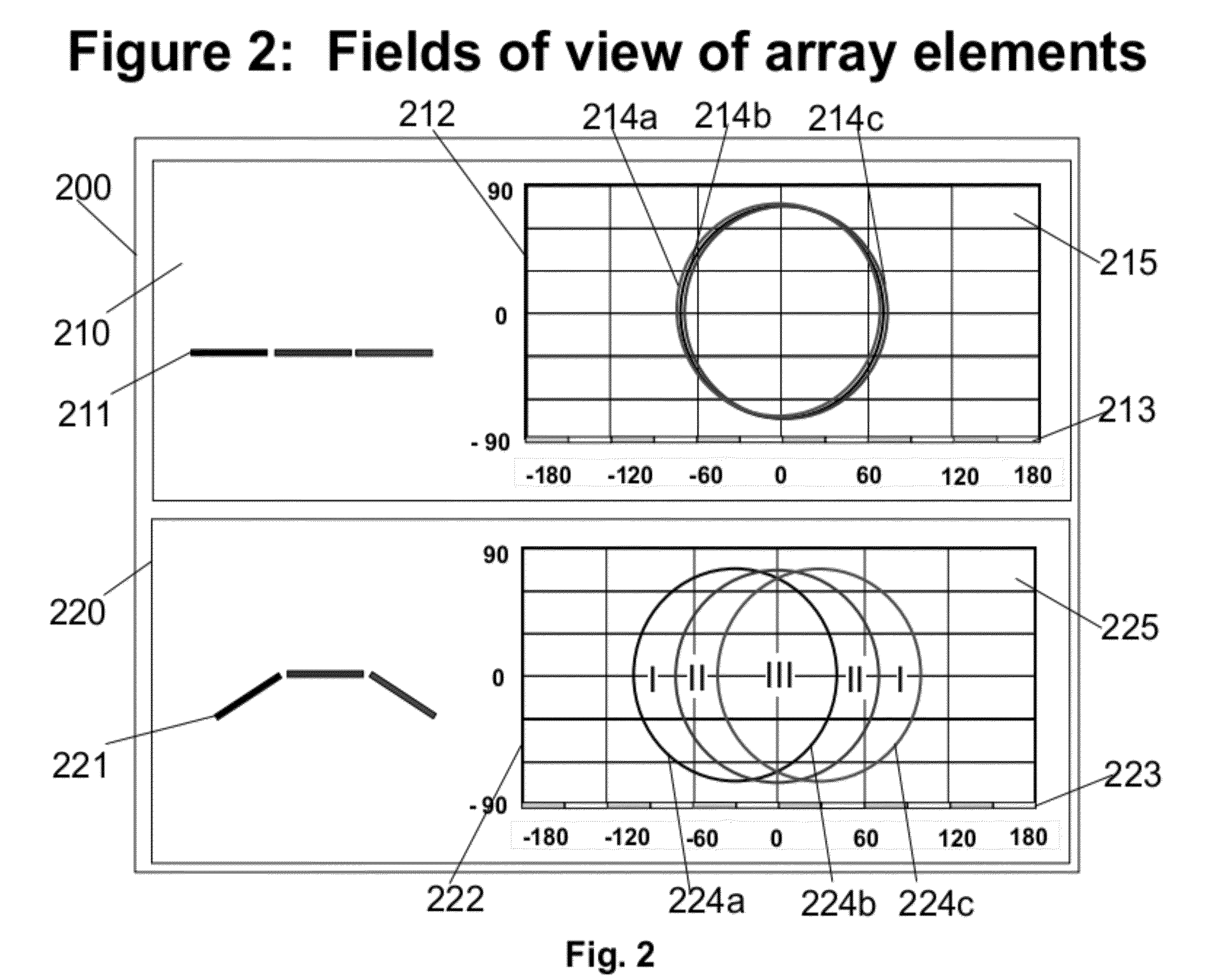
[0075]FIG. 2200 illustrates the FOVs of array elements for those of planar array 211 on upper panel 210 and those of non-planar array 221 on lower panel 220. Markings 211 on panel 210 depict the side view of the planar array. The array consists of 3 identical elements, indicated by 3 bars. The corresponding FOVs of these elements are illustrated...
PUM
 Abstract
Description
Claims
Application Information
 - R&D
- Intellectual Property
- Life Sciences
- Materials
- Tech Scout
- Unparalleled Data Quality
- Higher Quality Content
- 60% Fewer Hallucinations
Browse by: Latest US Patents, China's latest patents, Technical Efficacy Thesaurus, Application Domain, Technology Topic, Popular Technical Reports.
© 2025 PatSnap. All rights reserved.Legal|Privacy policy|Modern Slavery Act Transparency Statement|Sitemap|About US| Contact US: help@patsnap.com


