Streaming representation of moving objects and shapes in a geographic information service

a geographic information and service technology, applied in the field of streaming representation of moving objects and shapes in a geographic information service, can solve the problems of complex processing of this data, numerous challenges, and specialized skills and training, and achieve the effect of minimizing bandwidth problems

Active Publication Date: 2014-09-18
FLORIDA INTERNATIONAL UNIVERSITY
View PDF10 Cites 21 Cited by
  • Summary
  • Abstract
  • Description
  • Claims
  • Application Information

AI Technical Summary

Benefits of technology

[0007]Certain embodiments provide a GIS system that leverages video streaming sensor nodes and presents the dynamic information associated w...

Problems solved by technology

As a result, the processing of this data becomes complex and involves numerous challenges.
These tools are often expensive and can require specialized skills and training to use.
In addition, each tool may require the data to be in different formats, increasing the difficulty in combining heterogeneous types of data.
Another challenge associated with current commercial systems is that much of the information currently stored in these systems is e...

Method used


Image

  • Streaming representation of moving objects and shapes in a geographic information service
  • Streaming representation of moving objects and shapes in a geographic information service
  • Streaming representation of moving objects and shapes in a geographic information service

Examples


Embodiment Construction

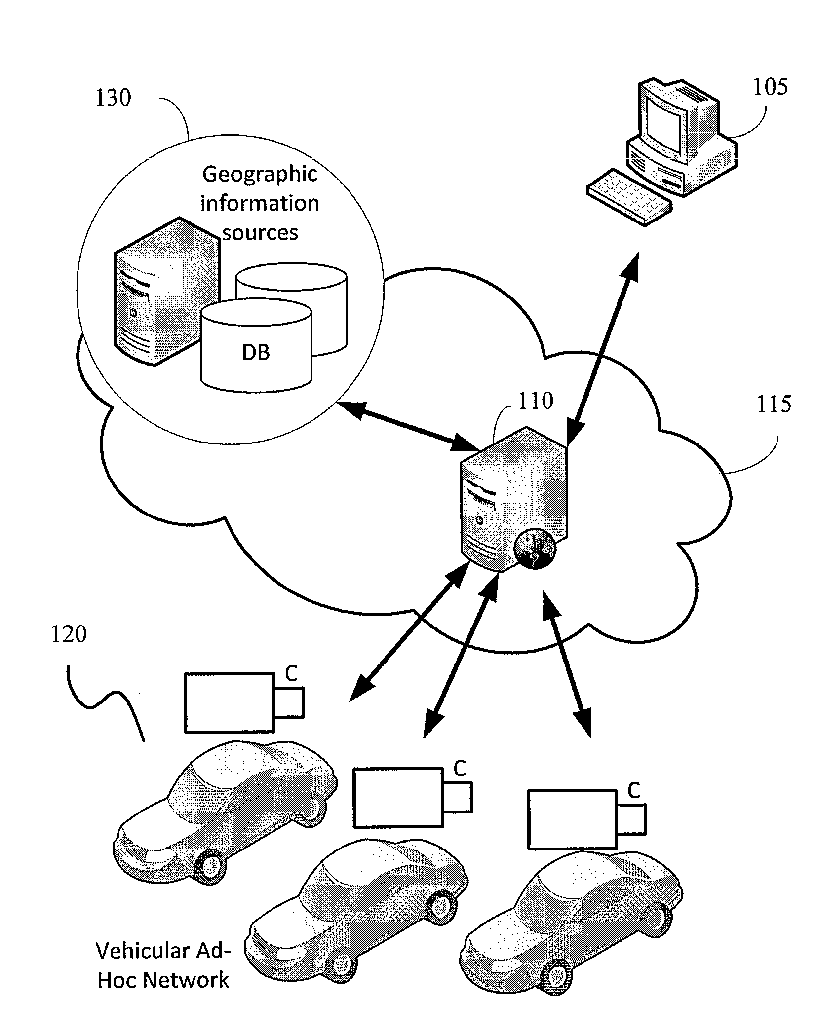
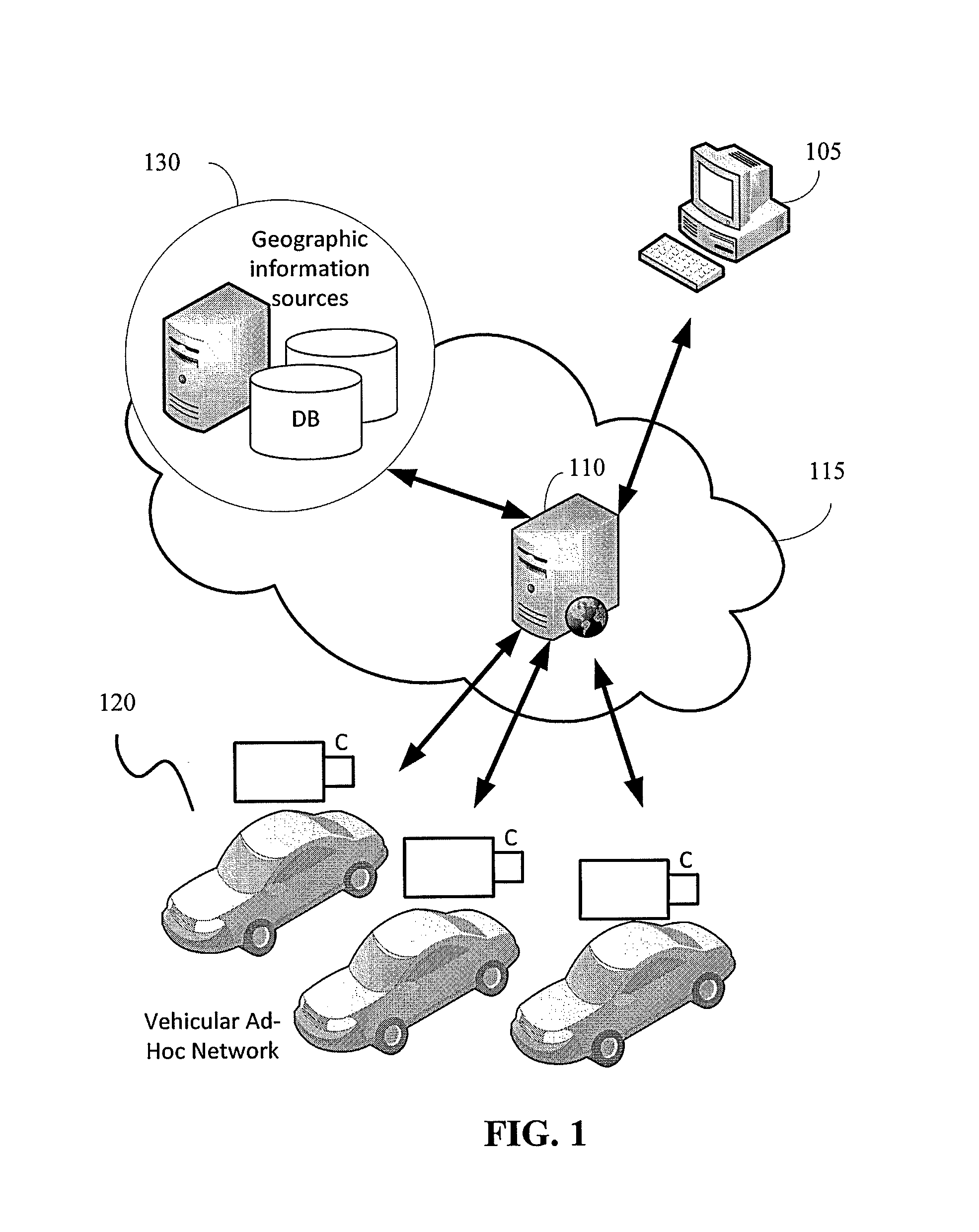
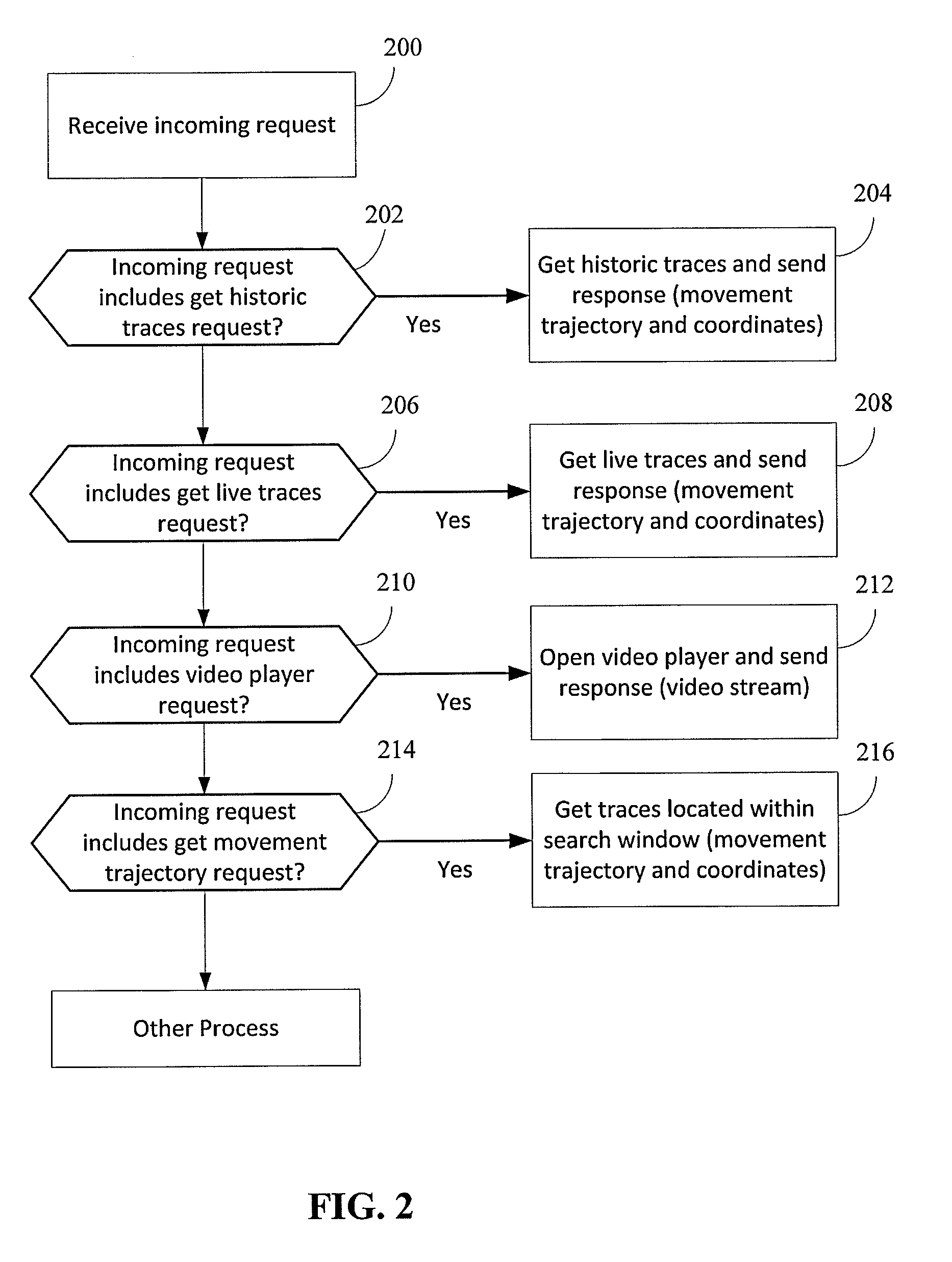
[0011]An application programming interface (API) for a Geographic Information System (GIS) is disclosed. The API enables clients to perform visual querying and rendering.

[0012]Querying, analysis, and visualization of real-time data pertaining to at least two moving objects in conjunction with relatively static multi-temporal geospatial data can be facilitated on client devices through the presentation of the API.

[0013]A GIS server, that may provide a GIS service including the API, can incorporate data from mobile video sensors and streaming technologies in order to present streaming and / or video data.

[0014]In certain embodiments, the GIS server can perform the step of processing and analyzing geographic, spatial and / or temporal data to provide visual representation of the trajectories of relevant objects, which may be known to the server in advance or transmitted in real time, sampled, and have uncertainty aspects.

[0015]Geographic data exploration can be enhanced through incorporati...


PUM


Abstract

A geographical information system (GIS) is described that enables querying, analysis and visualization of real-time streaming data pertaining to at least one moving object or entity (e.g., vehicles, people, sensors, weather phenomena, etc.) in conjunction with relatively static multi-temporal geospatial data. An application programming interface is provided to present the GIS functionality for handling dynamically moving objects or entities to clients.

Description

CROSS REFERENCE TO RELATED APPLICATION[0001]The present application claims the benefit of U.S. Provisional Application Ser. No. 61 / 792,985, filed Mar. 15, 2013, which is hereby incorporated by reference herein in its entirety, including any figures, tables, or drawings.GOVERNMENT SUPPORT[0002]This invention was made with government support under Award Number HRD-0833093 awarded by the National Science Foundation. The government has certain rights in the invention.BACKGROUND[0003]A Geographic Information System (GIS) captures, stores, analyzes, manages, and presents data linked to geographic locations. Example GISs include Google Earth™, ArcGIS® from ESRI, and commercial fleet management services.[0004]In general, a GIS presents tools for users to query and make decisions based on geographic information. The geographic information may be spatial and temporal; and is often heterogeneous, from divergent sources, and may contain structured and unstructured data. As a result, the process...

Claims


Application Information

Patent Timeline
IPC IPC(8): G06F17/30G06F3/0482
CPCG06F3/0482G06F17/30241G06F3/0481G06F16/29Y02A90/10
Inventor RISHE, NAPHTALI DAVID
Owner FLORIDA INTERNATIONAL UNIVERSITY
Why Eureka
Try Eureka