

Method and system for analyzing images from satellites
a satellite and image technology, applied in image analysis, image enhancement, instruments, etc., can solve problems such as error estimation and/or updating values
- Summary
- Abstract
- Description
- Claims
- Application Information
AI Technical Summary
Benefits of technology
Problems solved by technology
Method used
Image

Examples
Embodiment Construction
[0036]Various embodiments of the present invention will now be described more fully hereinafter with reference to the accompanying drawings, in which some, but not all embodiments of the invention are shown. Indeed, embodiments of the invention may be embodied in many different forms and should not be construed as limited to the embodiments set forth herein. Rather, these embodiments are provided so that this disclosure will satisfy applicable legal requirements. Unless otherwise defined, all technical and scientific terms used herein have the same meaning as commonly known and understood by one of ordinary skill in the art to which the invention relates. The term “or” is used herein in both the alternative and conjunctive sense, unless otherwise indicated. Like numbers refer to like elements throughout.
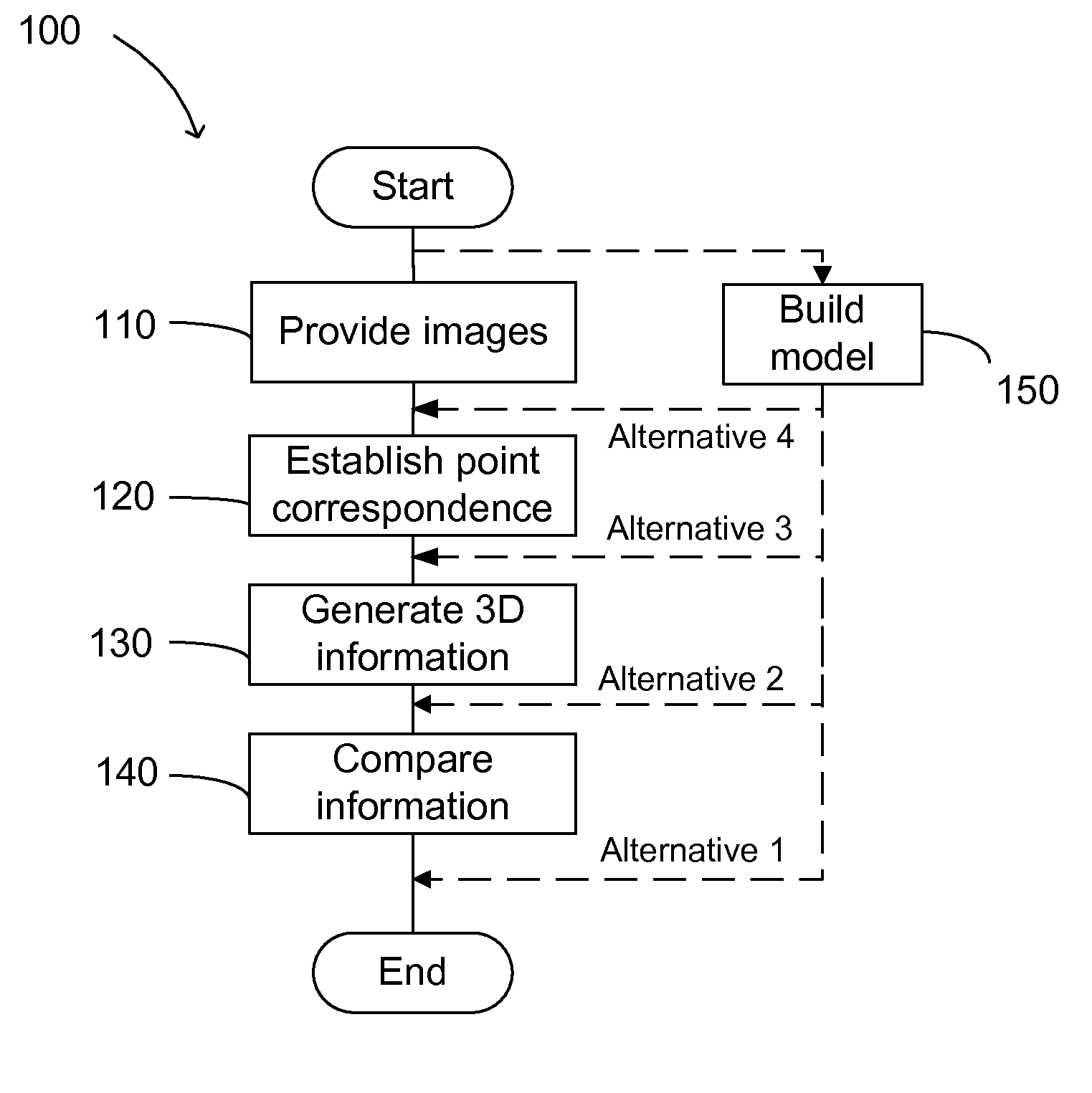
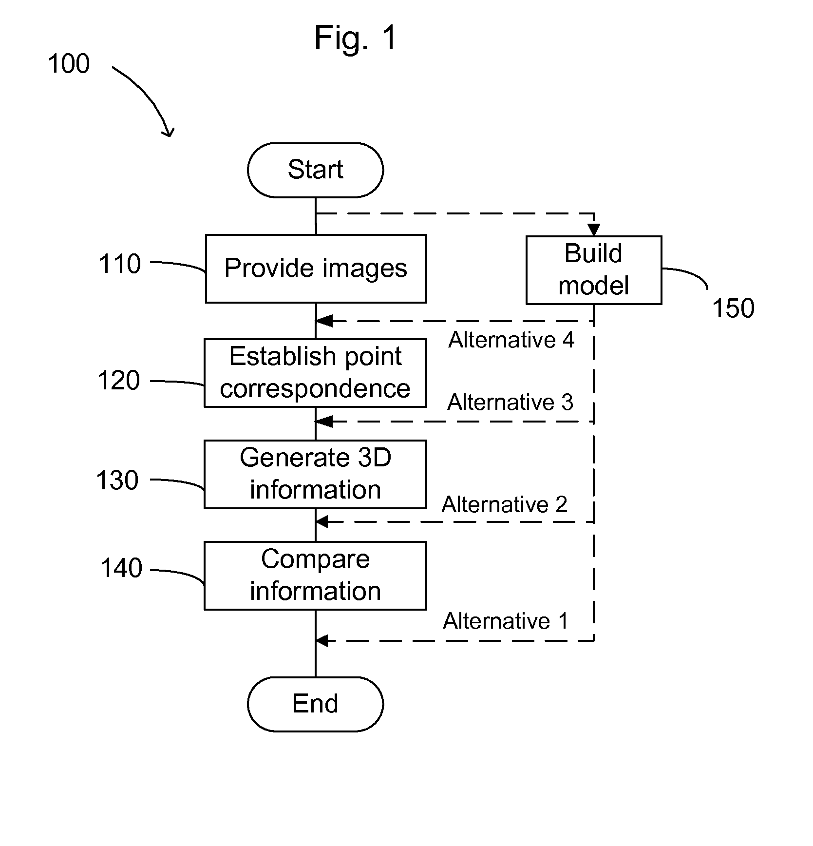
[0037]In FIG. 1 a flow chart is shown for a method 100 for analyzing images. After the start, the method starts with step 110.
[0038]In step 110 at least three images of an area of in...
PUM
 Abstract
Description
Claims
Application Information