High performance real-time interactive exploration and visualization of discrete geospatial data in time and space

Inactive Publication Date: 2016-03-31
THE UNITED STATES OF AMERICA AS REPRESENTED BY THE SECRETARY OF THE COMMERCE
View PDF0 Cites 4 Cited by
  • Summary
  • Abstract
  • Description
  • Claims
  • Application Information

AI Technical Summary

Benefits of technology

The server side architecture is a real-time stream processing system that uses server-based GPUs for data processing and wavelet-based compression to minimize bandwidth and latency for delivering data to end-users. This technology improves access to big data and allows for seamless integration of data across time and space. It also allows for visualization of how data types relate over time and spatially to see global interactions and their importance for environmental prediction. Overall, this technology enhances access and promotes scientific collaboration and new ideas.

Problems solved by technology

Due to the chaotic nature of our weather system, very complex computer models are required in order to predict world weather patterns and localized weather—as well as long-term trends.
These models require extensive amounts of data, and various government agencies and private companies have expended considerable resources to collect such data.
Early weather prediction and forecasting models were somewhat primitive.
Given the enormous amount of data involved, as well as the complex relationships between the data and weather patterns, as well as the chaotic nature of the weather system, computation of weather forecasts in early models may have taken hours or even overnight to process on early computers.
Waiting hours or even minutes to view weather data or weather forecasts is not a workable solution if weather patterns and trends are to be successfully identified.
However, usually, such displays are “stand alone” in that they display only one form of data (graphical image data) or limited numbers of other types of data.
They are usually limited in terms of time coverage or area coverage.
However, the Google Earth interface was not designed for weather use, but for geography and mapping.
However, the time-based data is stored canned data, and thus of no use to a researcher, as it does not provide a selection of data from different discrete and measured times.

Method used


Image

  • High performance real-time interactive exploration and visualization of discrete geospatial data in time and space
  • High performance real-time interactive exploration and visualization of discrete geospatial data in time and space
  • High performance real-time interactive exploration and visualization of discrete geospatial data in time and space

Examples


Embodiment Construction

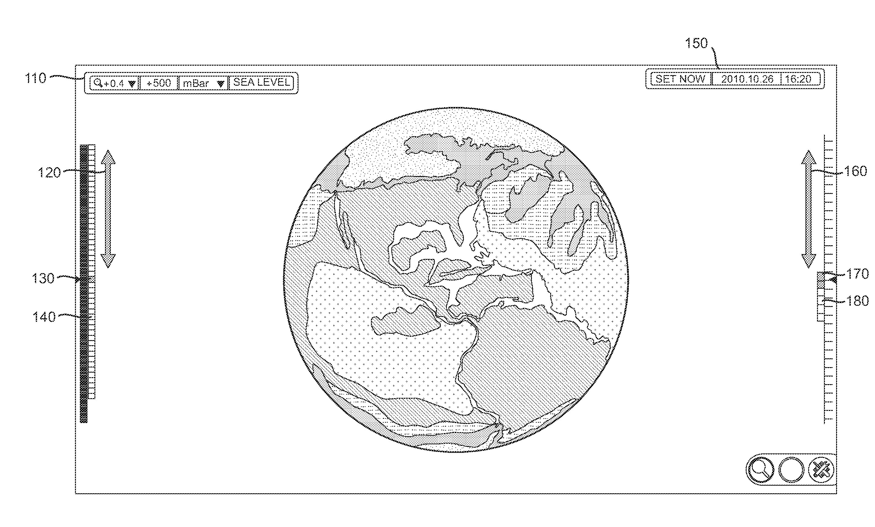
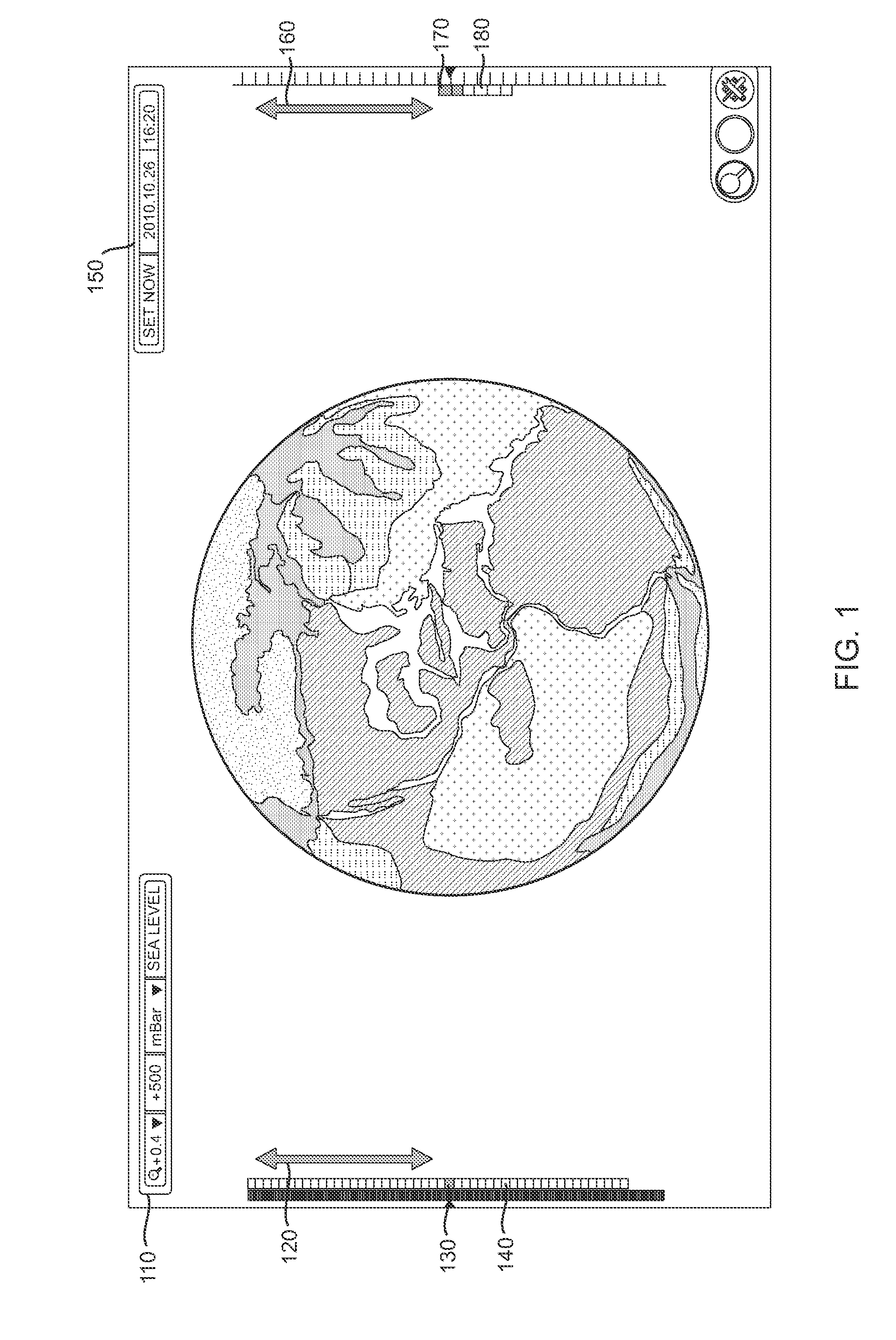
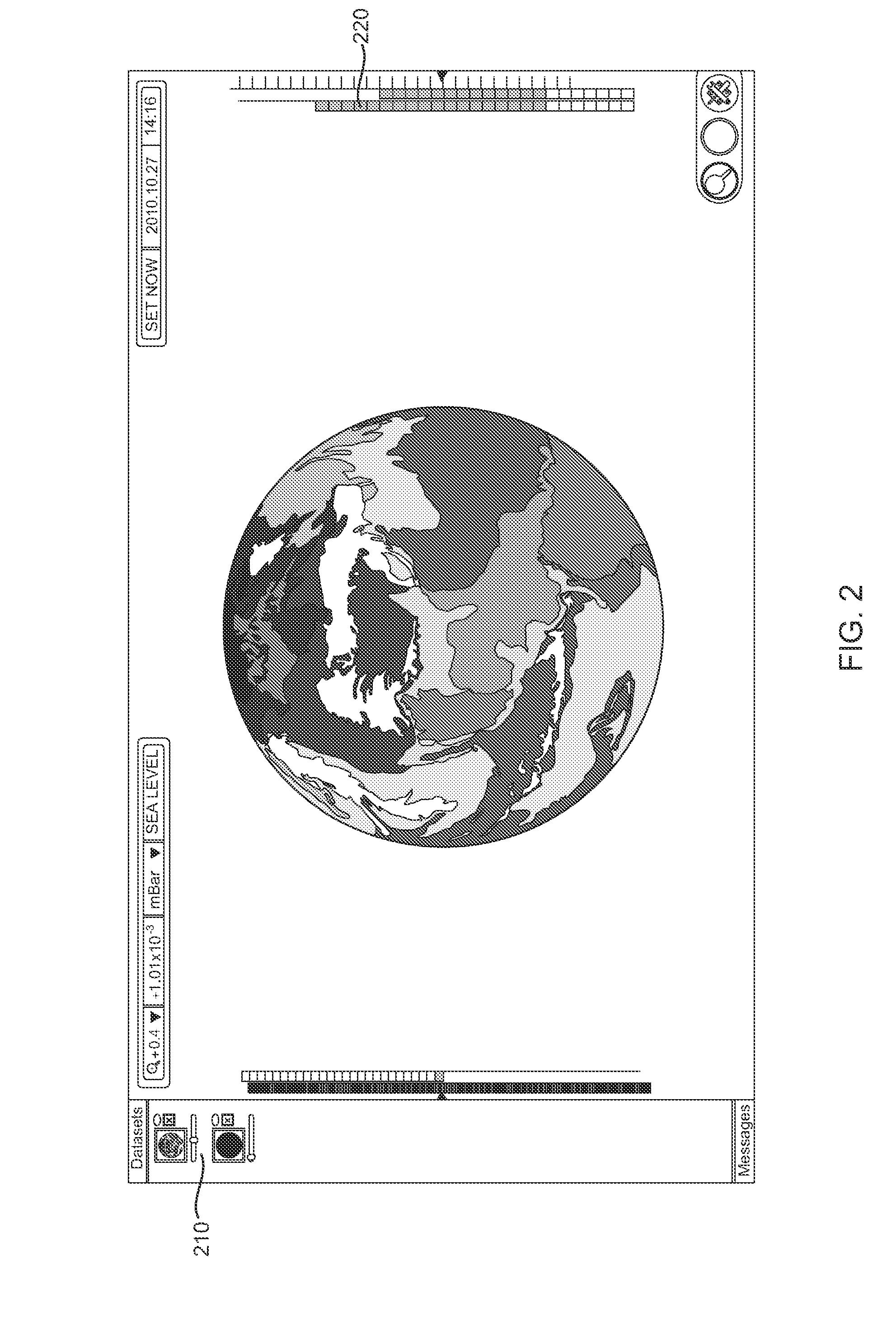
[0028]FIG. 11 is a simplified block diagram illustrating the basic components of the present invention. Referring to FIG. 11, data from a number of sources 1110-1150 may be collected and sent via networks 1160 (satellite links, internet, proprietary networks, and the like) to a server 1170 where such data may be stored and processed. In cases that do not involve additional processing of the data, metadata may be collected and stored on server 1170. The actual data is retained on sources 1110-1150. The client connects server 1170 asking what data is available and then makes a direct connection to data sources 1110-1150 for actual data.

[0029]Data sources may include but are not limited to Satellite data (e.g., Satellite weather data) 1110, Buoy data 1120 (e.g., wind direction and speed, temperature, barometric pressure, water temperature, and the like), Weather Station data 1130 (e.g., wind direction and speed, temperature, barometric pressure, doppler radar data, and the like), Cloud...


PUM


Abstract

A high performance real-time interactive exploration and visualization tool brings massive amounts of 4-D data, including output from multiple environmental forecast models as well as different data from different observations, in one place. Server side architecture provides a real-time stream processing system utilizing server-based Graphical Processing Units (GPU's) for data processing, wavelet based compression, and other preparation techniques for visualization, to minimize the bandwidth and latency for data delivery to end-users. Client side users interact through the visualization application developed using the Unity game engine and takes advantage of the GPU's allowing a user to interact with large data sets in real time. The invention improves accessibility to ‘Big Data’ and provides tools allowing novel visualization and seamless integration of data across time and space regardless of data size, physical location, or data format, allowing a user to see the global interactions and their importance for environmental prediction.

Description

CROSS-REFERENCE TO RELATED APPLICATIONS[0001]The present application claims priority from Provisional U.S. Patent Application No. 62 / 057,905 filed on Sep. 30, 2014, and incorporated herein by reference.STATEMENT OF GOVERNMENT INTEREST[0002]The research that led to the development of the present invention was sponsored by the National Oceanic and Atmospheric Administration. NOAA is a part of the U.S. Department of Commerce, a component of the U.S. Federal government. The United States Government has certain rights in this invention.FIELD OF THE INVENTION[0003]The present invention relates to an interactive user interface and display and supporting data ingest infrastructure for use in graphically displaying weather data in real time. In particular, the present invention is directed toward an interface which allows a user to visually interpret weather data both in terms of space and time.BACKGROUND OF THE INVENTION[0004]Predicting and forecasting weather and weather trends has been a ...

Claims


Application Information

Patent Timeline
IPC IPC(8): H04L29/08G06F3/0481G06T19/00
CPCH04L67/1002G06T2219/024G06T19/006G06F3/04815G06T19/00
Inventor HACKATHORN, ERICSTEWART, JEBBSMITH, JEFFLYNGE, JULIEN
Owner THE UNITED STATES OF AMERICA AS REPRESENTED BY THE SECRETARY OF THE COMMERCE
Why Eureka
Try Eureka