Coordinating Sensor Platforms Performing Persistent Surveillance

US20170199039A1Active Publication Date: 2017-07-13THE BOEING CO
2 Cites 3 Cited by

Patent Information

Authority / Receiving Office
US · United States
Current Assignee / Owner
Publication Date
2017-07-13

Smart Images

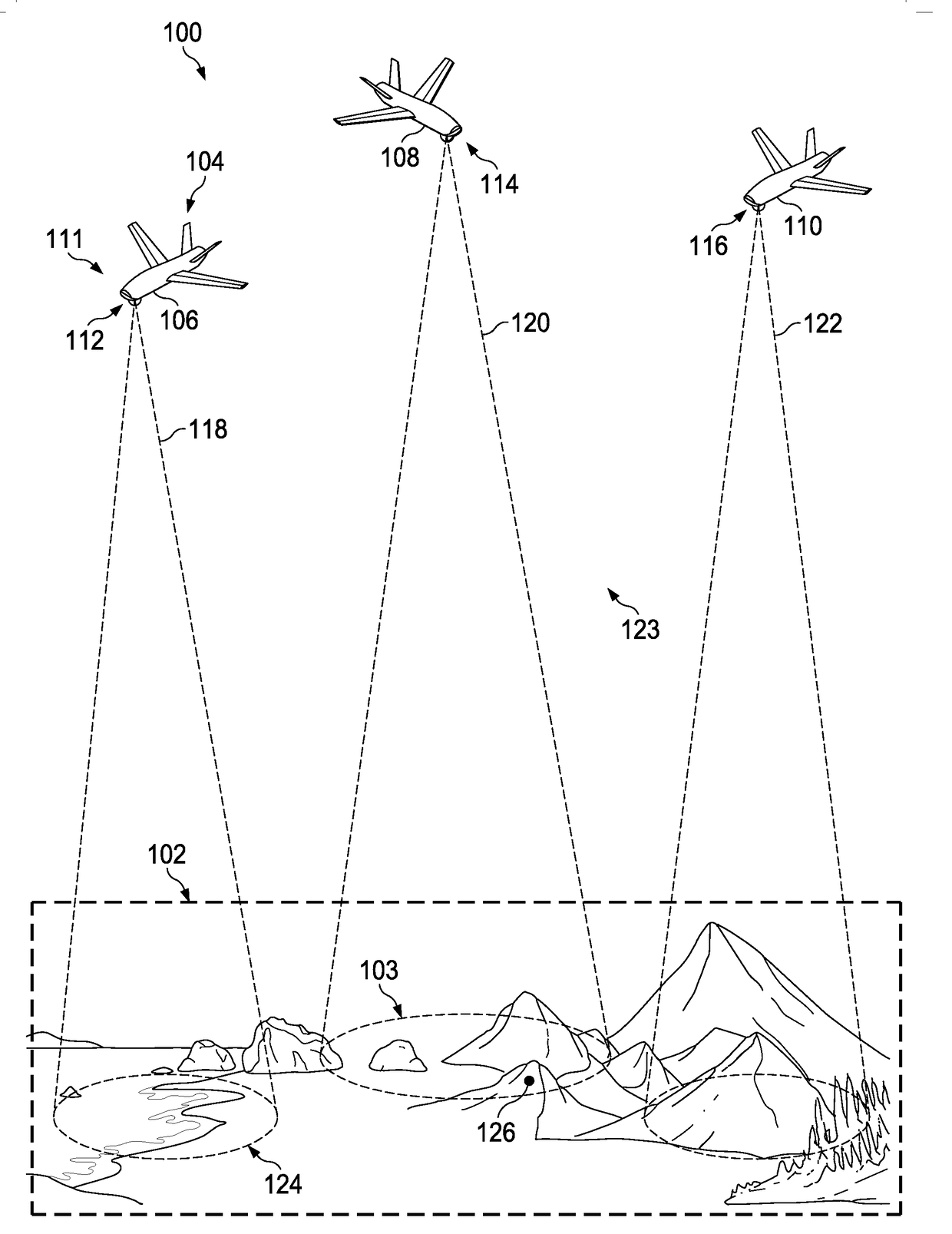
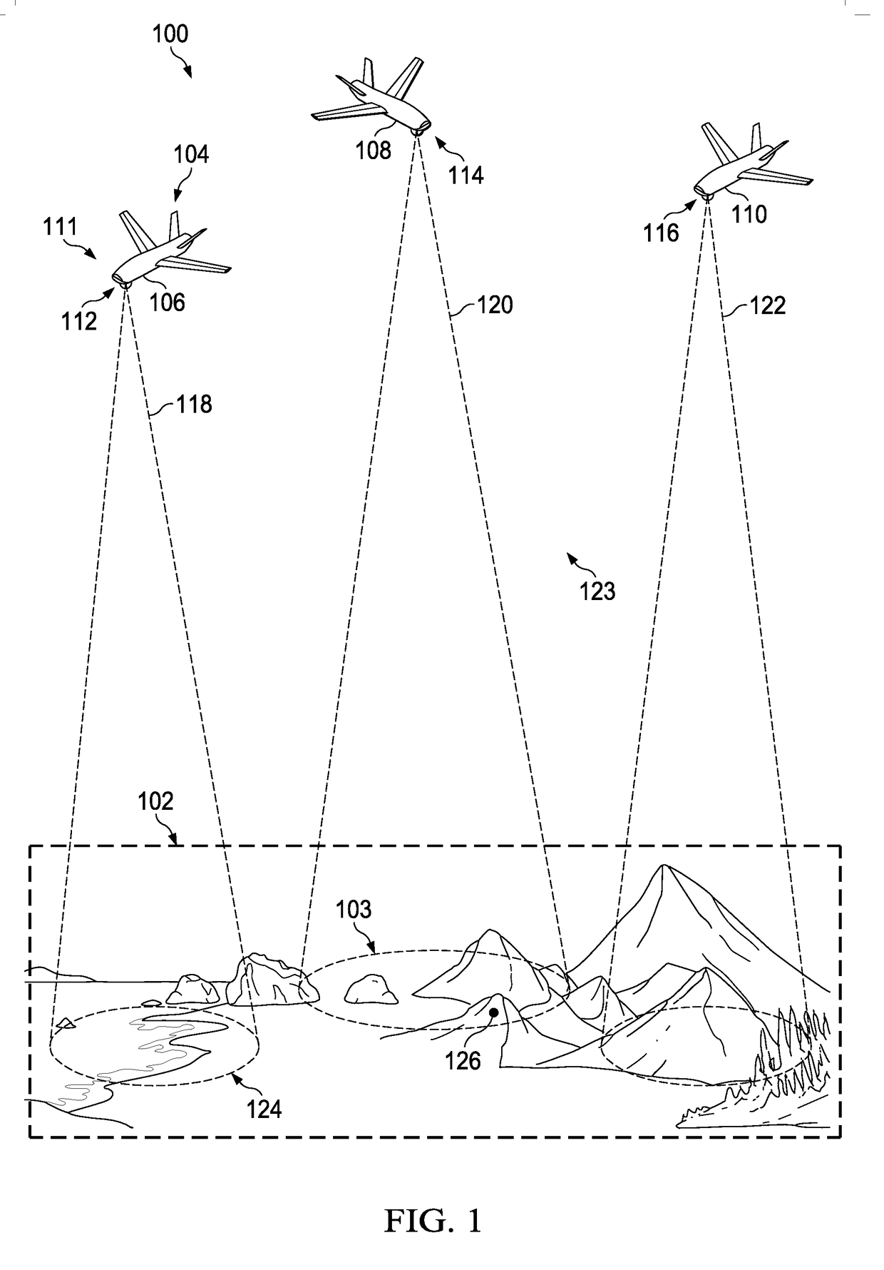
  • Figure 1
    Figure 1
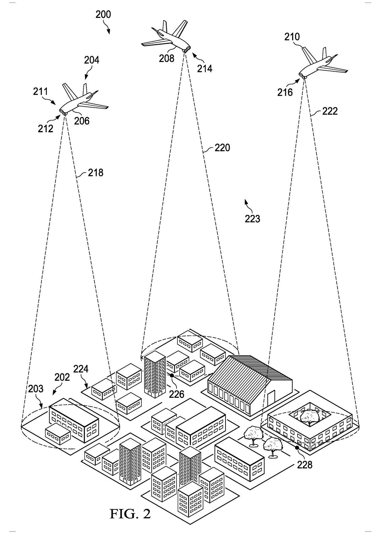
  • Figure 2
    Figure 2
  • Figure 3
    Figure 3
Patent Text Reader

Abstract

A method and apparatus for controlling a set of sensor platforms. The apparatus comprises a map manager and a controller. The manager creates a visibility map for an area of interest for a set of sensor platforms. The map manager further updates the visibility map over time while the set of sensor platforms monitors the area of interest. The controller controls a route of each of the set of sensor platforms using the visibility map.
Need to check novelty before this filing date? Find Prior Art

Description

BACKGROUND INFORMATION

[0001] 1. Field

[0002] The present disclosure relates generally to persistent surveillance. More particularly, the present disclosure relates to a method and apparatus for controlling the routing of a set of sensor platforms performing persistent surveillance of an area of interest using a dynamic visibility map of the area of interest.

[0003] 2. Background

[0004] Persistent surveillance is surveillance that is performed over an area of interest over a prolonged period of time. Persistent surveillance may also be referred to as persistent intelligence, surveillance, and reconnaissance (ISR). Persistent surveillance may be performed using different types of imaging systems. These imaging systems may be attached to platforms, such as unmanned aerial vehicles (UAVs).

[0005] For example, a group of unmanned aerial vehicles having attached imaging systems may be flown over an area of interest to monitor the area of interest for a selected period of time. The imaging system a...

Examples

Embodiment Construction

[0024]The illustrative embodiments recognize and take into account different considerations. For example, the illustrative embodiments recognize and take into account that it may be desirable to perform persistent surveillance in a manner that maintains a maximal line-of-sight from sensor platform to surface for multiple sensor platforms. In particular, it may be desirable to have a method for coordinating these sensor platforms in a manner that yields the highest collective visibility of an area of interest to the sensor platforms over time. Further, the illustrative embodiments recognize and take into account that it may be desirable to perform this type of coordination of the sensor platforms for a period of time that is indefinite or unknown.

[0025]Thus, the illustrative embodiments provide a method and apparatus for controlling a set of sensor platforms. In one illustrative example, a visibility map is created for an area of interest for the set of sensor platforms. The visibili...