Indexation of massive point cloud data for efficient visualization

US20200027248A1Active Publication Date: 2020-01-23MY VIRTUAL REALITY SOFTWARE
0 Cites 17 Cited by

Patent Information

Authority / Receiving Office
US · United States
Current Assignee / Owner
Publication Date
2020-01-23

Smart Images

  • Figure 1
    Figure 1
  • Figure 2
    Figure 2
  • Figure 3
    Figure 3
Patent Text Reader

Abstract

A method for pre-processing point clouds comprising large amounts of point data. The method comprises converting the points' coordinates to Morton indices, sorting the Morton indices and sequentially determining intervals based on predefined criteria, which intervals define the leaf nodes and form the basis and starting point for the generation of a tree index structure comprising the leaf nodes, nodes, branches and nodes connecting the branches. Point data contained within a node or sub-trees of a node are quantizable.
Need to check novelty before this filing date? Find Prior Art

Description

CROSS-REFERENCE TO RELATED APPLICATIONS

[0001] This application claims priority to European Patent Application No. 18176796.3, filed on Jun. 8, 2018. The foregoing patent application are incorporated herein by reference.FIELD OF INVENTION

[0002] A method for pre-processing point clouds comprising large amounts of point data.BACKGROUND

[0003] The method for pre-processing point clouds including large amounts of point data generally comprises converting the points' coordinates to Morton indices, sorting the Morton indices and determining, based on predefined criteria, intervals by a walk through (sequential scan) of the sorted array of Morton indices. The resulting intervals define the leaf nodes and form the basis and starting point for a subsequent generation of a tree index structure comprising the leaf nodes, nodes, branches and nodes connecting the branches (branch nodes). Point data contained within nodes and / or sub-trees of a node can be quantized, allowing for lossy or lossless comp...

Examples

Embodiment Construction

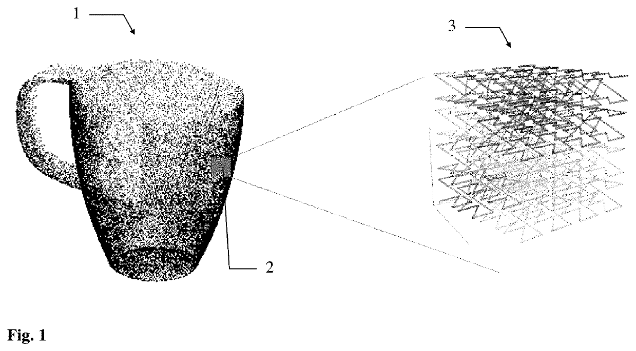
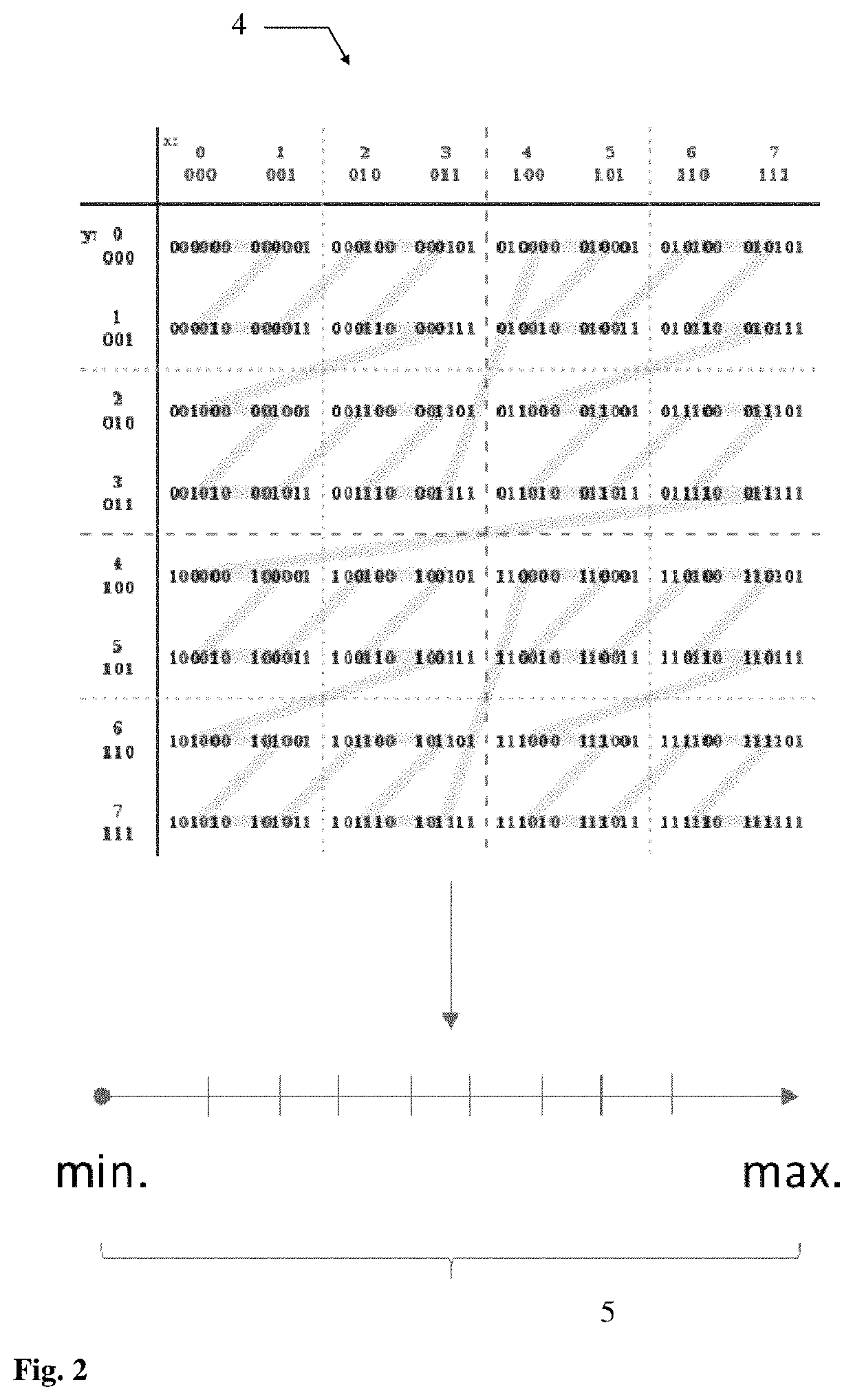
[0070]FIG. 1 shows a point cloud representation of a 3D object as it could result from scanning with a LIDAR system. The point cloud 1 is composed of a plurality of points. The points are stored with their corresponding x, y and z coordinates and depending on the LIDAR system used also with associated intensity and colour e.g. RGB values. As schematically illustrated the point density varies throughout the object. The square area in the point cloud illustrates a processing bucket 2. The point data contained within the processing bucket do not show any data dependency to surrounding point data. Therefore, the point data within the processing bucket can be processed by the method according to the invention in parallel to point data contained within a plurality of other processing buckets (not shown in FIG. 1). According to the invention the point coordinates of the corresponding points are then converted to Morton indices by bitwise interleaving of the binary coordinate values. Here a...