
Fusion between aoa and tdoa

a technology of fusion and navigation system, applied in direction finders, instruments, using reradiation, etc., can solve the problems of missile veering off course over time and distance, increasing the possibility of missed targets, and single projectile losing access to part of the navigation system

Active Publication Date: 2020-07-16
BAE SYST INFORMATION & ELECTRONICS SYST INTERGRATION INC
View PDF0 Cites 7 Cited by
  • Summary
  • Abstract
  • Description
  • Claims
  • Application Information

AI Technical Summary

Benefits of technology

The patent text describes a new navigation system for missiles that can increase their accuracy and hit a target that is off-center from the original emitter. This system can use GPS or other navigation aids to help with accuracy, and can even work in environments where those aids are not available. Multiple projectiles can also communicate with each other and work together to reach a common target at the same time. Overall, this patent aims to improve the accuracy and reliability of missile navigation systems.

Problems solved by technology

The present systems allow for a single projectile or missile to be fired at a single target which increases the potential for a missed target strike such that a minor error or miscalculation in geolocation, flight path, flight speed, or targeting profile can cause a single missile to miss its target.
Further, when targets are mobile, the movement of the target can affect the flight path of the projectile such that the target may be able to maneuver away from or confuse a single missile or single projectile again causing a missed target strike.
Additionally, some targets employ active navigation countermeasures, such as global positioning system (GPS) denial, in an area surrounding the target which can cause a single projectile to lose access to part of its navigation system, i.e., GPS.
In these instances, these projectiles fall back to unaided inertial navigational systems using equipment such as accelerometers and gyroscopes which are prone to drift, causing the missile to veer off course over time and distance.
The larger the area of GPS denial surrounding a target, the further off course a projectile can drift, again potentially resulting in a missed target strike.
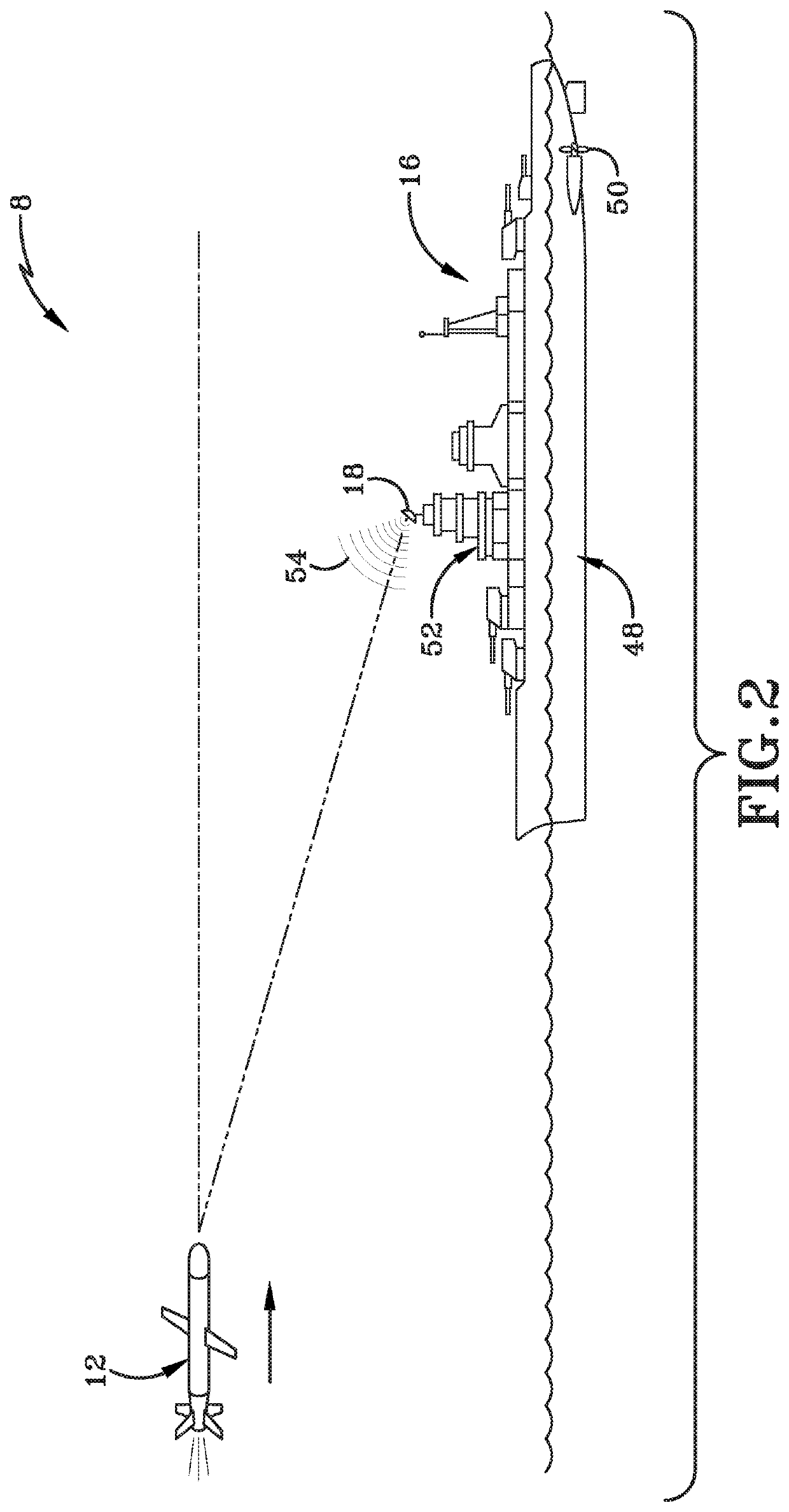
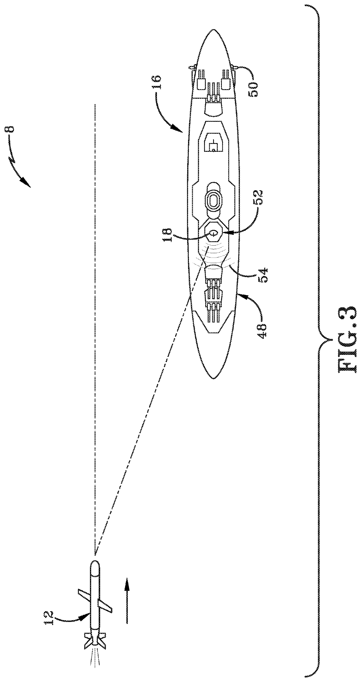
Using one example, when the target is a ship at sea, the emitter may be located at the top of a communications tower and striking the emitter with a projectile may destroy or hamper communications or detection systems of the target, but may not disable the target or its offensive or defensive capabilities.
Accordingly, issues continue to exist relating to accuracy of missile navigation systems, specifically hitting a location on a target that is offset from the geolocated target emitter and operating in a GPS (or other navigation aid) denied environments.

Method used


Image

  • Fusion between aoa and tdoa
  • Fusion between aoa and tdoa
  • Fusion between aoa and tdoa

Examples


Embodiment Construction

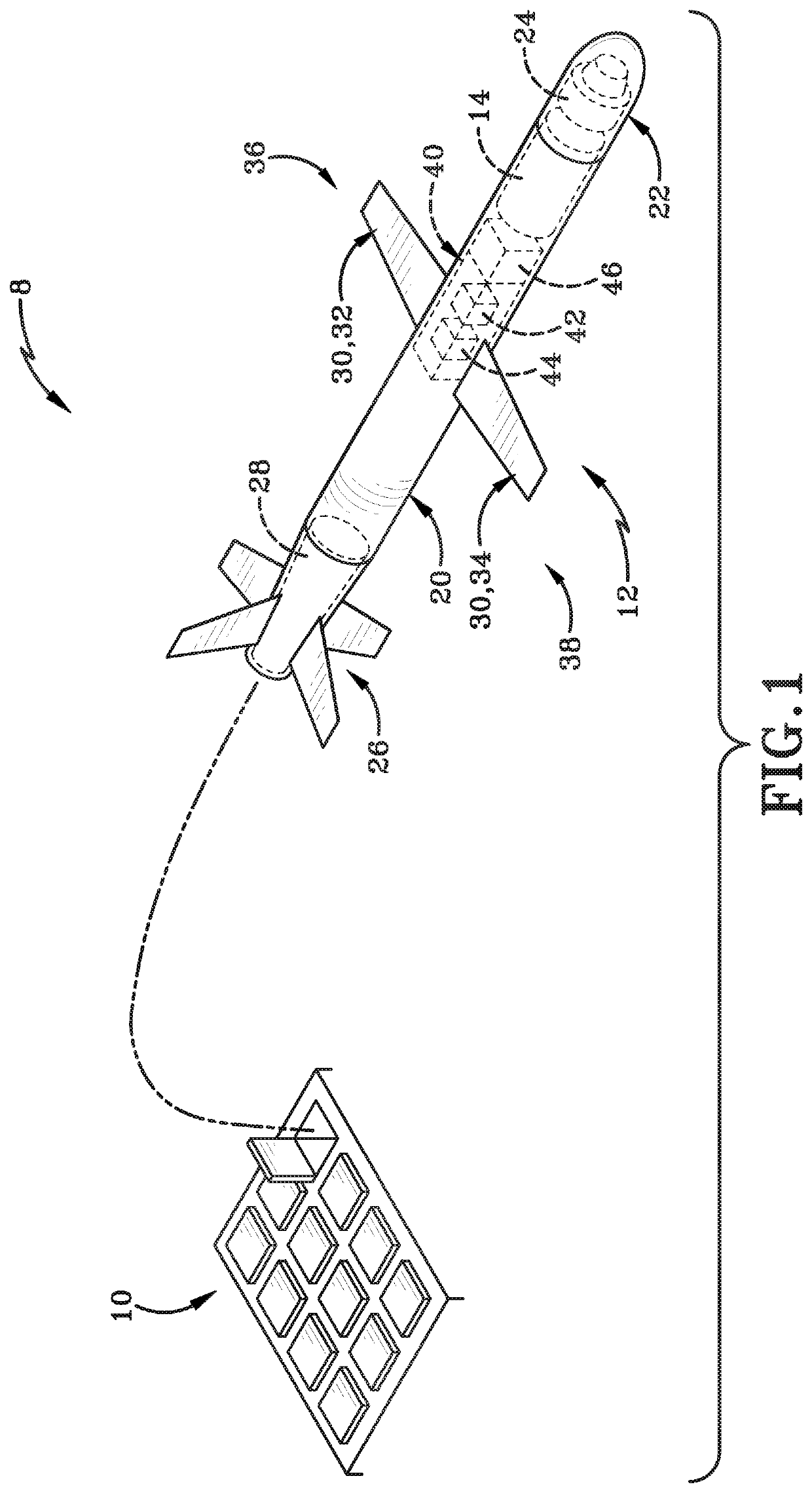
[0021]A navigation system 8 for a guided projectile is shown and provided herein. As discussed further herein, a guided projectile can be a missile or cruise missile, such as a long-range anti-ship missile (LRASM). It will be understood that the navigation system provided herein may be applied to other guided munitions or projectiles, aircraft, both manned or unmanned, or other systems utilizing navigational aids. As further described herein, navigation system 8 relates to targeting of enemy vehicles, aircraft, ships, and / or stationary installations. It will be further understood that the targets described herein may be mobile or stationary and may be known or unknown as further discussed below.

[0022]Current navigation systems used with cruise missiles generally rely on radar pulses or radio frequency pulses from an emitter on a target. The general location of the target may be determined by a firing platform of a missile prior to firing. In such implementations, target data may be ...


PUM


Abstract

A navigation system for a swarm of guided projectiles, such as cruise missiles, having three or more projectiles launched at a target is provided. The projectiles can be in secure communication with one another and can operate as a single swarm using a fusion of angle of arrival and time difference of arrival of a detected signal to direct the projectiles to a point of impact on a target that is offset from an emitter generating the detected signal. The projectiles can further use knowledge of their relative position to maintain and / or adjust their flight path and / or speed to maintain their course to the point of impact in areas of GPS denial or unavailability.

Description

BACKGROUNDTechnical Field[0001]The present disclosure relates generally to navigation systems for guided projectiles. More particularly, the present disclosure relates to an enhanced navigation system for cruise missiles that can geolocate a target and adjust the flight path of a missile according to the geolocation and estimated target movements. Specifically, the navigation system can continuously geolocate a target and can share that information across multiple projectiles fired simultaneously at a common target.Background Information[0002]Current navigation systems, particularly those used with guided munitions such as a cruise missile, allow a projectile to be fired against a target and guided to that target using the geolocation of an emitter collocated with that target. Presently, guided munitions include an antenna or a sensor array that can detect emitter pulses, and a processor that can use the detected pulses to calculate an angle off of the nose (azimuth) and an angle up...

Claims


Application Information

Patent Timeline
IPC IPC(8): G01S5/02
CPCG01S5/0294G01S5/0268G01S3/48G01S5/0072G01S5/06G01S5/12G01S2205/07G01S5/0264F42B15/01G01S13/4454G01S13/4445F41G7/2253F41G7/2286F41G7/2233F41G7/346
Inventor SLOCUM, DEAN C.
Owner BAE SYST INFORMATION & ELECTRONICS SYST INTERGRATION INC
Learn More