Downloading geographical data to a mobile station and displaying a map

a mobile station and map technology, applied in vehicle position indication, navigation instruments, instruments, etc., can solve the problems of inability to load comprehensive world dates, high cost, and inaccessibility of internet connections for loading, and achieve the effects of low cost, low cost and small siz

Inactive Publication Date: 2005-02-08
SAKARYA TASKIN
View PDF4 Cites 321 Cited by
  • Summary
  • Abstract
  • Description
  • Claims
  • Application Information

AI Technical Summary

Benefits of technology

It is an object of the present invention to provide a mobile station, a corresponding mobile communication network system, and a method of operation within this system, which provides the necessary geographical related base data in a suitable form at the mobile station with low costs, low and small size. It is a further object to combine GPS and other mobile based localisation means with mobile communication network system in such a way that loading and handling of the localisation data and local area information data are done in a very efficient way.

Problems solved by technology

Some map information is provided by data storage means, for example CD-ROMs, or can be downloaded from a database, for example via internet The problem arises that the map and other data loading via a Compact Disk (CD) is extensive and bulky, internet connections for loading are not everywhere available and are expensive since overall loading time is enormous, and loading of comprehensive world date is impossible due to storage or memory capacity limitations.
For example the map data potentially necessary for the user of the mobile station either exceeds the capacity of presently available portable data storage means, such as plug-in cards, or results in large and heavy mobile station equipment

Method used


Image

  • Downloading geographical data to a mobile station and displaying a map
  • Downloading geographical data to a mobile station and displaying a map
  • Downloading geographical data to a mobile station and displaying a map

Examples


Embodiment Construction

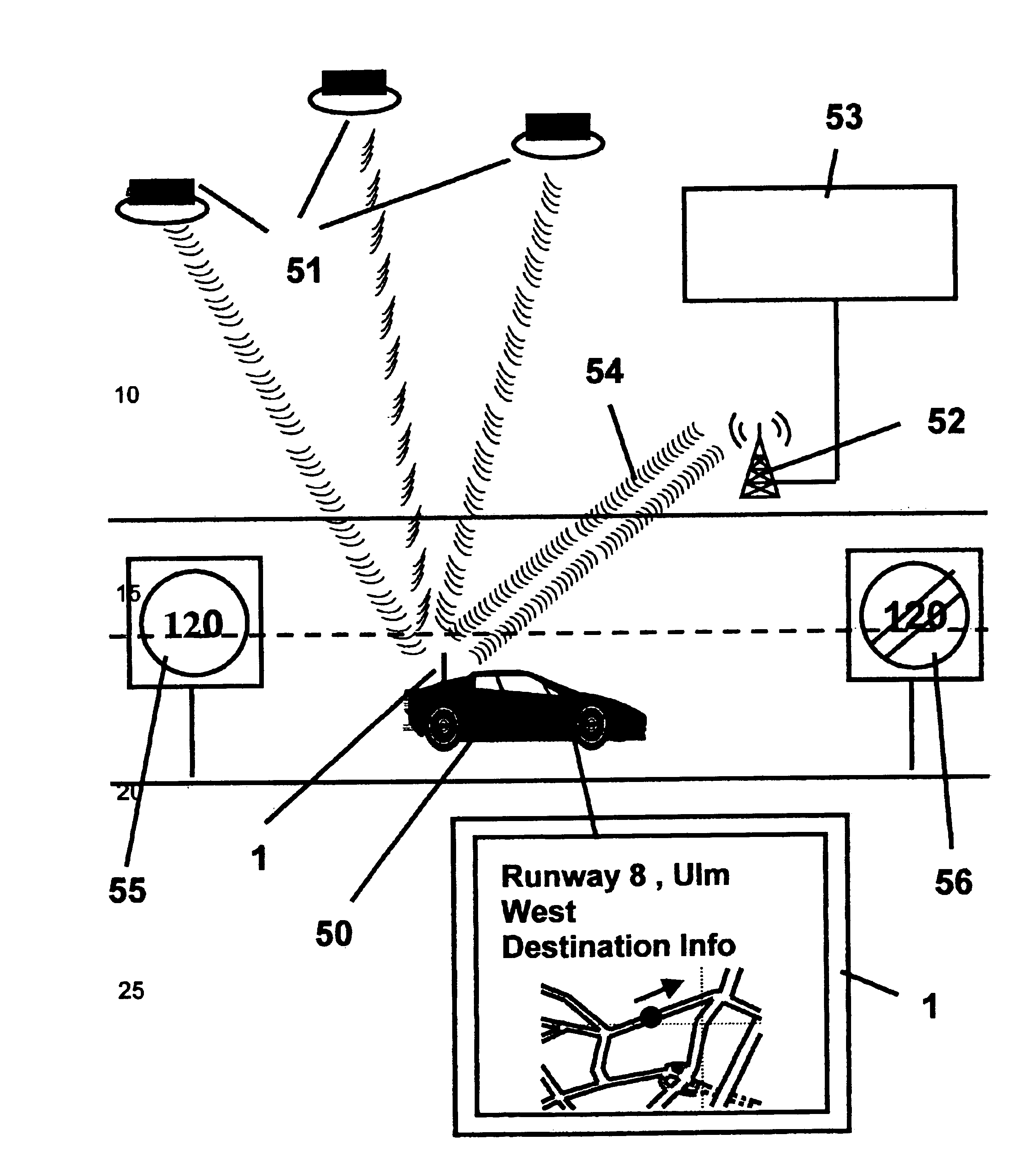
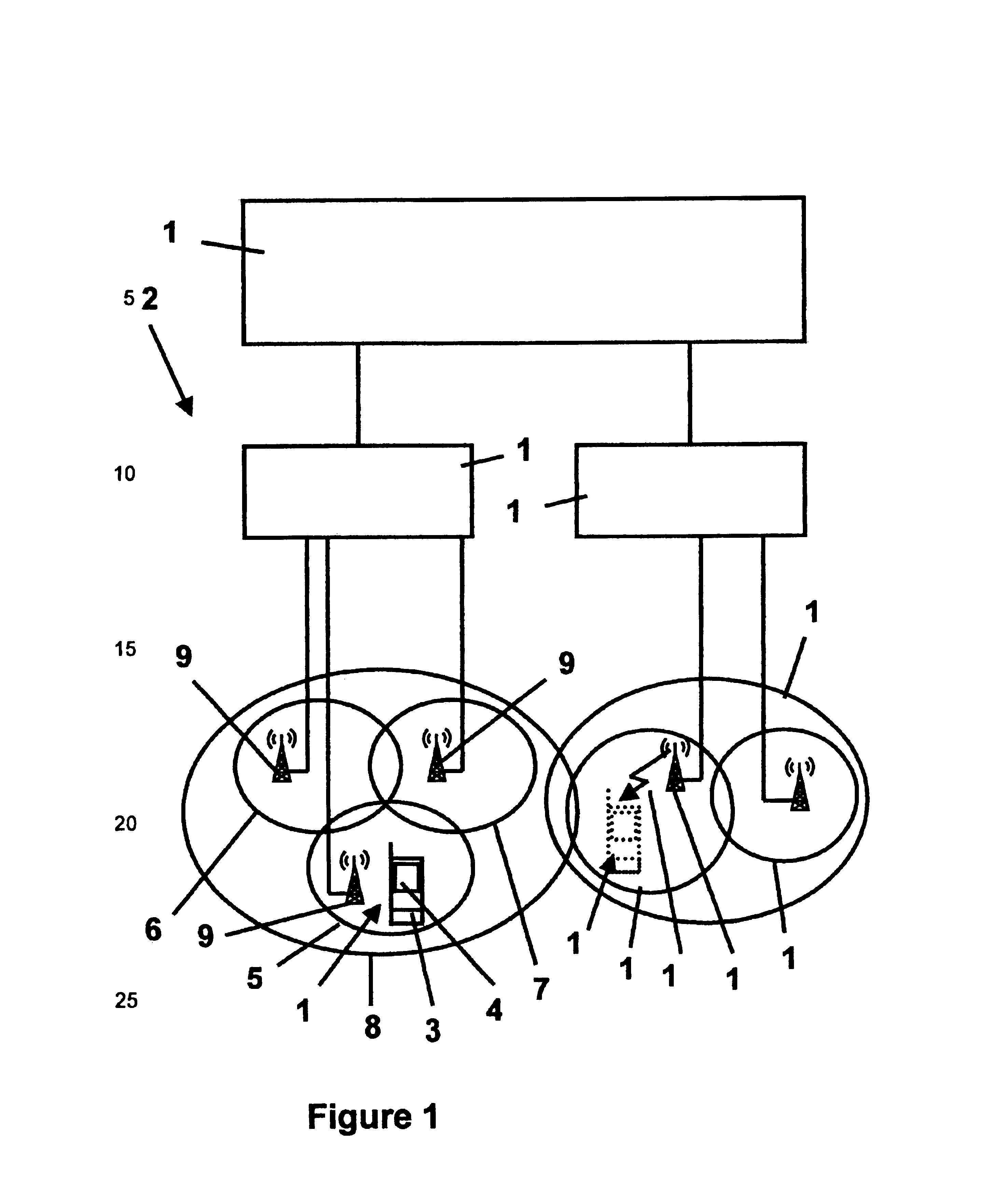
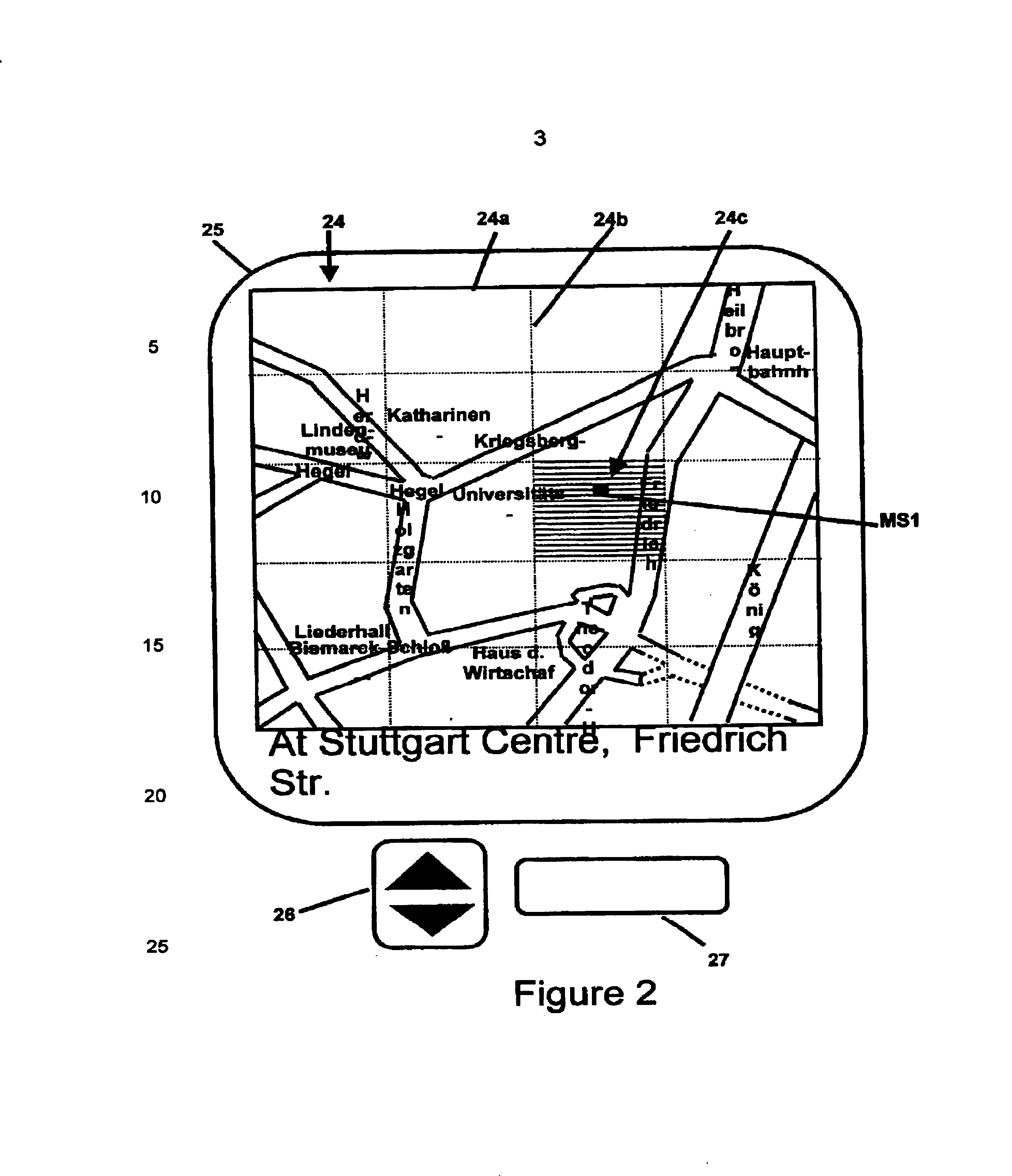
The invention relates in one embodiment to a mobile station of a mobile communication network system, said mobile station comprising a geographical position localising module for localising a geographical position of said mobile station, storage means, preferably a built-in or plugs in Integrated Circuit memory card, for storing geographical related base data, and display means for displaying geographical related base data as a map and / or a text string. The geographical related base data displayed on said display means has been at least partly provided by wireless transmission from said network system and is limited to a pre determinable extent depending on said geographical position of the mobile station. The geographical data has been at least partly provided, in particular in addition to already available data at the mobile station from previous loading, by a Network Broadcast Service, and / or by a Location Update Procedure, and / or by a Network Service Call.

For the geographical po...


PUM


Abstract

A mobile station (1) of a mobile communication network system (2), comprising a GPS/GSM or UMTS based geographical position localising module (3) for localising the geographical position (24c) of the mobile station, which has storage means for storing geographical related base data, and display means (4) for displaying geographical related base data as a map (24) or as a text string, is characterised in that the geographical related base data displayed has been at least partly provided by wireless transmission from the network system and is limited to a predetermined extent depending on the geographical position, travel modus and speed of the mobile station, and the mobile station itself calculates the geographical position which can be presented to others during call set-up or with SMS services and the mobile station can do routing using a navigational algorithm implemented in location finder module (31) of the mobile station.

Description

BACKGROUND OF THE INVENTION1. Field of the InventionA mobile station comprising a GPS and / or GSM / UMTS based localising nodule for displaying location dependent data and related information, a corresponding mobile communication network system, and a method of operation within this system.The present invention relates to a mobile station comprising a GPS and / or GSM / UMTS based localising module for displaying location dependent data, preferably Cell or Local Area dependent data, and related information, a corresponding mobile communication network system, and a method of operation within this system according to the preambles of the accompanying independent claims.2. Description of the Related ArtGeographical position localising methods and modules are known for example from the satellite based Geographical Positioning System (GPS) standard. They are used for example in navigation systems. Some map information is provided by data storage means, for example CD-ROMs, or can be downloaded...

Claims


Application Information

Patent Timeline
Patent Type & Authority Patents(United States)
IPC IPC(8): G01C21/32G01C21/28G08G1/0969H04Q7/22H04Q7/32G09B29/00H04W4/029G01C21/00G06F17/30G08G1/13G09B29/10H04W4/02H04W4/024H04W4/90H04W60/00H04W76/50H04W88/02H04W88/04
CPCG01C21/32H04W4/02G08G1/0969H04W88/02H04W60/00H04W88/04H04W76/50H04W4/90H04W4/029G01C21/3889H04W4/024
Inventor SAKARYA, TASKIN
Owner SAKARYA TASKIN
Why Eureka
Try Eureka