
System and method for providing directions

a technology of directions and systems, applied in the field of directions, can solve the problems of ineffective gps for directing people within a building, inability to provide directions, etc., and achieve the effect of being able to be updated regularly

Inactive Publication Date: 2006-04-25
GOOGLE LLC
View PDF10 Cites 168 Cited by
  • Summary
  • Abstract
  • Description
  • Claims
  • Application Information

AI Technical Summary

Benefits of technology

[0006]The present invention overcomes the foregoing and other problems with a system and method for directions. The present invention addresses the above problems because it can be readily updated to take into account floor plan modifications. Advantageously, the system operates independent of GPS, thereby providing operation in environments and under conditions in which satellite coverage is unavailable or is blocked by obstructions or shielding (e.g., in buildings, urban environments, next to large obstructions, etc.).
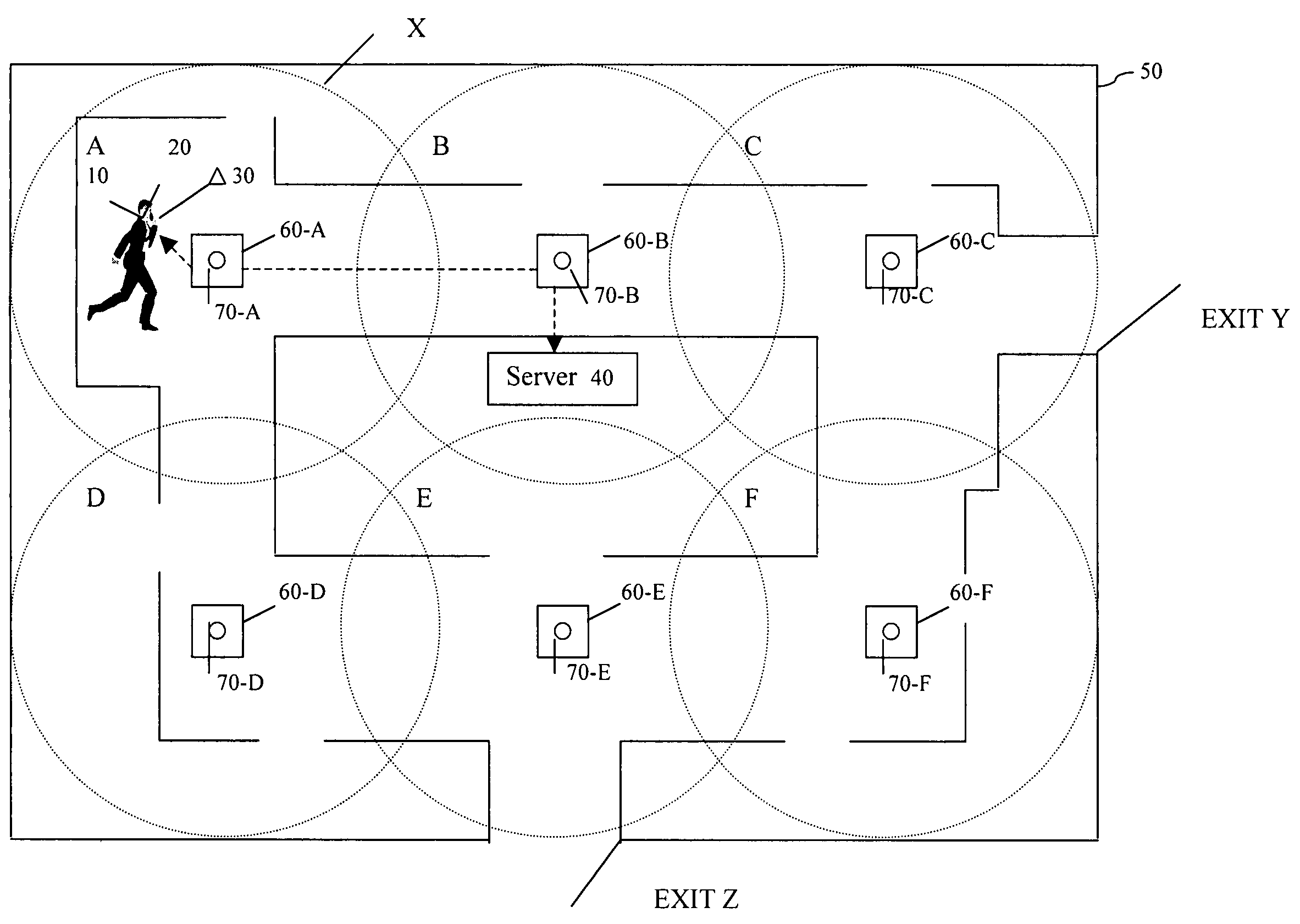
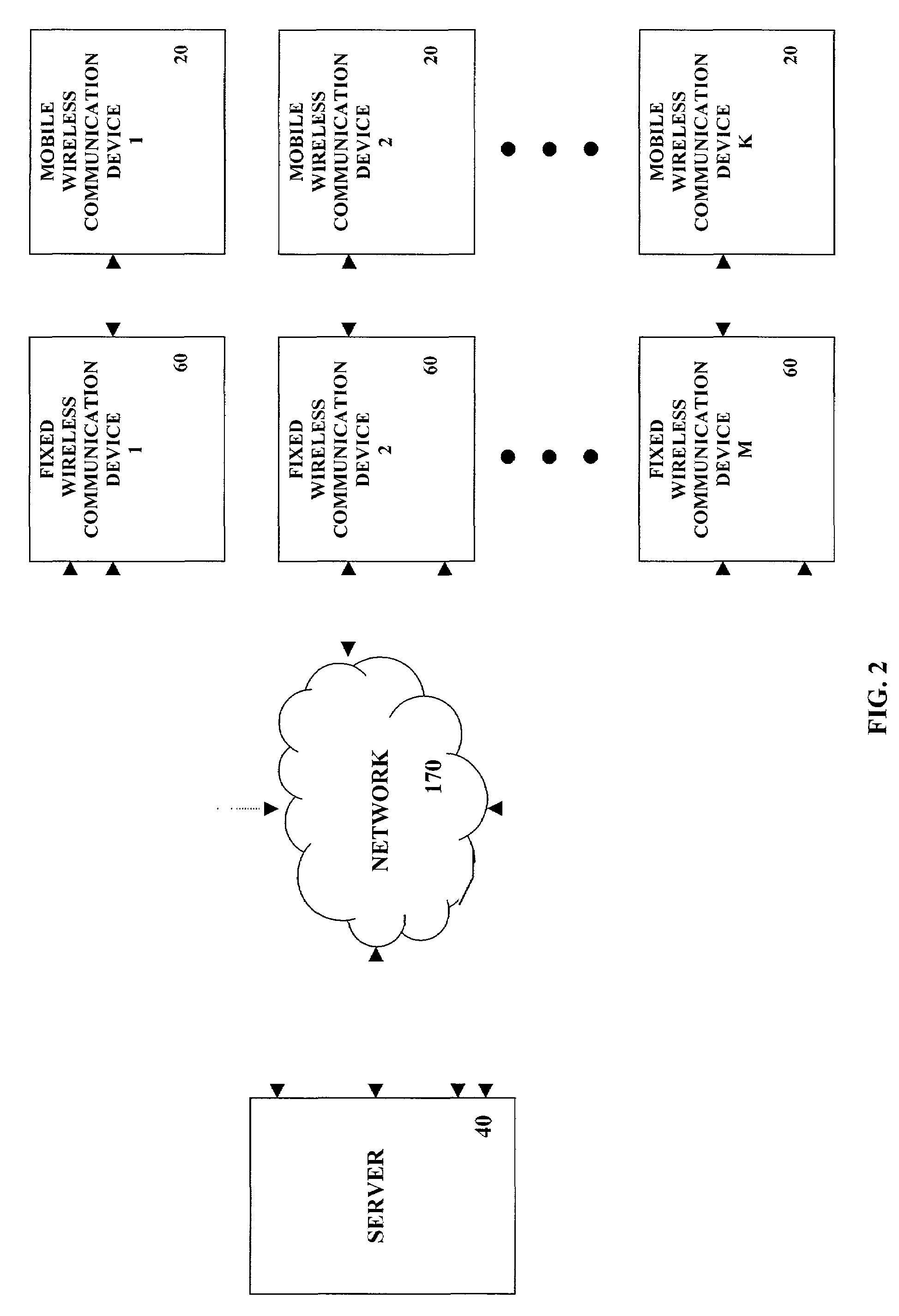
[0007]The current system and method addresses the above problems and provides valuable advantages because it enables a person equipped with a moveable or mobile wireless communication device to communicate with a server to obtain directional information on a small scale. Such devices are able to recognize and communicate with each other or with one or more computer networks and are equipped to send and receive information. For example, when a person desires to obtain directions to an “exit” in a building, a request can be made on the communication device. The request is transmitted to a server using the wireless communication device. The server has the ability to respond to the query. The answer is transmitted to the communication device. Depending on its capabilities, the mobile communication device can either display the answer, or verbalize the answer to the person.

Problems solved by technology

A map is typically used as an aid in finding directions from point A to point B. However, most people do not carry maps with them in their daily travels because they can be cumbersome.
Further, most people do not have maps detailing the internal particulars of buildings they enter.
Accordingly, GPS is ineffective for directing people within a building because its accuracy renders it ineffective for directing a person from point to point within and among levels of a building structure.
GPS based systems are also inadequate in buildings because the GPS satellite signal does not penetrate buildings.
In emergencies, the problems of the above, even if they were used, are compounded by such factors as panic, the cause of the emergency and its location, and the need to move people in an orderly fashion while not interfering with the efforts of persons responding to the emergency.

Method used


Image

  • System and method for providing directions
  • System and method for providing directions
  • System and method for providing directions

Examples


Embodiment Construction

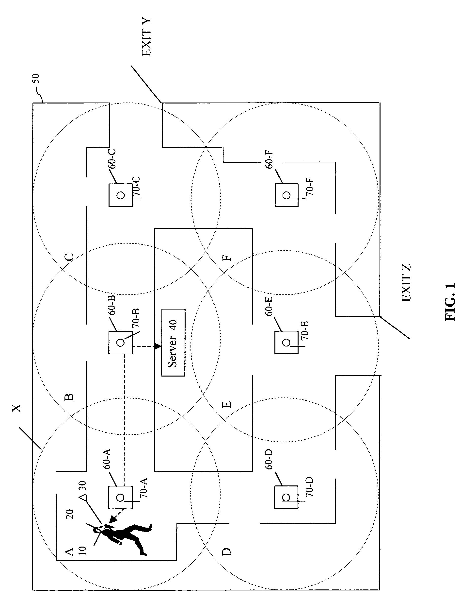
[0021]FIG. 1 illustrates a representative arrangement employing the principles of the invention. A user 10 has a communication device 20 which can be, for example, a mobile device such as a cellular phone, a personal digital assistant (PDA), portable palm computing device, a portable or laptop computer, an automotive embedded computer, computing means or the like. The mobile wireless communication device 20 is equipped with short-range wireless communication capability.

[0022]In one embodiment, the wireless technology used by the mobile wireless communication device 20 employs technology described in the “Specification of the Bluetooth System” available at www.bluetooth.com incorporated herein by reference. As shown, the Bluetooth technology is embedded in a Bluetooth chip 30 built in accordance with the specification. Bluetooth technology is a radio frequency specification for short-range, point-to-multipoint, point-to-point voice and data transfer. Software controls and identity co...


PUM


Abstract

A method for providing directions includes receiving at a server, from at least one fixed wireless communication device, information identifying a current location of a portable communication device. The portable communication device has short range wireless communication capability. The at least one fixed wireless communication device is located within a building. The method further includes identifying a direction of movement to be communicated to the portable communication device to direct it towards a destination within the building. The method also includes transmitting the direction of movement to the portable communication device from the server via a fixed wireless communication device.

Description

FIELD OF THE INVENTION[0001]The present system and method relates to providing directions using wireless devices.BACKGROUND OF THE INVENTION[0002]A map is typically used as an aid in finding directions from point A to point B. However, most people do not carry maps with them in their daily travels because they can be cumbersome. Further, most people do not have maps detailing the internal particulars of buildings they enter.[0003]A Global Positioning System (GPS) is a satellite system that transmits signals which, for civilian equipment, allows determination of a current location generally within an accuracy of + / −20 meters. Accordingly, GPS is ineffective for directing people within a building because its accuracy renders it ineffective for directing a person from point to point within and among levels of a building structure. GPS based systems are also inadequate in buildings because the GPS satellite signal does not penetrate buildings.[0004]In emergencies, the problems of the ab...

Claims


Application Information

Patent Timeline
IPC IPC(8): H04Q7/20
CPCG01S5/0247G01C21/20
Inventor MOSKOWITZ, PAUL ANDREWLEVAS, ANTHONYBOIES, STEPHEN J.DINKIN, SAMUELYU, PHILIP SHI-LUNG
Owner GOOGLE LLC
Learn More