System for processing digital map data

a digital map and data processing technology, applied in the field of system and method for processing digital map data, can solve the problems of cost and time-consuming computation, and achieve the effect of simplifying further processing

Active Publication Date: 2007-07-24
HARMAN BECKER AUTOMOTIVE SYST
View PDF7 Cites 24 Cited by
  • Summary
  • Abstract
  • Description
  • Claims
  • Application Information

AI Technical Summary

Problems solved by technology

When the starting point and desired destination are far from each other, route determination may require accessing and processing large amounts of data, resulting in costly and time consuming computations.

Method used


Image

  • System for processing digital map data
  • System for processing digital map data
  • System for processing digital map data

Examples


Embodiment Construction

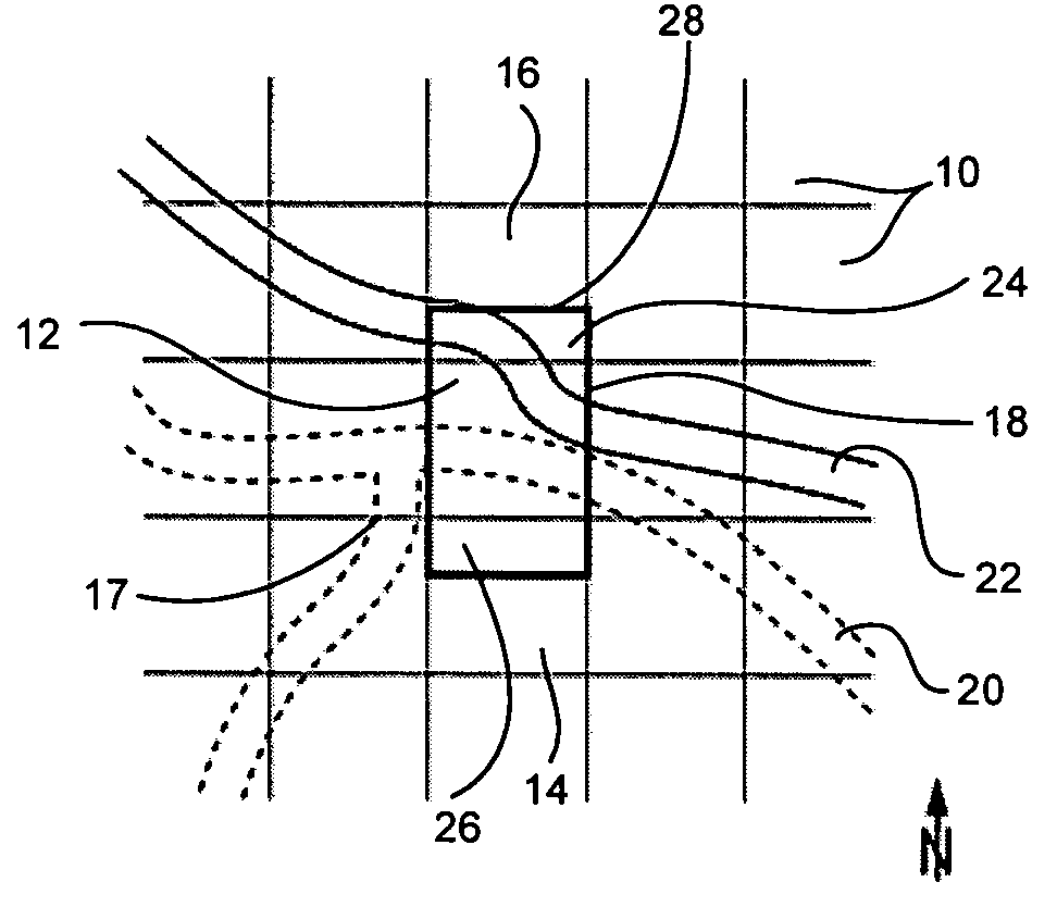
[0019]This application relates to a system for processing digital map data. In particular, this application relates to a system for processing digital map data for route determination and determining a route between two points. The system includes methods for processing digital map data for route determination and for determining a route between two points.

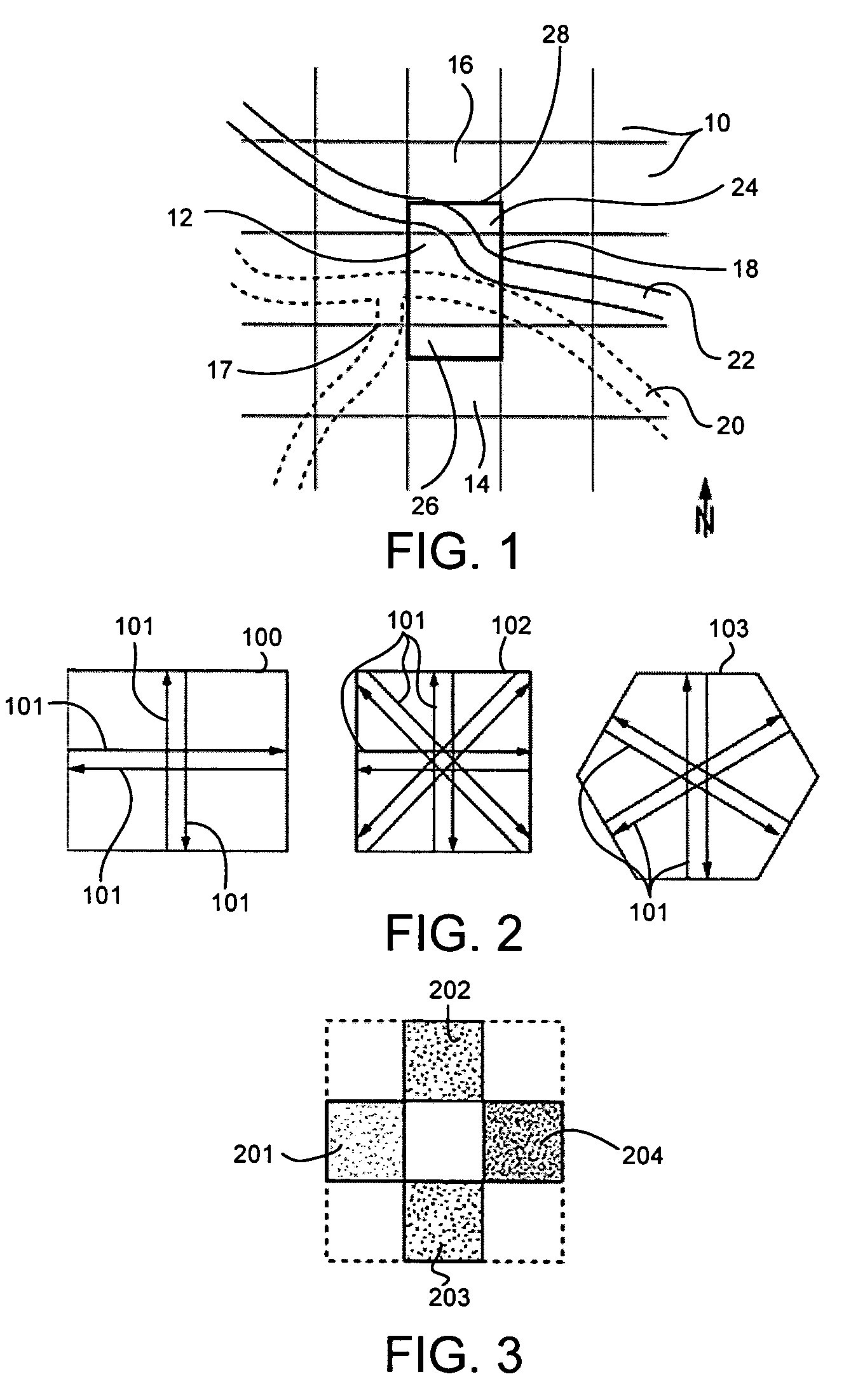
[0020]Digital map data may include map data representing a region that is divided into a plurality of zones. A cost value may be assigned to each zone based on predetermined cost criterion. A cost value may be a numerical value that represents some aspect related to traveling through the zone. For example, a cost value may represent the amount of estimated time it should take to travel through the zone. A cost value may also represent the distance that may be required to pass through the zone. In another example, the cost value may be related to the amount of tolls that must be paid to pass through the zone. Each of these criteria...


PUM


Abstract

A method for processing digital map data for route determination is provided that includes dividing a region into a plurality of zones, and for the zones, automatically determining at least one cost value for at least one direction of travel of the zone based on the digital map data of the zone and a predetermined cost criterion. A method for determining a route between two points is provided that includes dividing a region into a plurality of zones, for the zones, automatically determining at least one cost value for at least one direction of travel of the zone based on the digital map data of the zone and a predetermined cost criterion, and automatically determining at least one sequence of zones connecting the two points, where each zone of the sequence may be adjacent to another zone of the sequence, such that the sum of the cost values of the zones of the sequence may be optimized.

Description

PRIORITY CLAIM[0001]This application claims the benefit of European Patent Application No. EP 03 017 898.2, filed Aug. 5, 2003, which is hereby incorporated by reference herein in its entirety.BACKGROUND OF THE INVENTION[0002]1. Technical Field[0003]This application relates to a system and method for processing digital map data. In particular, this application relates to a system and method for processing digital map data for route determination and determining a route between two points.[0004]2. Related Art[0005]Navigation systems have uses in may different areas that provide a user with information on how to reach a predetermined destination starting from a predetermined starting point. For example, navigation systems are implemented in handheld navigation devices. In addition, vehicles of all types, including land and marine vehicles, are increasingly equipped with navigation systems.[0006]In a vehicle, a navigation system may assist the driver by providing driving instructions t...

Claims


Application Information

Patent Timeline
Patent Type & Authority Patents(United States)
IPC IPC(8): G08G1/123G09B29/00G01C21/00G01C21/34G06T17/05G08G1/0968G08G1/0969
CPCG01C21/3446G08G1/0968
Inventor GELHAR, JENSLUSSEN, HARALDNAGEL, PHILIPP HARALD
Owner HARMAN BECKER AUTOMOTIVE SYST
Why Eureka
Try Eureka