

Display method and apparatus for navigation system for performing cluster search of objects
a navigation system and object technology, applied in navigation instruments, maps/plans/charts, instruments, etc., can solve the problem of users not being able to easily tell whether a particular type of pois is suitable for us
- Summary
- Abstract
- Description
- Claims
- Application Information
AI Technical Summary
Benefits of technology
Problems solved by technology
Method used
Image

Examples
Embodiment Construction
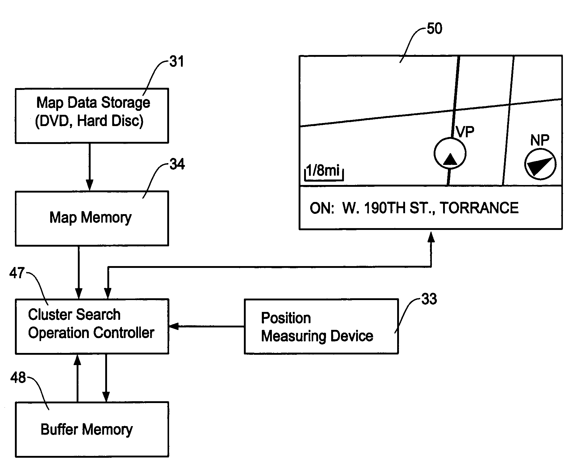
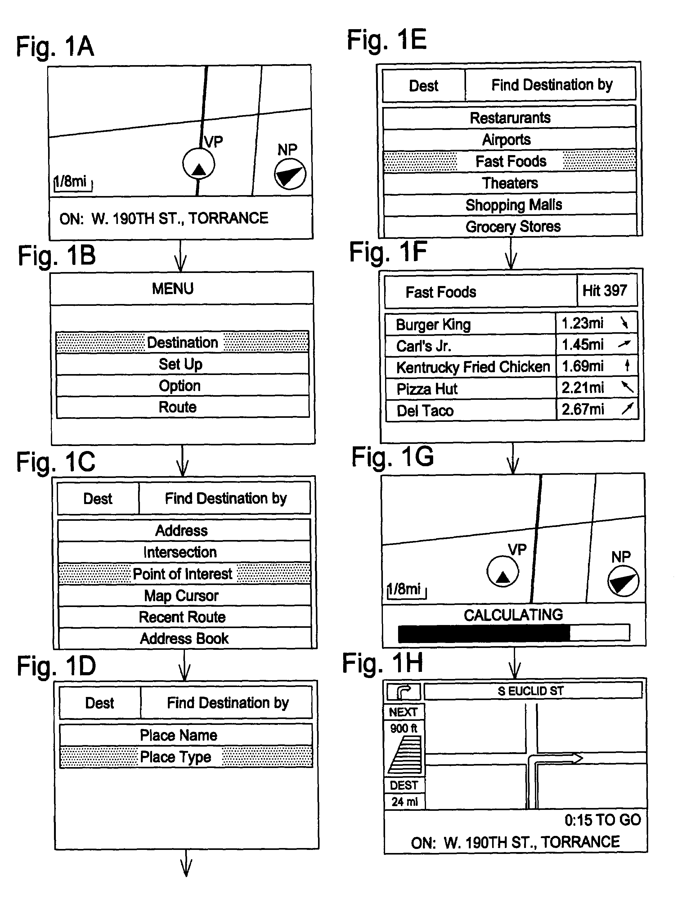
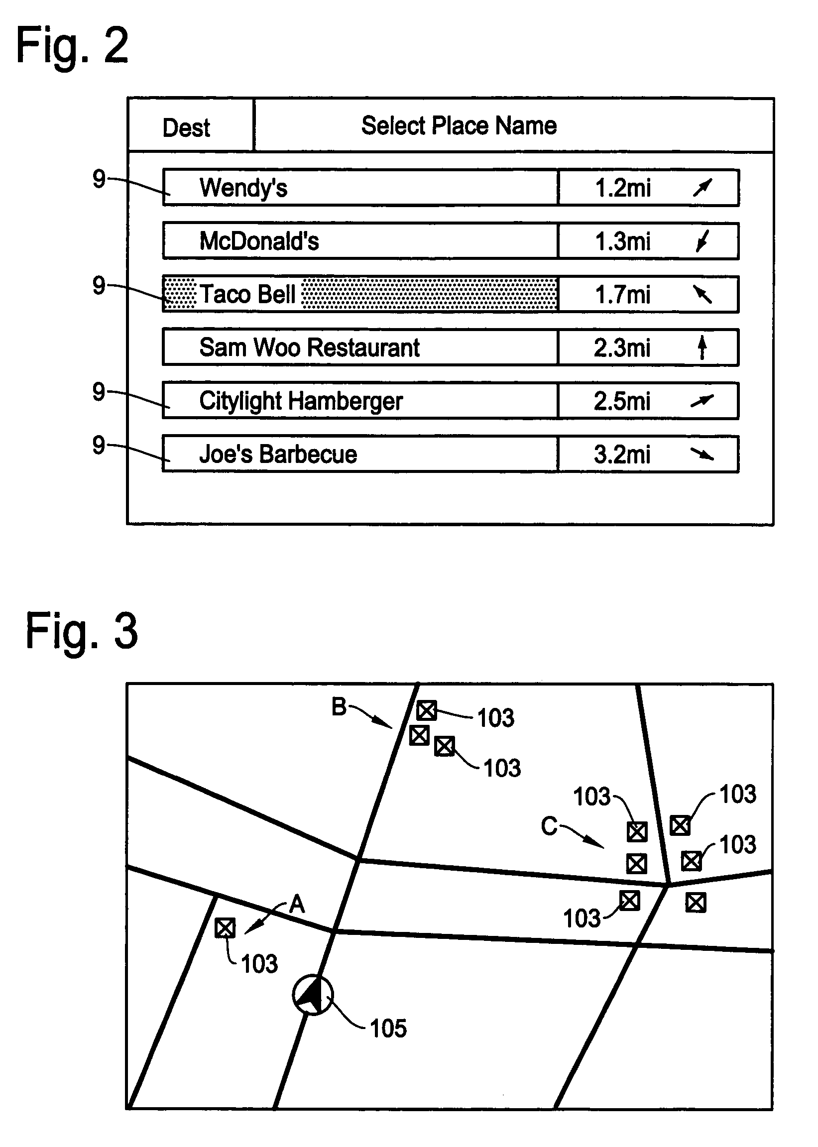
[0041]The present invention will be described in detail with reference to the accompanying drawings. The navigation system of the present invention is designed to conduct a data search for finding relative density of objects such as points of interest (POI) in a specified area and displays the result of the search in various manners. Within the context of this invention, such a data search is referred to as a “cluster search” and a specified area for the cluster search is referred to as a “search area”.
[0042]The cluster search method and apparatus of the present invention detects the relative density of objects within the search area. As noted above, a typical example of the objects is points of interest (POI) which are place names and place types contained in the map data of a navigation system which are similar to those listed in a telephone yellow book. It should be noted that the present invention can also be applied to other objects such as intersections, etc., although the pre...
PUM
 Abstract
Description
Claims
Application Information