Surface configuration measuring method and surface configuration measuring system
a surface configuration and measuring method technology, applied in the field of measuring methods and measuring systems, can solve the problems of increasing work and insufficientness, affecting the accuracy of cross-sectional profiles, and inability to accurately represent actual conditions on the elevation of stakes, so as to reduce the working load
- Summary
- Abstract
- Description
- Claims
- Application Information
AI Technical Summary
Benefits of technology
Problems solved by technology
Method used
Image
Examples
first embodiment
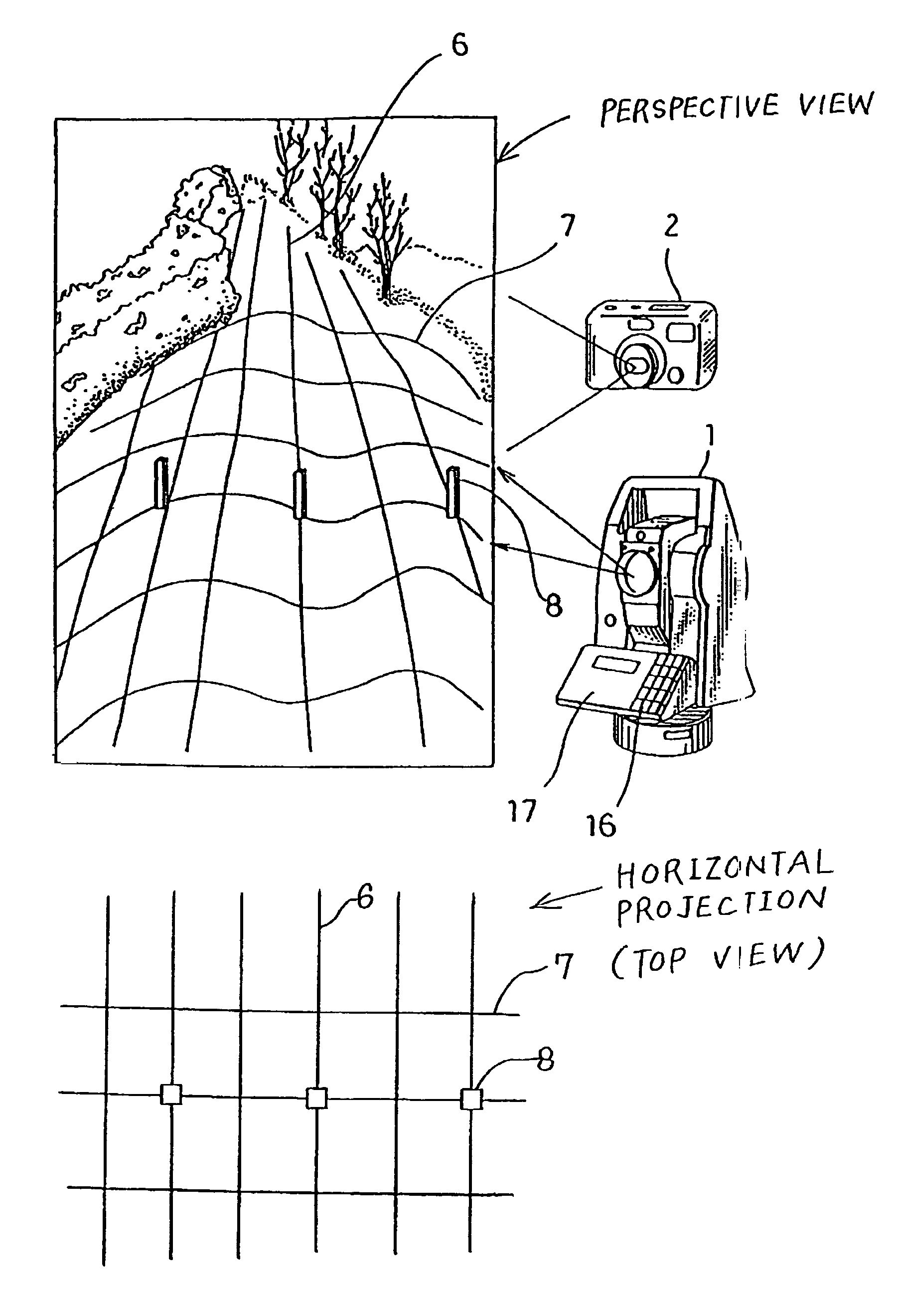
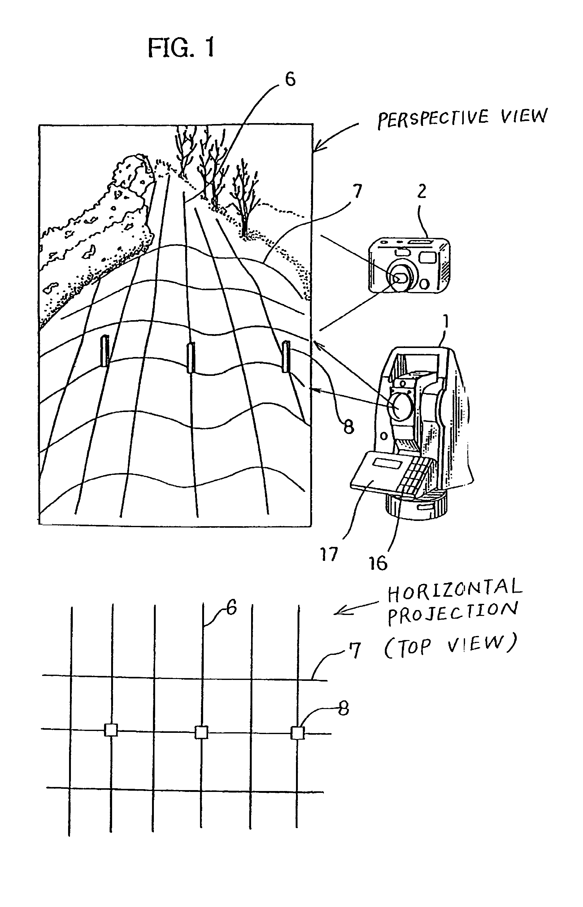
[0044]Referring to FIG. 5 to FIG. 9, as the present invention, description will be given now on an embodiment of a simple case. The following description is given on a case where cross-sectional measurement is carried out. In FIG. 7, a broken line represents configuration of the ground surface.
[0045]The surveying instrument 1 is set at a known point, and a machine height of the surveying instrument 1 is measured (Step 01 and Step 02).
[0046]A traverse (or a cross-sectional) line 7 (a straight line) is drawn on the ground surface of a portion to be measured (Step 03).
[0047]To facilitate the distinction from the ground surface, it is preferable to select and use colors like white color, yellow color, etc.
[0048]Reference stakes 8, serving as markers, are driven at least at two points (more preferably at three points or more) along the cross-sectional line 7 (Step 04).
[0049]In this case, the marker is not limited to the reference stake, and any object may be selected and used so far as i...
second embodiment
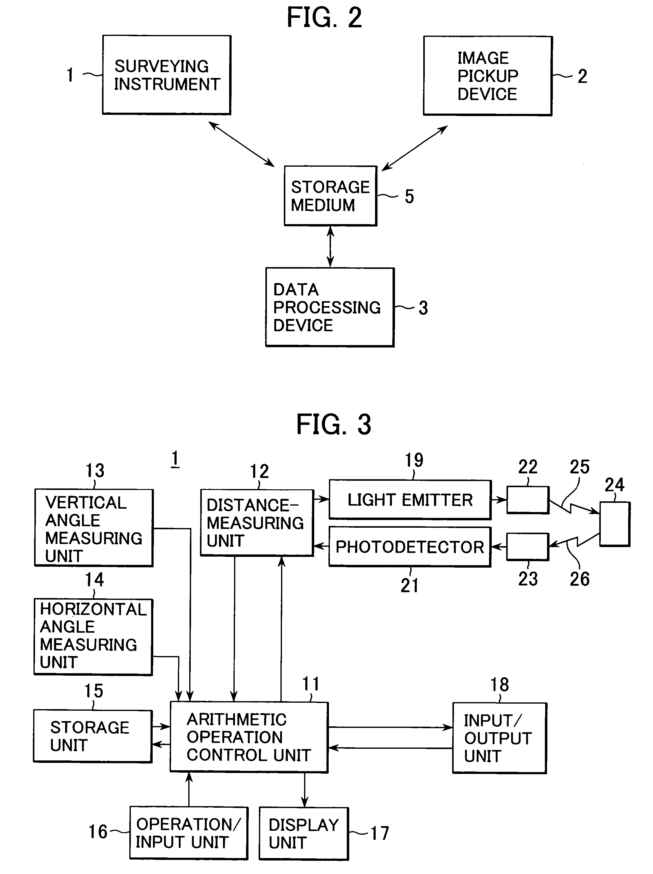
[0061]Now, referring to FIG. 1 to FIG. 5 and FIG. 10 to FIG. 13, description will be given on the invention, in which measurement is performed more accurately.
[0062]In the storage unit 31 of the data processing device 3, there are stored an image processing program 34, a data processing program 35, a measurement data calculating program 36, an image reproducing program 37, etc. The image processing program 34 superimposes TIN data 57 with a pickup image and performs image processing such as conversion from a pickup image 51 which is superimposed with TIN data (one point transmission image)(See FIG. 10) to an orthogonal projection image 52 (ortho-image) or conversion from an ortho-image to an one point transmission image. The data processing program 35 performs data processing such as processing of the image data on the measurement data by texture mapping. The measurement data calculating program 36 obtains measurement data at an arbitrary point on the image from synthesized data of ...
PUM
 Abstract
Description
Claims
Application Information
 - R&D
- Intellectual Property
- Life Sciences
- Materials
- Tech Scout
- Unparalleled Data Quality
- Higher Quality Content
- 60% Fewer Hallucinations
Browse by: Latest US Patents, China's latest patents, Technical Efficacy Thesaurus, Application Domain, Technology Topic, Popular Technical Reports.
© 2025 PatSnap. All rights reserved.Legal|Privacy policy|Modern Slavery Act Transparency Statement|Sitemap|About US| Contact US: help@patsnap.com


