Automatic GNSS signal allocation between remote and base receivers

Active Publication Date: 2013-09-10
HEMISPHERE GNSS
View PDF16 Cites 12 Cited by
  • Summary
  • Abstract
  • Description
  • Claims
  • Application Information

AI Technical Summary

Benefits of technology

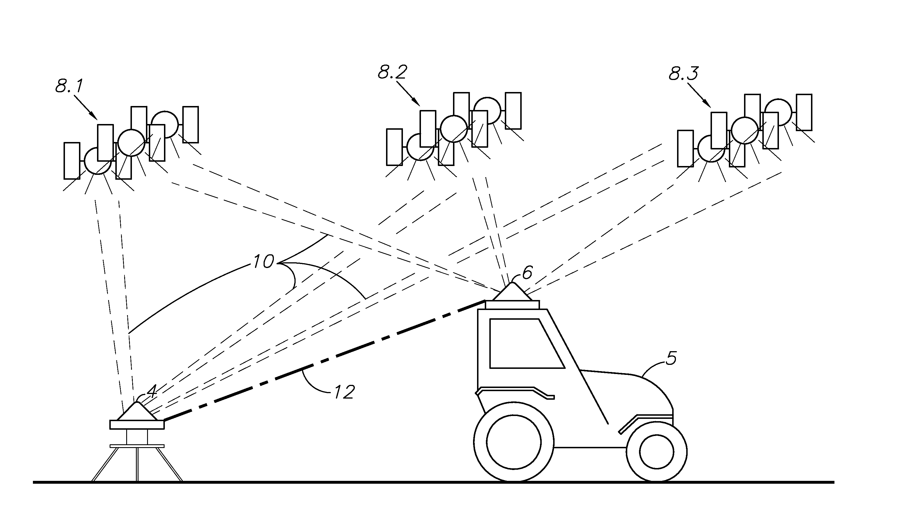
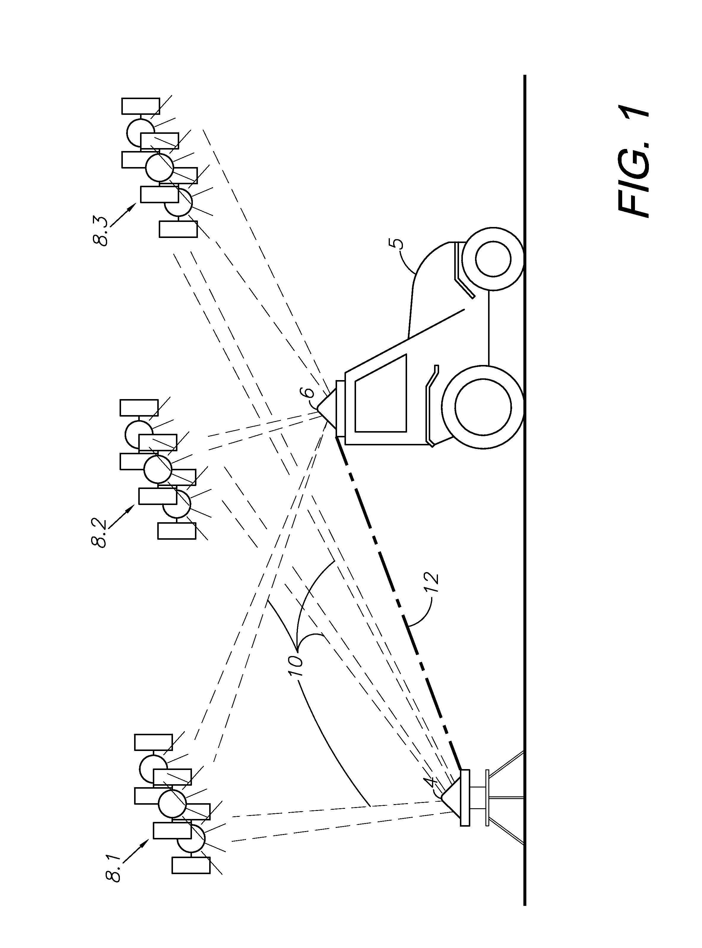
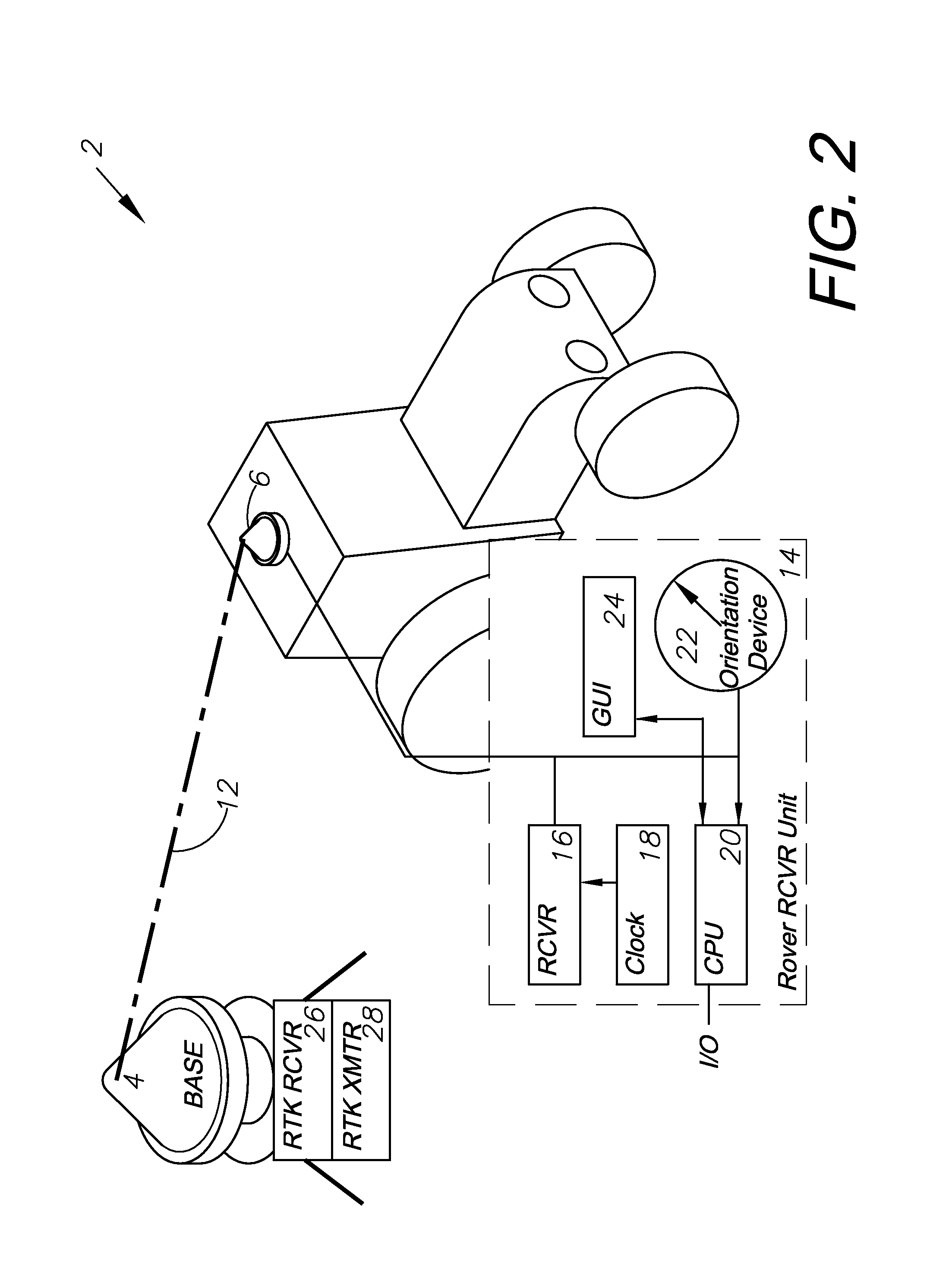
[0013]In the practice of an aspect of the present invention, a vehicle is equipped with and guided by a typical GNSS guidance system capable of detecting satellites from multiple different GNSS guidance networks, determining redundant signals using a base station transceiver, and synchronizing which satellite networks are being used between the base station transceiver and the remote rover receiver. This process will correct irregularities caused by the rover receiver tracking different satellites from the base statio

Problems solved by technology

One of the main difficulties regarding GNSS position tracking is ensuring that enough satellites have a clear view of the rover receiver.
If the rover

Method used


Image

  • Automatic GNSS signal allocation between remote and base receivers
  • Automatic GNSS signal allocation between remote and base receivers
  • Automatic GNSS signal allocation between remote and base receivers

Examples


Example

I. Introduction and Environment

[0018]As required, detailed embodiments and aspects of the present invention are disclosed herein; however, it is to be understood that the disclosed embodiments are merely exemplary of the invention, which may be embodied in various forms. Therefore, specific structural and functional details disclosed herein are not to be interpreted as limiting, but merely as a basis for the claims and as a representative basis for teaching one skilled in the art to variously employ the present invention in virtually any appropriately detailed structure.

[0019]Certain terminology will be used in the following description for convenience in reference only and will not be limiting. For example, up, down, front, back, right and left refer to the invention as oriented in the view being referred to. The words “inwardly” and “outwardly” refer to directions toward and away from, respectively, the geometric center of the embodiment being described and designated parts thereo...


PUM


Abstract

A differential global navigation satellite system (DGNSS)-based guidance system which is capable of utilizing satellites from multiple GNSS networks, for example in a real time kinematic (RTK) system. The remote rover receiver and the base station transceiver periodically synchronize to ensure that the satellites being tracked by the rover receiver correspond with those tracked by the base station transceiver. This ensures that redundant position data is filtered out and an accurate GNSS position of the rover unit can be determined. The ability to use satellites from different GNSS networks increases the accuracy of the positioning system and increases the chance of multiple satellites being available to a receiver under a greater number of circumstances.

Description

BACKGROUND OF THE INVENTION[0001]1. Field of the Invention[0002]The present invention relates generally to vehicle guidance, and in particular to a system and method for global navigation satellite system (GNSS)-based positioning using a base station to provide differential GNSS (DGNSS) data for real time kinematic (RTK) vehicle guidance, wherein the base station communicates with the vehicle receiver and the vehicle receiver reallocates the satellites and the satellite systems it is tracking to match those tracked by the base station.[0003]2. Description of the Related Art[0004]GNSS guidance and control are widely used for vehicle and personal navigation and a variety of other uses involving precision location in geodesic reference systems. GNSS, which includes the Global Positioning System (GPS) and other satellite-based positioning systems, has progressed to sub-centimeter accuracy with known correction techniques, including a number of commercial satellite based augmentation sys...

Claims


Application Information

Patent Timeline
IPC IPC(8): G01C21/28
CPCA01B69/007G01S19/32G01S19/54G01S19/41G01S19/49G01S19/33
Inventor WHITEHEAD, MICHAEL L.
Owner HEMISPHERE GNSS
Why Eureka
Try Eureka