
System and method for proximity detection

a proximity detection and system technology, applied in the field of navigation, can solve the problems of affecting and the single method of navigation is not optimal for every user, so as to improve the accuracy of confidence computation

Inactive Publication Date: 2013-11-26
KAARYA
View PDF15 Cites 42 Cited by
  • Summary
  • Abstract
  • Description
  • Claims
  • Application Information

AI Technical Summary

Benefits of technology

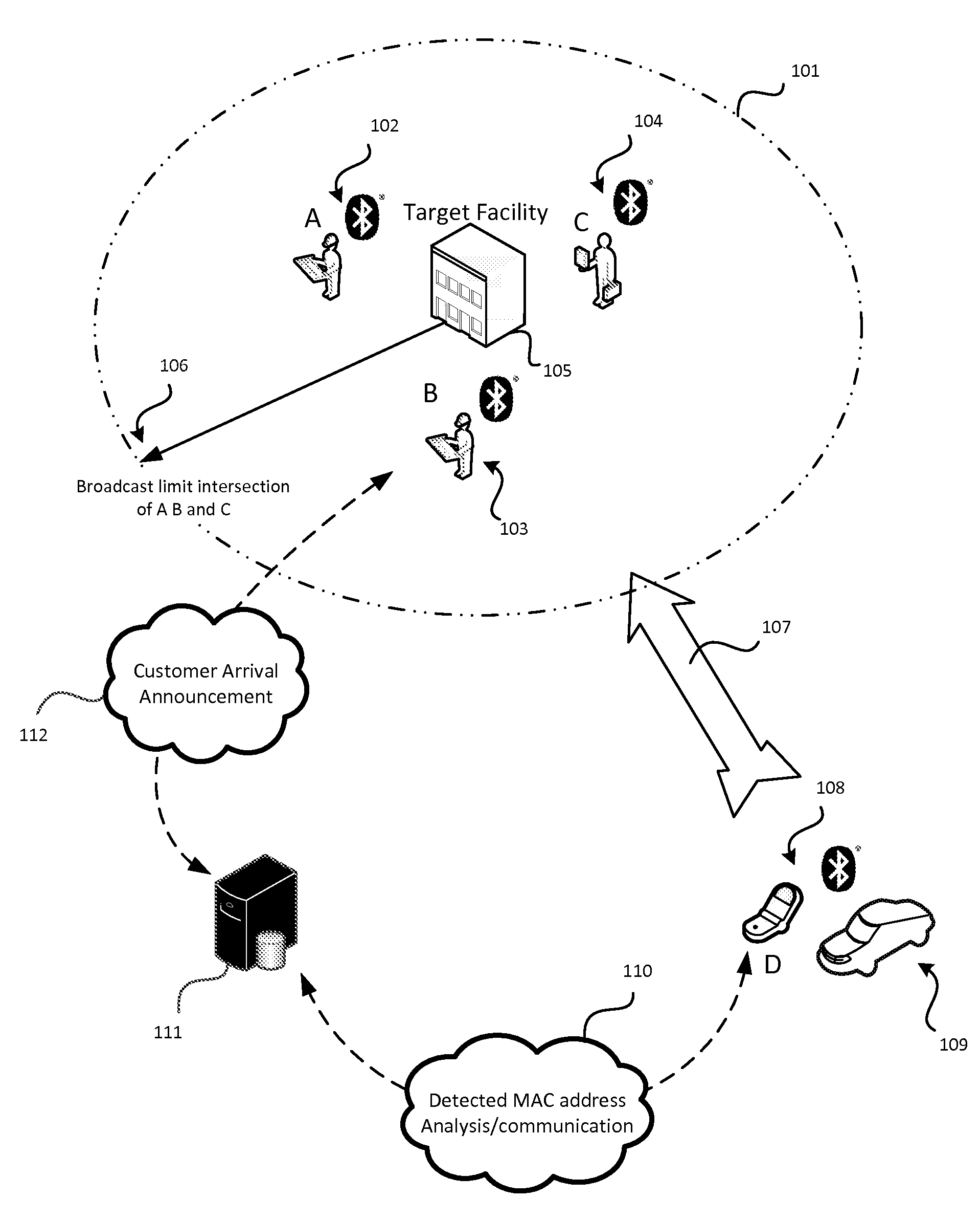
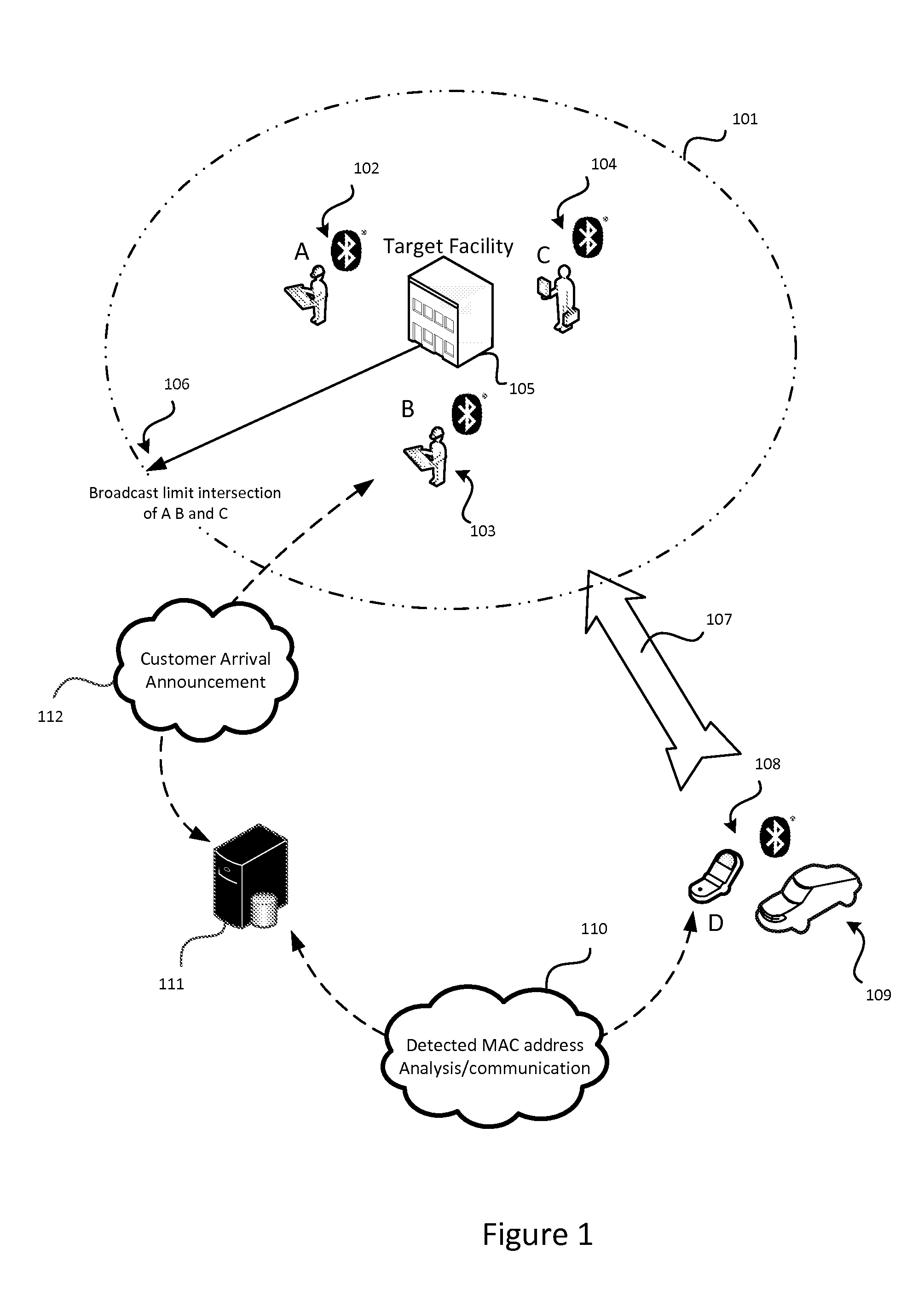
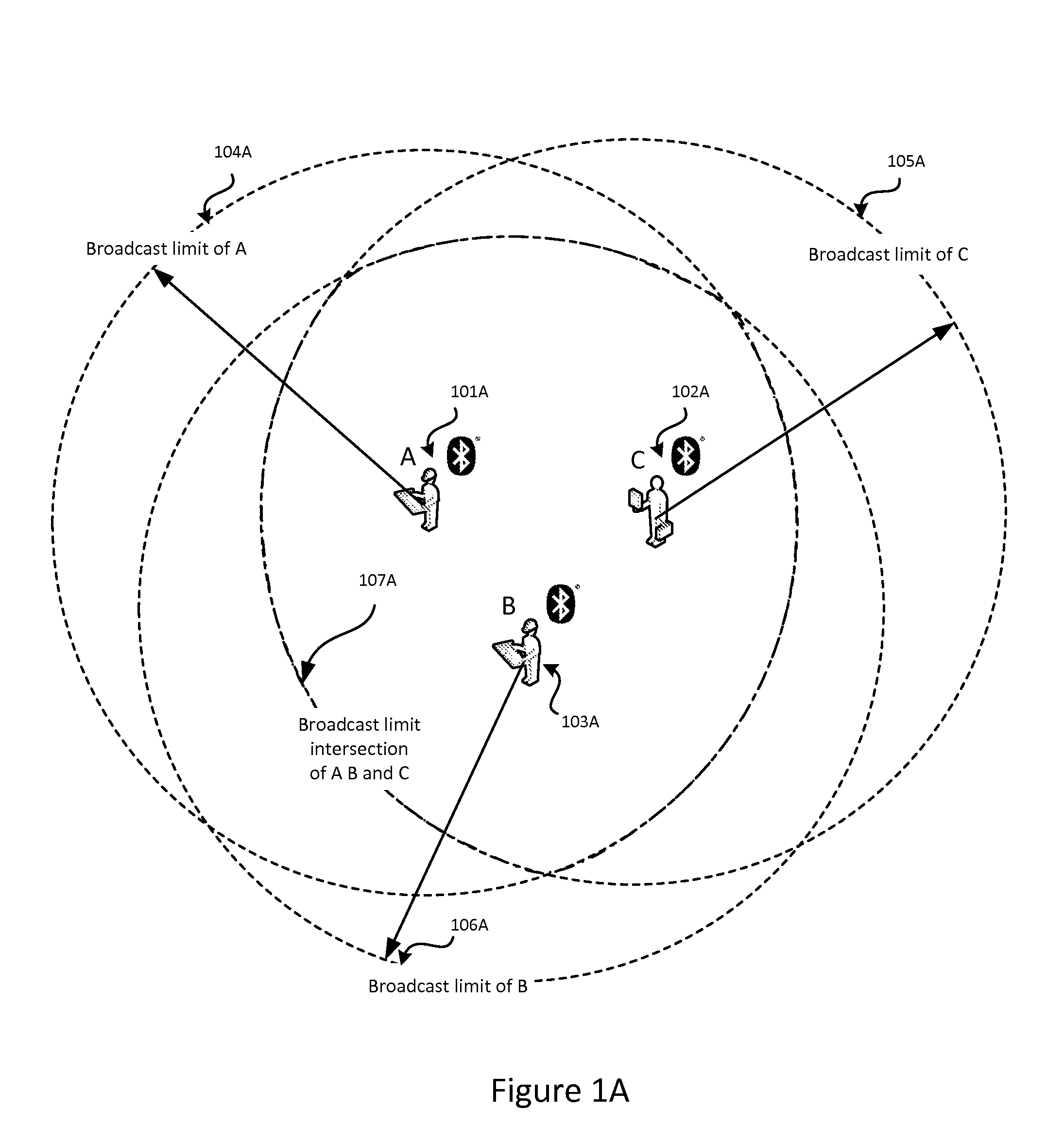
The present invention solves the problem of detecting the arrival of a customer or visitor at a specific location or facility and announcing it by monitoring radio frequency broadcast identification codes from nearby mobile devices. The system can adapt to changes in facility characteristics over time by adjusting and improving the accuracy of the confidence computation, utilizing information regarding user scheduled appointments at the specified location. Additionally, an option for the customer or visitor to announce arrival provides fault-tolerance.

Problems solved by technology

In practice, however, since navigation often involves not simply location information, but relevance and context, a single method for navigation is not optimal for every problem.
Satellite based systems have a number of inherent shortcomings, the most problematic among these is dependence on clear lines of sight to multiple satellites.
Any disruption in a clear line of sight causes immediate failure.
Any time a user is indoors, in a garage, or in an urban “canyon” between tall buildings, the system falters or fails.
Satellite systems require significant power consumption in order to function at optimal performance.
These exemplar satellite / GPS systems work well for the specific context they are used in, but suffer from the same shortcomings as all such systems for other proximity / navigation applications.
Among such problems is the maintenance or otherwise real-time access to a complex database with accurate information regarding latitude / longitude perimeters of all relevant locations.
All satellite based proximity / navigation solutions, including such geo-fencing solutions fail for all sheltered or indoor customer-arrival problems, such as arrival of a customer at a particular store in a mall or a particular office, such as a medical office, within a larger facility, such as a shopping mall or office complex.
Although the most widely adopted type of solution, these systems require the installation, service, and maintenance of specialized and perhaps proprietary hardware at one or more locations in or around a facility, and are impossible to modify or adjust without changing the facility installed beacon hardware.
No solutions have been proposed for the customer-arrival problem which do not rely upon a satellite based system, nor provide an adaptable and context sensitive system which utilizes only existing facility and customer devices.

Method used


Image

  • System and method for proximity detection
  • System and method for proximity detection
  • System and method for proximity detection

Examples


Embodiment Construction

[0029]In the preferred embodiment of the present invention, a vehicle service facility desires to improve efficiency and customer service by notifying service assistants at the facility when customers have arrived at the facility. Customers may or may not have service appointments in advance of their arrival. Customers or users of the service facility have an application available on their mobile phone to optionally send a manual notification of arrival: “I am here”.

[0030]Service advisers, service assistants, and supervisors at the vehicle service facility each carry mobile devices registered with the decision system. Such mobile devices may be smartphones, tablets, or both. Such devices may have an application available and installed on them as a client application which receives the arrival event notification from decision system of the present invention.

[0031]FIG. 1 depicts an example configuration of the preferred embodiment context of the invention. In FIG. 1, the customer (mob...


PUM


Abstract

The present invention is for a system and method for determining the proximity of a mobile device to a location without the use of a satellite based or other location awareness system, nor a stationary beacon of any kind. Instead, the mobile device monitors radio frequency broadcast identification codes from nearby mobile devices, and determines if the set of detected identification codes is sufficiently similar to a weighted set of identification codes attributed to specified location. If the calculation of similarity meets the confidence conditions of the system, notification is made that the customer or visitor has arrived. The invention utilizes a combination of confidence interval computation, machine learning, and fault tolerance mechanisms to optimize the success of correctly detecting that the device is near the relevant location.

Description

[0001]This application for patent claims priority from provisional patent application 61 / 453,943.FIELD OF THE INVENTION[0002]The present invention generally relates to the field of navigation, specifically the determination of the proximity of a mobile device to a location.BACKGROUND OF THE INVENTION[0003]Navigation is a fundamental objective of transportation and as old a problem as the evolution of animals from plants. Biological systems evolved a number of very clever methods for navigation, roughly categorized as allothetic or idiothetic navigation. Allothetic navigation is defined as the use of external cues from the environment for determining location. Idiothetic navigation is defined as the use of internal systems for navigation and orientation, such as the inner ear vestibular canals in humans used for balance. Analogous systems in machines for allothetic systems are GPS navigation, and gyroscopic orientation for idiothetic navigation.[0004]The wide availability and commonp...

Claims


Application Information

Patent Timeline
Patent Type & Authority Patents(United States)
IPC IPC(8): G08B1/08
CPCG01S5/0252H04W64/00H04W4/023G01S5/02529
Inventor NATH, UJJUALSHARMA, GAURAVFLETCHER, WILLIAMMACGLASHAN, DOUGLASBILLETT, BRIAN
Owner KAARYA
Learn More